Fremont County, Wyoming
Top Spots in and near Fremont County
-
Lander, Wyoming
Hike the Sinks Canyon Trail
4 mi / 300 ft gainSinks Canyon is named for the geological mystery known as "The Sink" and "The Rise", where the Popo Agie River disappears underground along an unknown course only to appear again hundreds of yards away. But what is no mystery is the fantastic beauty of the Canyon: the wildlife and wildflowers, th...Read more -
Lander, Wyoming
Popo Agie Nature Trail
0.98 mi / 164 ft gainSinks Canyon State Park 6 miles south of Lander, Wyoming is a treasure of hiking, trail running, and rock climbing. Rightly considered the gateway to the southern Winds, Sinks is a great way to get a taste of some of the most beautiful mountain scenery to be found in the United States and the Pop...Read more -
Boulder, Wyoming
Climb East Temple Peak
23 miThe quickest way to the summit of East Temple is from Big Sandy Trailhead. Getting to the Big Sandy Trailhead can be a little difficult since you must travel about 46 miles on unmarked dirt roads. Most cars should be able to make it to the trailhead if the dirt is dry but a high clearance vehicle...Read more -
Boulder, Wyoming
Big Sandy Lake
10.94 mi / 633 ft gainBig Sandy Lake is beautiful. You'll turn at Boulder, WY and head about an hour to Big Sandy Campground. You'll want to get there as early as you can as it fills up fast, when we arrived at about 10:30pm on a Friday there was no sites or parking, but don't worry. The surrounding area is National ...Read more -
Boulder, Wyoming
Climb Wolf's Head
5 mi / 1700 ft gainThis is one of North America’s 50 classic climbs and rightfully so. It involves easy route finding on a skinny, 5.5 ridge that can be accessed and seen from your base camp at the middle of the cirque. This climb is over 9 miles from the trailhead so the easiest way to climb it is to follow the C...Read more -
Boulder, Wyoming
Backpack the Cirque of the Towers Loop
30 mi / 4000 ft gainDay1: Drove up to the Big Sandy Trailhead from Salt Lake City. Hike the 5 to 6 miles to Big Sandy Lake. This is a relatively flat and easy hike. There is not much of a vista, but it is a nice hike along the Big Sandy River. You can camp just off of Lost Creek. I got there late as it was a long dr...Read more -
Boulder, Wyoming
Cirque of the Towers to Fremont Trail Loop
23.66 mi / 3573 ft gainCirque of the Towers to Fremont Trail Loop is a loop trail that takes you by a lake located near Boulder, Wyoming.Read more -
Boulder, Wyoming
Pyramid Lake Trail
4.024.95 mi / 2539 ft gainPyramid Lake Trail is an out-and-back trail that takes you by a lake located near Boulder, Wyoming.Read more -
Lander, Wyoming
Rock Climbing Wild Iris
5.0Wild Iris is an iconic rock climbing destination for all sport climbers. It sits at about 9000 feet and there is little cell reception so let someone know where you will be. It was developed years ago by the late Rock Climbing legend Todd Skinner. At the time this area was very futuristic for c...Read more -
Lander, Wyoming
Camp at the Radio Towers on Limestone Mountain
Limestone Mountain on the southern end of the Wind River range is famous for the nearby climbing mecca, Wild Iris, but it is also an excellent place to camp with ready access via forest roads to all manner of outdoor adventure activities including hiking and mountain biking. The top of the mounta...Read more -
Pinedale, Wyoming
Seneca Lake Trail
5.018.4 mi / 2280 ft gainThe Wind River Range is one of the best backpacking + climbing wildernesses in the lower 48. Seneca Lake is right at the beginning of some of the most spectacular high alpine climbing and backpacking routes. From the Elkhart trailhead parking lot, take the Pole Creek Trail directly adjacent to ...Read more -
Pinedale, Wyoming
Photographers Point via Pole Creek Trail
4.59.26 mi / 1188 ft gainBegin at the main Elkhart Park parking area. Take the Pole Creek Trail directly adjacent to the restroom. You will follow this trail for approximately 4.5 miles through lodgepole pine forests and beautiful alpine parks. When you begin seeing large boulders and sheer rock walls, you are approac...Read more -
Pinedale, Wyoming
Climb Fremont Peak via Southeast Buttress
30 mi / 4350 ft gainThe typical approach to the SE Buttress is from Indian Basin, probably because it is easier, provided you plan on going to Indian Basin anyway. However, if you plan on visiting Titcomb or climbing Gannett peak via Bonney Pass, I suggest approaching from Lower (Southern) Titcomb Lake. I thought it...Read more -
Pinedale, Wyoming
Backpack to Titcomb Basin and Summit Gannett Peak
5.050 mi / 4000 ft gainIf you are looking for a challenging hike in one of the most remote areas of the rocky mountains then this is the expedition for you. Starting near Pinedale, Wyoming in Elkhart Park you begin a 50 mile round trip that can include a summit of Gannett Peak. Starting elevation of the hike is near 8...Read more -
Pinedale, Wyoming
Elbow Lake in the Wind River Range
2.035.66 mi / 4357 ft gainElkhart Park Trailhead; Wind River Range, WY. Pole Creek Trail->Seneca Lake Trail->Highline Trail->Elbow Lake This is an advanced 4 day out and back trip departing from the Elkhart Park Trailhead with two days of travel to Elbow Lake. As one of the most remote ranges in the country, th...Read more -
Pinedale, Wyoming
Backpack and Fly Fish the Wind River Range
5.0Day 1: Hit the Elkhart trailhead. Get set up at Hobbs lake, do a little fishing, eat and turn in for the night.Day 2: Head out for Island Lake to set a base camp for the next few days. Keep an eye out for mountain storms and if you do catch as short one, be sure to take in the view. It's amazing!...Read more
Top Activities
Camping and Lodging in Fremont County

Boulder, Wyoming
Blucher Creek Campground
The Blucher Creek Campground is 74 miles from Rock Springs and 70 miles from Lander. It's an ADA accessible site and features a safety st...
Pinedale, Wyoming
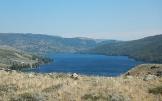
Half Moon Lake Campground
Overview
Half Moon Lake campground is situated just off the northeast shore of Half Moon Lake at an elevation of 7,600 feet in the Bridge...
Pinedale, Wyoming
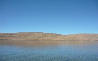
Fremont Lake
Overview
Fremont Lake Campground is located on the east shore of pristine Fremont Lake at an elevation of 7,400 feet, just 7 miles northe...
Pinedale, Wyoming
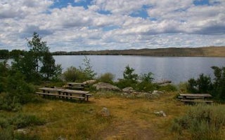
Sandy Beach Picnic Area
Overview
Sandy Beach Picnic Area is located on the southeast shores of pristine Fremont Lake at an elevation of 7,400 feet, just 3 miles ...
Cora, Wyoming
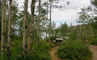
Narrows Campground
Overview
Narrows Campground is located next to scenic New Fork Lake, at the edge of the Wind River Range in northwestern Wyoming. Visitor...
Big Piney, Wyoming
New Fork Campground
The New Fork Campground at 6,800 feet is located adjacent to the beautiful New Fork River. This site provides a put in-takeout point for ...


