Hillsboro, West Virginia
Top Spots in and near Hillsboro
-
Danese, West Virginia
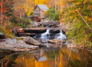
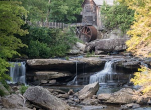
Photograph the Glade Creek Grist Mill
5.0Hidden deep in the Appalachian Mountains near the New River Gorge sits an extremely photogenic grist mill. A recreation of the original mills that dotted West Virginia, Glade Creek Grist Mill was completed in 1976 at Babcock SP. Built fully operational from the parts of 3 other WV mills, it was p...Read more -
Danese, West Virginia
Island in the Sky Trail
5.00.8 mi / 108 ft gainTo reach the trailhead, park at the main parking area near Glade Creek Grist Mill. Cross the bridge toward the grist mill, and the trailhead is directly behind the mill. Even though the Island in the Sky trail is only a mile long out and back, it is lined almost the whole way with rhododendron bu...Read more -
Goshen, Virginia
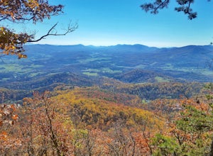
Hike Goshen Pass
4.35.6 mi / 1200 ft gainThe parking for the trailhead is down an unmarked gravel/dirt road about 1.5 miles upriver from the Virginia Wayside rest area on Route 39 West. You'll see the swing bridge out across the river and the road will be immediately after this on your right. The road goes back about 200 yards to the pa...Read more -
Lexington, Virginia
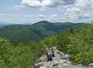
House Mountain Trail
4.08.93 mi / 2733 ft gainHouse Mountain provides two amazing views via two out-and-back hikes, for a combined hike of 8.75 miles. If you’re short on energy and/or time, the 6 miles round trip to Big House Mountain is (in my opinion) the better of the two overlooks. Either way, keep in mind that this hike covers a great...Read more -
Rockbridge Baths, Virginia
Fly Fish Goshen Pass
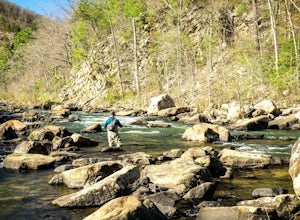
5.0The fly fishing on the Maury River is one of a kind through the Goshen Pass. The Pass is littered with huge boulders, which actually makes it possible to fish without waders, although it's much easier and more enjoyable with waders.From Lexington, VA, take Route 39 towards Goshen for approximatel...Read more -
Rockbridge Baths, Virginia
Rock Climb at Goshen Pass
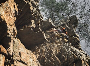
5.0Goshen Pass is a beautiful area for kayaking and fishing in Bath County, Virginia near Lexington. But not as well known is the fact that there are a few places that are great for rock climbing. You'll want to park at the swinging bridge which is two miles past the picnic area on route 39 once you...Read more -
Edmond, West Virginia
Beauty Mountain Trail
5.01.1 mi / 279 ft gainThe Beauty Mountain Trail Head is located less than 10 miles form Fayetteville, WV. To reach the trail head, you will have to travel down some very narrow roads, and I recommend going old school and printing out the directions because cell service in the area is not the best. Once at the trail ...Read more -
Waiteville, West Virginia
Hanging Rock Raptor Observatory
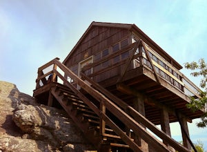
4.81.93 mi / 381 ft gainLocated on Limestone Hill Road north of Waiteville, WV at about 3800 feet above sea level is an old Fire watch tower. The tower, built in 1956 was abandoned in 1972. In 1983 the US Forest Department acquired this area as part of the Jefferson National Forest. Since then the Tower has become know...Read more -
Fayetteville, West Virginia
Hike to the Nuttallburg Headhouse
1.4 mi / 400 ft gainFrom Lansing-Edmond road, turn right onto Beauty Mountain Road. Go for 0.1 miles and the road will appear to split into three roads. The main road goes left, but take the middle road here. After another 0.1 miles you will arrive at a gate with a few parking spaces on the left side. Do not block t...Read more -
Fayetteville, West Virginia
Hike Around the Trails of Nuttallburg
5.03 mi / 200 ft gain**The road to Nuttallburg is part gravel and only wide enough for one car. Take caution driving along this road-you may have to back up some if you meet another car. Nuttallburg is an old coal mining town that once thrived in the early 1900's, but fell into ruin and then was restored by the Natio...Read more -
Shady Spring, West Virginia
Sandstone Falls
5.00.52 mi / 46 ft gainStarting at the trailhead, follow signs for the falls. After a short walk, hikers will reach the walkway bridge where they can snap a couple shots of the minor Sandstone Falls to the right. Many hikers stop here, thinking these falls are the final destination. Do not make this mistake—the best is...Read more -
Eagle Rock, Virginia
Canoe or Kayak the Upper James River
4.3Put in at the Horseshoe Bend Boat Ramp near Buchanan, VA. The pin on the map will take you right there. Takeout will be at the boat ramp in downtown Buchanan, approximately 9 miles down river. This ramp is located just above the Rt. 11 bridge.Twin River Outfitters uses this ramp also, so there's ...Read more -
Edmond, West Virginia
Hike the Endless Wall Trail
4.72 mi / 260 ft gainFrom the Fern Creek Trailhead this is a 2.0 mile out and back hike to Diamond Point. The trail is relatively flat with minimal elevation gain and has a bridge stream crossing. When you arrive at the sign stating "Climber's Access", take a short side trip here to see the views of the gorge. Contin...Read more -
Fayetteville, West Virginia
Hike the Kaymoor Miners Trail
5.02 mi / 900 ft gainKaymoor was on old West Virginia coal mining town that thrived in the early 1900's until it was abandoned in the 1950's. Along this trail you will see remnants of the old mine entrance, mining cars, a coal processing plant, and coke ovens, among other structures. This trail, although short, is qu...Read more -
Lansing, West Virginia
Canyon Rim Overlook Boardwalk
5.00.62 mi / 151 ft gainCanyon Rim Overlook Boardwalk is an out-and-back trail that takes you by a river located near Lansing, West Virginia.Read more -
Fayetteville, West Virginia
Hike the Long Point Trail
4.83.2 mi / 200 ft gainWith minimal elevation gain, this 3.2 mile hike can be done in a short amount of time. From the parking lot, take the trail to the right of the bathroom. There will be two trail intersections at 0.4 miles and 0.7 miles, both of which are well marked. Stay straight at both intersections to remain ...Read more

