Skagit County, Washington
Top Spots in and near Skagit County
-
Marblemount, Washington
4.9
7.39 mi
/ 3415 ft gain
Be careful when heading up this 4.5 mile trail since there can be snow coverage into the summer. When you start the trail, you'll get a little tree coverage as you start climbing up. Unfortunately, the shade starts to dissipate after about a mile, where you'll cross over Sibley Creek and enter th...
Read more
-
Concrete, Washington
The Trail
From the parking area proceed back towards the road and hang a right up an abandoned road bed. The trail follows this road bed for a about 0.2 miles before the real trail becomes evident. The first 0.5 - 1.0 miles of this trail can be difficult. Deadfall, wet, steep, and root covere...
Read more
-
Concrete, Washington
Turn left off of the Grandy-Baker Lake Road onto FS RD 1130 just past the Boulder Creek Campground. Stay right at the first fork in the road. At 3.9 miles go right towards Rainbow Falls. The falls are located at a large bend in the road at approximately 4.5 miles. I have never found a good safe...
Read more
-
Darrington, Washington
Not for the faint of heart - or those with a fear of heights - Mount Pugh offers some of the most rewarding summit views in the Cascades.Located off the northern end of the Mountain Loop Highway, this is an easy day trip from anywhere in the Puget Sound area. Though finding the trailhead can be t...
Read more
-
Marblemount, Washington
North Cascade National Park is home to some of the most rugged and remote mountains in the lower 48 states. Because of this, the area is rarely seen up close and personal in the winter, but there are a few spots where you can see these wild mountains that will defy all imagination. In terms of lo...
Read more
-
Marblemount, Washington
3.7
10.57 mi
/ 3885 ft gain
To get to your campground or to Trappers Peak, hike roughly five miles along the trail to ridge, where the trail divides. If you head left you'll go down into lake basis where you can drop your gear. Come back to the divide and head right, which will lead you up to trappers peak.
Something to ke...
Read more
-
Granite Falls, Washington
4.3
4.33 mi
/ 1165 ft gain
The trail takes you on a gradual climb up to Heather Lake with beautiful second growth to admire along the way. The trail can be very wet and muddy with many tree roots to catch your toes, so make sure to wear a sturdy pair of tennis shoes or hiking shoes. Dogs are permitted on this trail on-leas...
Read more
-
Granite Falls, Washington
4.6
5.98 mi
/ 1434 ft gain
If you're looking for a taste of the Mountain Loop Highway area, but don't have it in you for a longer, steeper journey, look no further than Lake 22. The trail starts out as flat and well-maintained, from the parking lot, before becoming a true mountain rainforest trail. Water and dampness are f...
Read more
-
Concrete, Washington
NOTE: This is a very challenging mountaineering adventure. Please do not attempt without the proper skill, knowledge, and equipment.
The Sulphide Glacier is the easiest and most popular route to the summit of Mt. Shuksan, and is a great beginner’s glacier + rock climb. More experienced climbers...
Read more
-
Darrington, Washington
After the long drive down FR 26, turn onto FR 2680. 6 miles down the road, you'll see what slightly resembles a trail to your left. Park and prepare for your gorgeous hike!The trail starts with a 1.5 mile windy trek through the woods. You'll pop out onto the lush meadows of the mountain sides. He...
Read more
-
Granite Falls, Washington
This campsite is located along the Mountain Loop Highway. There are various options for dispersed camping around the area, as well as some you can reserve ahead of time such as the Coal Creek Campground and the Beaver Creek Group Campground. This campsite is located just before Beaver Creek grou...
Read more
-
Granite Falls, Washington
4.8
5.22 mi
/ 2113 ft gain
Hike the well-maintained Mount Pilchuck Lookout trail through a variety of terrain: old-growth forest and granite boulder fields. At the top, you'll reach a lookout tower perched on Mount Pilchuck. Pilchuck sits on the western edge of the Cascades, which offers up amazing panoramic views once you...
Read more
-
Granite Falls, Washington
4.3
2.38 mi
/ 289 ft gain
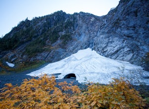
Disclaimer: Hiking into the caves is extremely dangerous as there is potential for the ice to fall. We do not recommend hiking inside of them and if you choose to do so, you're doing it at your own risk.
This is a short hike at just 2.3 miles roundtrip with little elevation change. The hike take...
Read more
-
Granite Falls, Washington
https://www.theoutbound.com/wa...Starting out at the Deer Creek gate of Mountain Loop Highway the road is flat and uneventful for the first 2 miles or so, though it does offer some great views of the Big Four as well as a few other peaks and the babbling south fork of the Stillaguamish river. The...
Read more
-
Marblemount, Washington
The Picket Range is a remote and rugged subrange of Washington's North Cascades. It draws very few visitors per year, and the odds of seeing another human on your adventure are very low. West McMillan Spire is an 8,000' peak located in the Southern Pickets. It is a Class 3 climb involving bot...
Read more
-
Deming, Washington
4.7
5.5 mi
/ 1500 ft gain
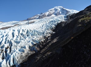
Starting at the marked Heliotrope Ridge parking lot of FS Road 39, just 8 miles out of the quaint town of Glacier, Washington, you begin your ascent to the glacier viewpoint. The trailhead sign indicates that it is a strenuous 2,000 ft gain over 2.5 miles up to the overlook.This clearly cut trail...
Read more

