Seabeck, Washington
Top Spots in and near Seabeck
-
Kirkland, Washington
Forbes Creek Stairs
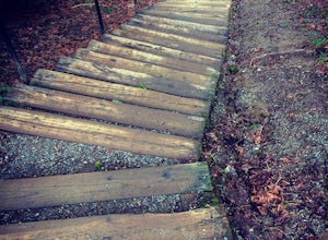
3.00.19 mi / 92 ft gainAll benefits of a stair master paired with fresh air is the perfect recipe for a northwest workout. 210 wooden railroad ties make up a staircase that will test your endurance, build strength and get you sweating in no time. The stairs are open year round, 24 hours a day and offer parking for abo...Read more -
Bellevue, Washington
Bellevue Botanical Garden
The park is open dawn to dusk. The botanical garden is free to visit and offers excellent photography opportunities. Additional InfoCopper Kettle Coffee Bar is available at the garden: Weekdays: 10am – 3pm; Saturday & Sunday: 10am – 5pmGarden Map with different attractions featuredBotanica...Read more -
Port Angeles, Washington
Hike to Elk Mountain from Obstruction Point
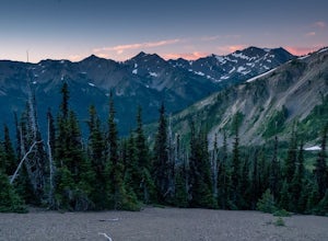
5.04 mi / 644 ft gainOlympic National Park is built for someone with a week or more to spare for backpacking deep into the heart of the park's endless miles of wilderness. Between the mountains, the coast, and the rainforest, there is a lot of park to see for someone who is trying to fit their visit into an extended ...Read more -
Port Angeles, Washington
Backpack to Grand Park in the Olympics
5.07.5 mi / 2500 ft gainThe beauty of many of the north coast trails in the Olympic Peninsula is that your car does a lot of the heavy lifting for you. This is certainly true of the Grand Valley Trail, which begins more than a vertical mile above the Strait of Juan de Fuca at the end of the Obstruction Point Road. Six...Read more -
Port Angeles, Washington
Badger Valley Trail to Grand Pass Trail Loop
4.010.42 mi / 3235 ft gainBadger Valley Trail to Grand Pass Trail Loop Trail is a loop trail that takes you by a lake located near Port Angeles, Washington.Read more -
Bellevue, Washington
Coal Creek Trail
4.05.55 mi / 545 ft gainThis trail takes you through Coal Creek park and follows the creek along the trail with minimal elevation gain. This trail can also be accessed from the northern end of the park if that's a more convenient drive. For the lower parking lot, park at the Red Town lot (exit 13 off I-90) and cross the...Read more -
Bellevue, Washington
Coal Creek Falls via Red Town Trailhead
3.02.29 mi / 518 ft gainThe popular trailhead is located in the Cougar Mountain Regional Wildlife Park. There is a veritable maze of trails and trailheads here so it is helpful to bring along a map of the area. A trail map for Cougar Mountain can be found on kingcounty.gov. From the trailhead veer left following the Re...Read more -
Bellevue, Washington
Anti-Aircraft Peak Loop
4.53.53 mi / 436 ft gainHead up the road about .75 miles and take a left onto the Klondike Swamp Trail (well-singed). Stay on Klondike for a mile before taking a left onto Lost Beagle Trail. From here the trail climbs uphill and wraps around the edge of the park, offering views of the surrounding area. Hop on Shangri-La...Read more -
Montesano, Washington
Hike to Wynoochee Falls
0.4 mi / 100 ft gainLocated along FR-2270 (Google Maps calls it FR-2312) in Olympic National Forest, the trailhead is marked by a pullout and a pair of signposts but no sign. This area was formerly the Wynoochee Falls Campground. The trailhead is at the North end of the parking lot. This easy hike involves navigatin...Read more -
Renton, Washington
Far County Falls via Licorice Fern Trail
4.24.25 mi / 801 ft gainFrom Seattle, take the I-90 E to exit 15. Make a right on 17th Ave. This street will later become Renton/Issaquah Rd. Drive about four miles then turn right on to May Valley Rd. Make a sharp right onto SE 112th St. This street will soon turn into 169th Ave SE as it turns left. The trailhead is ri...Read more -
Port Angeles, Washington
Hike to PJ Lake, Olympic National Park
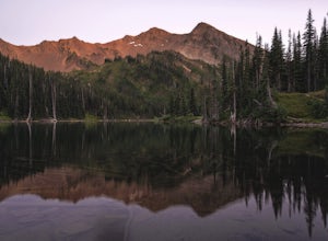
1.63 mi / 692 ft gainA short and scenic trail of tranquility that leads to the secluded Lake PJ, hidden on Hurricane Ridge. Nothing but nature stirs here. The trail, while well-traveled, is far quieter than others in the surrounding area of Olympic. You might see one other hiker. It is lined with wildflowers and in t...Read more -
Port Townsend, Washington
Hike to Point Wilson
5.02.5 mi / 0 ft gainThis trail offers amazing views of Mt. Baker, Vancouver Island, the San Juan Islands, and the Cascade Mountains. The Point Wilson trail is located in Fort Worden State Park on the Olympic Peninsula, along the Strait of Juan De Fuca. The trail is 2.5 miles round trip, and is accessible regardless ...Read more -
Quinault, Washington
Backpack to Enchanted Valley Chateau
5.031.59 mi / 5052 ft gainThis backpacking trip can easily be done in 2 days, but some people prefer to stretch it out to 3. Luckily there are several different spots to stop and camp, so you can split up the distance however you are the most comfortable. The elevation over the course of the trail is minimal, which means ...Read more -
Woodinville, Washington
Woodland Plateau and Lloyd Trail Loop
5.02.63 mi / 276 ft gainWoodland Plateau and Lloyd Trail Loop is a loop trail where you may see local wildlife located near Woodinville, Washington.Read more -
Port Angeles, Washington
Klahhane Ridge (Switchback Route)
4.05 mi / 1700 ft gainHiking to Klahhane Ridge is a rewarding experience that provides you with sweeping views of the Olympic Mountains. Further access to overnight opportunities is possible if you venture beyond the summit trail. Here’s the scoop: Get an early start. There is a decent amount of parking available at ...Read more -
Issaquah, Washington
Poo Poo Point
4.46.57 mi / 1880 ft gainThe Poo Poo Point trail is a great option for beautiful forest and great views only about 20 minutes outside of Seattle. The longer and less steep of the two routes to Poo Poo Point, this trail leaves from the Issaquah High School (the shorter and steeper Chirico Trail leaves from the paragliding...Read more

