San Juan County, Washington
Top Spots in and near San Juan County
-
Bellingham, Washington
Take Chuckanut Drive to the trailhead which is located directly across from the entrance to Larrabee State Park. A small lot in front of the trail has space for 8-10 cars, or you can park at the State Park and walk across the road (carefully!) to reach the trailhead. Either way you will need a Di...
Read more
-
Bellingham, Washington
On Chuckanut Drive (State Route 11) pull off onto a small, unmarked, one-way road that offers parking for Teddy Bear Cove before quickly rejoining the road. There is space to pull over on the road for approximately 15-20 cars. If you are heading North to South, the road is on your right, if headi...
Read more
-
Blaine, Washington
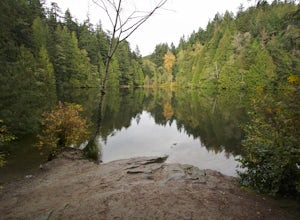
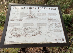
Terrell Marsh Trail is a loop trail that takes you past scenic surroundings located near Blaine, Washington.
Read more
-
Bellingham, Washington
The trail to Locust Beach is very easy to find. Parking on Locust Avenue is available from dawn to dusk on the side of the road, and in a small gravel lot. Follow the road towards the water, and continue right on a small but well-marked trail down to the beach. Be careful - the stairs are kind of...
Read more
-
Ferndale, Washington
Driving up to the park entrance: take a right to drive towards the barnyards, playgrounds, covered picnic areas, historic house and community gardens, and access to the Snoqualmie River. Or, drive straight and park outside of the fragrance gardens and historic house/ museum, and take a walk to a...
Read more
-
Victoria, British Columbia
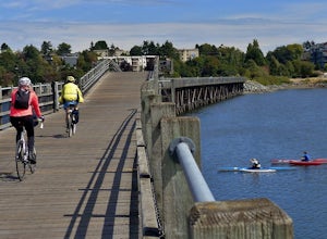
The Galloping Goose Regional Trail connects downtown Victoria, Canada to the former town of Leechtown. Part of the Trans Canada Trail (which traverses the entire country) the Galloping Goose follows the path of the former Canadian National Railway passing through the communities of Sooke, Metchos...
Read more
-
Victoria, British Columbia
Victoria Harbor located on the southwestern tip of Vancouver Island, British Columbia is the southernmost port in Canada. Enjoying a moderate climate year round, one will quickly see why it is also known as Canada's busiest port. Pleasure boats, water taxis, large car and passenger ferries, tugbo...
Read more
-
Victoria, British Columbia
Beacon Hill Park is the jewel of Victoria's crown. Spanning 200 acres and connecting Downtown to the ocean alongside Dallas Road, Beacon Hill Park is one of the highlights of visiting the Capitol city on Vancouver Islands southern tip. Every corner of the park features unique flora, fauna and p...
Read more
-
Bellingham, Washington
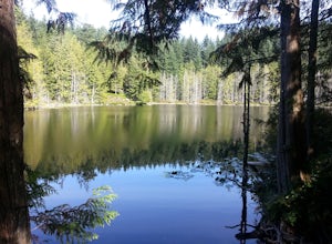
These two quaint lakes in the Chuckanuts are a must-do for people looking for a day hike, short camping trip or steep trail run in the Bellingham area. Starting at the trailhead off of Old Samish Road, one begins the 2 mile ascent to the two lakes. The first 1,400ft climb has its fair share of up...
Read more
-
Victoria, British Columbia
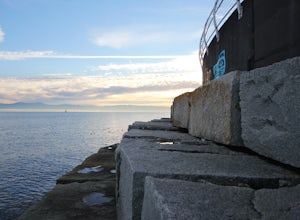
Accessible from downtown Victoria, The Breakwater at Ogden Point makes a fun, easy-access shore-dive. I've been freediving here a couple times now and have loved it each time. You can access the granite stepping blocks by a staircase on the left side (if you're facing the water) of The Breakwater...
Read more
-
Bow, Washington
1.0
7.71 mi
/ 2047 ft gain
The HikeThe hike there isn't short, has several steep sections, and ends at the top of the mountain. There are cliff warnings at the top, so be careful as you explore the view! The steepest portions are at the beginning and right at the end. The trail is very well maintained (because it is so pop...
Read more
-
Bow, Washington
4.3
6.57 mi
/ 1857 ft gain
The trail begins on the Pacific Northwest Trail, which ascends quickly up the side of Blanchard Mountain. The trail contains several switchbacks which wind through second-growth alder, Western red cedar, and Douglas fir forest.
After about one mile there is an overlook with a bench that offers a...
Read more
-
Salt Spring Island, British Columbia
From the Fulford ferry terminal, turn left onto Morningside Drive and follow the road to the end, where you’ll find a small area to park your car. From here, head up towards the subdivision and keep an eye out for the trail marker on your left, located 100m past the gate into Reginald Hills Estat...
Read more
-
Bow, Washington
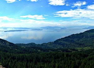
The sunset is amazing at Sammish Overlook. The view is the definition of panoramic and you almost have to strain your eyes because there is so much to look at. Plan to arrive before sunset if you want to capture some photos. This is a great "date spot" and you're likely to see couples up here pic...
Read more
-
Victoria, British Columbia
4.0
5.75 mi
/ 1499 ft gain
Gowlland Tod is a beautiful park, running along the Finlayson Arm fjord. Jocelyn hill is in the middle of the park, and can be accessed from the Caleb Pike access at the South end (along the Ridge trail) or from the McKenzie Bight access at the North end (along the Timberman trail). With planning...
Read more
-
Victoria, British Columbia
4.5
1.9 mi
/ 196.9 ft gain
Take Highway 1 west from Victoria. Turn onto Exit 10 (View Royal/Colwood) and continue on the Island Highway. Turn right at Six Mile Road, which leads straight to Thetis Lake Regional Park.Note that this park is also accessible by bike via the Galloping Goose Trail.With minimal elevation (~60m) a...
Read more

