La Push, Washington
Top Spots in and near La Push
-
Port Renfrew, British Columbia
Camp and Surf at Sombrio Beach
5.01 miHeading west from Victoria, take the TransCanada Highway to Hwy 14. Continue past Sooke towards Port Renfrew. Look for the sign that reads Sombrio Beach Trailhead (approximately 45 minutes past Sooke) and take the left. Note that this dirt road can be incredibly rugged (aka full of potholes) and ...Read more -
Port Renfrew, British Columbia
Explore Botanical Beach
5.01 miThis is a gorgeous beach with so much going on. It's a quick walk from the parking lot (about .8 miles), or you can do the entire Botanical Beach Loop which is 3.5km. Go at low tide for amazing tidal pools and exploring caves if the tide is at its lowest. You can beach hop and climb up to some...Read more -
Port Renfrew, British Columbia
Hike to Mystic Beach
5.0Head west from Victoria along Highway 14 past Sooke and Jordan River until you see the Juan De Fuca Marine Trail - China Creek trailhead about 5km past Jordan River on the West Coast Road. Ample signage, parking, and outhouses are available here.The trail taking you to Mystic Beach is just one s...Read more -
Port Renfrew, British Columbia
Thru-Run the Juan de Fuca Trail
29.2 miIf you have your eye on Vancouver Island as an adventure destination - and we hope that you do - then you likely already know that our Island is not only home to a diverse and unique alpine hiking scene, but that it also offers 3 (+) world-class long distance hiking routes along our coastline. Fr...Read more -
Shirley, British Columbia
Beach Day at Sandcut Beach
The adventure begins during the rugged wooded hike from the gravel parking lot to the stunning beach (10 minutes). Once you reach the stone and pebble beach, plant yourself down to enjoy the 180 degree view of the Juan de Fuca Strait (and a picnic lunch if you’ve come prepared!).Head east to find...Read more -
Port Angeles, Washington
Camp at Salt Creek
4.0This county park is great for day use or overnight camping. Half the campsites are about 20 feet from the water, so you can hear waves crashing on the rocks as you sleep.A short walk from all the sites going east, you will end up at a large field with picnic tables and a playground for kids (visi...Read more -
Amanda Park, Washington
Walk along the Maple Glade Rain Forest Trail
0.49 mi / 56 ft gainThe Quinault Valley receives an average of 12 feet of rain per year which maintains the temperate rain forest ecosystem. The Quinault Rain Forest is located within the Olympic National Park and is located on the N. Shore Road about 6 miles off of HWY 101. Once you arrive to the ranger station y...Read more -
Port Renfrew, British Columbia
Backpacking the West Coast Trail
5.0The trail requires a permit from May 1 - September 16. All other dates have restrictions. Check Parks Canada website for more details.You can start from the north or south end of the trail. There are buses provided by the Pacific Rim National Park that will shuttle you back to your car or to the ...Read more -
Port Renfrew, British Columbia
Backpack the West Coast Trail, Pacific Rim NP
46.6 mi / 360.9 ft gainIn the summer of 2016, myself and three others decided to hike the West Coast Trail (WCT) on a bit of a whim! We naively, and courageously, choose the WCT as our first major backpacking hiking trip - we thought it would be best to throw ourselves into a hike that has earned a reputation for being...Read more -
Port Angeles, Washington
Swim in the Elwha River
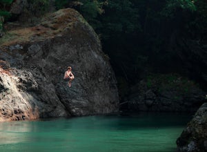
Tucked away in the trees along Olympic Hot Springs Road, the Elwha River slows to a crawl and forms a perfect natural swimming hole. It is a great place to cool off, picnic, and enjoy the beautiful forest surrounding the Elwha River. The river's water is crystal clear and a vivid blue-green co...Read more -
Port Angeles, Washington
West Elwha River Trail
5.06.11 mi / 1198 ft gainWest Elwha River Trail is an out-and-back trail that takes you by a river located near Port Angeles, Washington.Read more -
Port Angeles, Washington
Wolf Creek Trail
8.12 mi / 3970 ft gainTo tackle the Wolf Creek Trail, you start by winding up Whiskey Bend Road just outside of Port Angeles, falling the curves and hills of Elwha River. The peaks of the Olympic Mountains stand in the distance.Once you approach a clearing and small parking area, you grab the gear and hit the trail. T...Read more -
Port Angeles, Washington
Humes Ranch and Goblin Gates
6.4 mi / 994 ft gainThe Elwha River Trail cuts south into the heart of Olympic National Park along a densely forested valley, following the same route taken by some of the earliest explorers of the Olympic Peninsula at the end of the 19th century. Past Port Angeles, at a hard curve in US-101, take Olympic Hot Sprin...Read more -
Port Angeles, Washington
Olympic Hot Springs
3.721.52 mi / 3556 ft gainA local favorite, this moderate day hike winds its way uphill from the Appleton Pass trailhead through old growth stands of fir, hemlock and cedar for 2.2 miles to a cluster of hot springs interspersed among the trees. Note: This route is now closed due to a washed out road. The current route is ...Read more -
Port Angeles, Washington
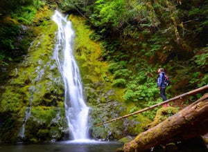
Madison Falls
4.00.16 mi / 98 ft gainMadison Falls is at the end of a 200 foot paved pathway. It is approximately 60 feet tall and lingers in the midst of incredible lush forest. Enjoy it from a viewing point of up close and personal where you can see the greenest of moss growing up along the rocks.Read more -
Port Renfrew, British Columbia
Hiking through the Avatar Grove
To get to the Avatar Grove, drive to Port Renfrew along West Coast highway 14. Turn right onto Deering Rd and cross the long bridge over the San Juan River. Stay right at the next Y intersection, and then left at the T intersection. At the next Y keep left and cross a tall bridge over the crys...Read more

