Washington
Looking for the best backpacking in Washington? We've got you covered with the top trails, trips, hiking, backpacking, camping and more around Washington. The detailed guides, photos, and reviews are all submitted by the Outbound community.
Top Backpacking Spots in and near Washington
-
Ronald, Washington
Sprite Lake via Paddy-Go-Easy Pass Trail
6.5 mi / 2923 ft gainThe Trail Begin backpacking the Paddy-Go-Easy Pass Trail (#1595) through dense spruce forests with riparian undergrowth. The trail will switchback and climb steadily across dry meadows filled with wildflowers, and you'll have increasing views westward of Mount Daniel, Mount Hinman, and Cathedral...Read more -
Port Angeles, Washington
Backpack to Grand Park in the Olympics
5.07.5 mi / 2500 ft gainThe beauty of many of the north coast trails in the Olympic Peninsula is that your car does a lot of the heavy lifting for you. This is certainly true of the Grand Valley Trail, which begins more than a vertical mile above the Strait of Juan de Fuca at the end of the Obstruction Point Road. Six...Read more -
Deming, Washington
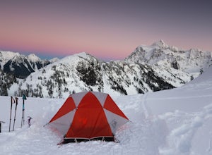
Winter Backpack in the Mt. Baker Backcountry
6 mi / 1500 ft gainArrive at the upper ski resort parking lot (approx. 4300 feet elev.) and snowshoe, skin, or split board up. Make your way toward Artist Point and eventually Huntoon Point, gaining approximately 1500 feet of elevation over approximately 3 miles (one way). Past Huntoon Point, there are several grea...Read more -
Skykomish, Washington
Hike to Lake Deer via Lake Dorothy Trailhead
12.6 mi / 1600 ft gainStart off by traveling along Highway 2 and turning towards the Money Creek Campground. Turn off onto Forest Road 6410 and follow that to the Lake Dorothy Trailhead (about 9 miles).This first section of the hike can be pretty crowded on a nice summer day as the trail is very family friendly and it...Read more -
Granite Falls, Washington
North Lake via Independence Lake
5.56 mi / 2431 ft gainNorth Lake is everything you could want in a subalpine lake: emerald green hues, cold, clear water, lots of brook trout and far from cell-phone reception. This backpack is perfect when the weather gets hot and sunny, though it does reside in what is known as “the wettest section of the Cascades,...Read more -
Forks, Washington
Hike the Hoh River Trail to Five Mile Island
10.6 mi / 300 ft gainOlympic National Park was established to preserve “the finest example of primeval forest” and so the Hoh Valley remains much like it has for thousands of years. This is the best trail to experience the magic of Hoh Valley, the grandeur of its old growth trees, lush understory and iridescent glaci...Read more -
Ashford, Washington
Winter Camp at Glacier Vista
5.03 mi / 1000 ft gainIt's always a good idea to check the weather, but when it comes to getting a peak at Mt. Rainier you might be better off just showing up and hoping for a miracle. To do this from Seattle, you'll have a 2 hour 20 minute drive down I-5 and WA-167. After a couple turns here and there (you can follow...Read more -
Cougar, Washington
Loowit Trail Loop
4.032.46 mi / 7014 ft gainThis is a very difficult hike. Camp sites are scarce and access to water is very limited. Overexposure is a concern so be sure to pack a hat and apply sunscreen frequently. There are sketchy sections of the trail where you will be forced to navigate steep washed out gullies that are unstable due ...Read more -
Deming, Washington
Winter Backpack to Artist Point
4 mi / 1000 ft gainYou do need a Northwest Forest Pass to park in the lot overnight. You can buy a day use E-pass online here (pick Mount Baker-Snoqualmie National Forest from the drop down menu) and print it out and it's ready to use. Or you can buy the annual pass here.The adventure to Artist Point begins in the ...Read more -
Brinnon, Washington
Camp at the Dose Forks
15 mi / 1200 ft gainThe Dose Forks Campground is an overlooked campsite deep within the Olympic National Park, making it a perfect weekend camping destination. A mild, 7.5 mile (one-way) trail delivers you to this enchanting area and is a must for those who love photographing forests. There are no reservation requir...Read more -
Snoqualmie Pass, Washington
Hike Alta Mountain
4.012 mi / 3300 ft gainStart off at Trail #1313 to Rachel Lake. The first 2.5 miles is a flat, slow uphill hike till you get to a river crossing. From there, the next 1.3 miles will be a 1,000 foot elevation gain to Rachel Lake. Once you arrive, this is a good spot to rest, eat some snacks, and replenish your water sup...Read more -
Leavenworth, Washington
Climb Prusik Peak's West Ridge
18 mi / 5000 ft gainThe Enchantments are an amazing experience in themselves. Yet one of the most striking features of any hike into the core zone of the Enchantments is that of Prusik Peak. This pyramid like spire rises dramatically from the many puddle lakes and boulder fields you pass along your way. With it's...Read more -
Quilcene, Washington
Backpack to Marmot and Constance Passes
24 mi / 5200 ft gainThe secret to this trip: Marmot Pass and Boulder Shelter, where you can camp on National Forest Service land. Multiple excellent, large backpacking sites sit just on the edge of the National Park, giving you great access to Mt. Constance and Mt. Deception, two of the tallest peaks in the Olympics...Read more -
Pacific Crest Trail, Washington
Summit Black Peak
5.010 mi / 4400 ft gainStarting at the Heather-Maple Pass Loop Trailhead, jump onto the trail that will take you counter-clockwise along the loop. After about 1.25 miles, you will come to a split in the trail, take the right path and continue for just under a mile until you reach Heather Pass. Off to the right there ar...Read more -
Marblemount, Washington
Lookout Mountain Trail
5.09.06 mi / 4610 ft gainBeginning about 7 miles down the Cascade River Road from Marblemount, the Lookout Mountain Lookout trailhead is on the north side of the road with parking for about 4-5 cars. With about 4500' elevation gain in 4.7 miles, this hike is definitely a thigh burner. The trail begins with a steep climb...Read more -
Leavenworth, Washington
Climb to the Summit of Colchuck Peak
12.5 mi / 5300 ft gainGetting There: From US2 in Leavenworth, Washington, turn onto Icicle Creek Rd. Drive 8.2 miles and turn left on Forest Service Road 7601—you might be able to spot it more easily as the turnoff for the Bridge Creek Campground. In 3.7 miles, you'll arrive at the Stuart Lake Trailhead parking lot; w...Read more

