Boyce, Virginia
Top Spots in and near Boyce
-
Great Falls, Virginia
Canoe from Algonkian Regional Park to Riverbend Park
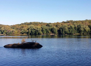
4.0Starting at Algonkian Regional Park and ending at Riverbend Park, this 8.5 mile canoe trip is a perfect way to get away from the traffic that is Northern Virginia. Paddling hard, people have completed it in 4 hours. It can easily be turned into an all day trip lasting 8 or more hours, if paddli...Read more -
Stanley, Virginia
Camp at Big Meadows, Shenandoah National Park
4.4Visiting Shenandoah National Park for the first time can be quite overwhelming. The 109 mile long Skyline Drive, combined with over 500 miles of hiking trails, makes camping is a necessity if you truly want to experience Shenandoah.From the Appalachian thru-hiker to the RV'er, Big Meadows is perf...Read more -
Basye, Virginia
Orkney Springs Trail
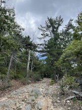
4.94 mi / 1440 ft gainEasy to get to from Bryce resort, Orkney Springs Trail is a moderate to challenging trail. It starts with an easy trail through the woods but does get very steep in mile 2 in what seems like a very rocky dried-out river bed. There is a spectacular view around mile 2. If that's what you’re after y...Read more -
Potomac, Maryland
Great Falls and the Billy Goat Trail
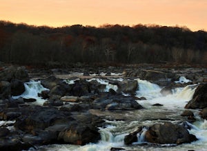
4.54.61 mi / 272 ft gainJust outside of Washington DC is a great hike and rock scramble you don't want to miss. Great Falls lies in both Virginia and Maryland and has beautiful views of the Potomac River. Start out at the Great Falls Tavern parking lot (Maryland side), and keep in mind it is $10 to park here if you don...Read more -
McLean, Virginia
Difficult Run, Ridge, and River Trails
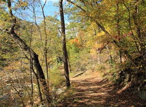
4.53.28 mi / 463 ft gainDifficult Run is a popular hiking location right down the street from Great Falls National Park. Starting at the Difficult Run parking lot you head to the trail at the far end of the lot. The trail will split. The green blazes will take you to the left but you can also stay to the right and hike ...Read more -
Stanley, Virginia
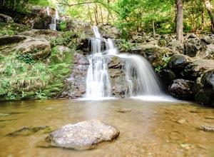
Dark Hollow Falls
4.61.32 mi / 440 ft gainCatch the trailhead to these falls at mile 50.7 on Skyline Drive, just north of Big Meadows Lodge and Campground and the trailhead is just to the left of the parking lot. This is an easy 1.4 mile roundtrip hike, straight down to get to the falls, and straight up to arrive back at your car. Many...Read more -
Stanley, Virginia
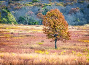
Big Meadows Loop
4.71 mi / 30 ft gainBig Meadows is home to many types of wildlife and is a great location to photograph many different types of animals. The best time to see the wildlife in the meadow is near dawn and dusk. White-tailed deer and a variety of local birds are the most common animals seen in the meadow, and because o...Read more -
Stanley, Virginia
Lewis Falls via Lewis Spring
3.01.71 mi / 607 ft gainLewis Spring is the source of Hawksbill Creek which forms Lewis Falls (also known as Lewis Spring Falls) and eventually flows through the town of Luray and joins the Shenandoah River. The waterfall starts with 2 streams before hitting rock halfway down and fanning out. During dry seasons and summ...Read more -
Montgomery Village, Maryland
Hike the Seneca Creek Greenway Trail Upper Section
5.014.86 mi / 836 ft gainPark in the lot off of Watkins Mill Road to access the trail. This hike is dog friendly and is accessible from March until November.Read more -
Rapidan, Virginia
Hike to Historical Rapidan Camp in Shenandoah National Park
5.04.5 mi / 890 ft gainFor this hike park at the Milam Gap parking lot located at mile 52.8 on Skyline Drive. Once parked you will cross Skyline Drive to reach the trail. Hikers will follow the blue blazes along the trail and creek. After you have crossed the creek twice you will come to a larger waterfall. At this po...Read more -
Stanley, Virginia
Hike to Naked Creek Falls
3.01 mi / 1000 ft gainPlease note that there is no trail leading to these falls. This hike is for advanced hikers.Park your car at Naked Creek Overlook in Shenandoah National Park and walk through the field staying to the left. As you start to enter the woods you will hear the creek running on your left. Make your wa...Read more -
Fairfax Station, Virginia
Explore Burke Lake in Fairfax
4.54.7 mi / 0 ft gainBurke Lake Park has something for everyone. Whether you enjoy trail running, hiking, fishing, canoeing, Frisbee golf, or just having a picnic with your family, you can do it all at Burke Lake. Those who want to be active or exercise can run, hike or biket the 4.7 mile trail that circles the entir...Read more -
McLean, Virginia
Scott's Run Nature Preserve Loop
4.22.51 mi / 397 ft gainThis nature preserve can be hiked year-round and is a sanctuary for rare wildflowers, birds, and other wildlife including deer and fox. There are six main interconnecting trails that run through the preserve; winding their way around matured hardwood forest, sheer bluffs, and rocky cliffs overloo...Read more -
Mathias, West Virginia
Hike Cranny Crow to Millers Rock Loop
10.6 mi / 2100 ft gainThis is a really good day hike to explore another one of the many fantastic state parks that West Virginia has to offer while avoiding some of the crowds that many of the popular ones have. The main feature of the park is the Cranny Crow Overlook which features views into two Virginia and three W...Read more -
Stanley, Virginia
Hike to Bear Church Rock via Bootens Gap
3.59.4 mi / 800 ft gainThe trail leads along the ridge of Jones Mountain to the gorgeous views at Bear Church Rock, and it's the perfect hike for those seeking solitude - didn't see another soul the entire time on a holiday weekend.From the parking lot, head out left on the AT northbound. In .4 miles you will come to a...Read more -
Madison, Virginia
Hike Bear Church Rock via the Graves Mill Trail
3.58.5 mi / 2250 ft gainStarting at the Graves Mill Parking area, head up the yellow blazed trail that is marked by a big cement marker. The trail will follow closely beside the gorgeous Rapidan River. Hike for half a mile until you come to the intersection of the Staunton River Trail. Turn left (do not cross the river)...Read more

