Pennsylvania
Looking for the best hiking in Pennsylvania? We've got you covered with the top trails, trips, hiking, backpacking, camping and more around Pennsylvania. The detailed guides, photos, and reviews are all submitted by the Outbound community.
Top Hiking Spots in and near Pennsylvania
-
Clinton, Pennsylvania
Hike the Mineral Springs Loop
4.71.2 miStarting at the Frankfort Mineral Springs parking lot, this 1.2 mile loop winds along the creek and leads you up into the waterfall and old resort area.After you reach this picture perfect spot, you can continue on the rest of the loop. This will take you through a patch of pines and down a nice ...Read more -
Milford, Pennsylvania
Explore Raymondskill Falls
4.00.6 mi / 178 ft gainThis waterfall is just a short walk away from the main parking lot.Just a .30 mile hike will take you to a gorgeous three-tiered waterfall. There are platforms providing viewing areas to the falls.Raymondskill Falls is located in the northern portion of the Delaware National Water Gap Recreationa...Read more -
Lake Harmony, Pennsylvania
Shades of Death Trail
4.51.89 mi / 223 ft gainThe trailhead and parking are available by the park office or along PA 534 by the nature center and amphitheater. This trail is beautiful and seemed to change around every bend. Sand Spring Run flows alongside the entire trail. Rock formations and rhododendron mix with remains of a logging mill a...Read more -
Penn Forest Township, Pennsylvania
Tank Hollow Vista
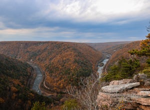
4.03.33 mi / 272 ft gainThis is a simple, short hike to a fantastic vista looking out over the Lehigh River Gorge. The trailhead for the hike to Tank Hollow Vista is along Behrens Road just outside of Jim Thorpe, PA. Most of the hike is on state game lands. If the gate is open from the first lot, you can shorten this h...Read more -
Coudersport, Pennsylvania
Camp at Cherry Springs State Park
4.61 miCherry Springs State Park was my first ever International Dark Sky Park and it stole my heart, and I promise it will steal yours too.The park itself is very quaint, but don't let it's size deter you! The park is still as remote and wild as it was nearly two centuries ago, and that's nearly imposs...Read more -
Milford, Pennsylvania
Hike to Cliff Park Ridge
5.06.4 mi / 700 ft gainThis 6.4 mile out-and-back trail (2.7 miles each way) is an excellent trail for those looking to spend an early morning or afternoon outside without the strenuousness of all-out mountain hiking. Throughout the entire hike, there is only 700 ft. of elevation gain. Don't let this turn you away if y...Read more -
Walnutport, Pennsylvania
Lehigh Gap via Appalachian Trail
4.52.15 mi / 817 ft gainLehigh Gap was formed by the Lehigh River carving a large hole in the foothills of the Appalachian Mountains. One side is owned and operated by the Lehigh Gap Nature Center and has some great hikes, but this side is government-owned. Parking for this portion of the Appalachian Travel is up a litt...Read more -
Philadelphia, Pennsylvania
Hike the Wissahickon Gorge: Valley Green and Two Meadows Loop
5.08.5 miThe Wissahickon Gorge offers beautiful hiking without even having to leave the Philadelphia city limits. There are seemingly countless entry points into the gorge and hiking options are plentiful, with everything from a leisurely stroll down Forbidden Drive to an 18 mile boot buster available.One...Read more -
Wellsboro, Pennsylvania
West Rim Trail
4.027.97 mi / 4065 ft gainHiking north to south, the trailhead is just off of Colton Road at a gravel parking lot with bathrooms. The trail is marked with orange blazes and has the largest elevation gain at the beginning and then has relatively moderate elevation change throughout the remainder of the hike. At 2.6 mile...Read more -
Lehighton, Pennsylvania
Hike the Falls Trail at Beltzville State Park
4.05.5 miAt the Christman Trailhead, hike a quick, flat 2.5 miles following the yellow trail markers through farm meadows and birch forests to the Falls Trail loop/intersection. Here hike the Falls trail which is a 0.5 mile loop that links back to the 2.5 mile section back to the parking area. Bridges and...Read more -
Lake Harmony, Pennsylvania
Explore Boulder Field in Hickory Run State Park
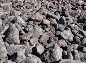
3.0Boulder Field is easily found following signs in Hickory Run State Park and has its own parking lot. Boulder Field is a small piece of landscape leftover from the last ice advance thousands of years ago. It covers an area of 400 feet wide by 1,800 feet long and about 10 feet deep. Boulders rang...Read more -
Montoursville, Pennsylvania
Hike to Jacoby Run Falls
4.03.3 mi / 341 ft gainThe trailhead is at a large gravel parking area off of Wallis Run Road. The trail begins on a boardwalk over a wetland that leads into hemlock forest and mixed hardwoods.The yellow blazed trail follows Jacoby Hollow at a steady slight incline and leads to the 45 foot Jacoby Falls. Best times to...Read more -
Williamsport, Pennsylvania
Backpack the Old Logger's Path
5.027 miThe Old Logger's Path follows abandoned logging roads in a loop through the Loyalsock State Forest. There are multiple places to join the trail, but most people start in the ghost town of Masten, PA.Highlights include Rock Run, noted by many as the most beautiful steam in Pennsylvania. Vistas alo...Read more -
Brown Township, Pennsylvania
Hike the Hemlock Mountain Loop
5.06.48 mi / 1200 ft gainThe trail starts where Naval Run Road ends. Follow the the blue blazes into Naval Run. After crossing Naval Run continue right up an old logging skid trail along the run. The trail will intersect with the Black Forest Trail at Naval Run Falls.The trail will follow the orange blazes of Black Fo...Read more -
Morris, Pennsylvania
Hike to Pine Island Vista
5.05.1 miThe access to this trail is from a mountain road, Clay Mine Road. From Stony Fork, follow Dibble Hill Road to Clay Mine Road, once on Clay Mine Road, follow into the forest and park at the first gravel parking area on the right. You will see the unmarked trail at the rear of the parking startin...Read more -
Ellwood City, Pennsylvania
Hike to Slippery Rock Creek from Hell's Hollow
5.04.6 miThis nicely groomed trail starts at Hell's Hollow and branches off to the left. The trails total length is 24 miles long, but we chose to start off slow and go with an out and back just to the creek. This is a 2.3 mile hike one way which also has some steep inclines and a few switch backs.The sta...Read more

