Oregon
Looking for the best backpacking in Oregon? We've got you covered with the top trails, trips, hiking, backpacking, camping and more around Oregon. The detailed guides, photos, and reviews are all submitted by the Outbound community.
Top Backpacking Spots in and near Oregon
-
Sisters, Oregon
Camp at Big Lake
The crystal clear waters of Big Lake sit at an elevation of 4,600 ft. in the Willamette National Forest, on the western slopes of the Cascade Mountain Range. The Big Lake Campground (N 44 22.439 W 121 53.599) lies on the western shore of Big Lake, at the top of the Santiam Pass near Hoodoo Ski Re...Read more -
Halfway, Oregon
Hidden Lake via East Eagle Trailhead
5.018.52 mi / 3789 ft gainThe Wallowa Mountains are one of Oregon's best-kept secrets, and this overnight backpack into the Eagle Cap Wilderness will deliver you into the heart of the range. Following the East Eagle Creek through a valley filled with meadows and the occasional aspen, you will be surrounded by towering gra...Read more -
Halfway, Oregon
Eagle Cap Wilderness Loop
5.040.13 mi / 10630 ft gainThe top trip in Oregon's Eagle Cap Wilderness takes you in a loop around Eagle Cap, Oregon's 13th tallest peak and through three high mountain passes. East Eagle trailhead has two main parking lots, the first one you come to is a trailer parking lot meant for horse trailers, but make sure you dri...Read more -
Jefferson County, Oregon
Hike Canyon Creek Meadow and 3 Fingered Jack
5.0This hike is truly spectacular from the moment you step foot out of your car. Jack Lake lies at the beginning of the trail, and provides a beautiful sample of what's to come. Stop and take pictures if you feel so inclined, but don't stop here to camp, because it gets a LOT better!Follow the trail...Read more -
Cascade Locks, Oregon
Ruckel Ridge Loop
5.08.08 mi / 3730 ft gainThis ridge is one of the lesser known paths from the Eagle Creek Trailhead. Instead of taking Ruckel Creek Trail, find the trail leading up Ruckel Ridge. It is a far more difficult hike of about 7 miles leading up to Benson Plateau. Along the way there are beautiful lookout points for Mount Hood,...Read more -
Cascade Locks, Oregon
Backpack the Mark. O Hatfield Wilderness Via Eagle Creek
1.026 mi / 2300 ft gainThis is a somewhat incomplete report because we did not venture too far into the Mark O. Hatfield Wilderness. The sky had been threatening us with rain for the duration of our hike along Eagle Creek and we did not want to push our luck too far since we were hoping for an early start on our drive ...Read more -
Idanha, Oregon
Hike Grizzly Peak
4.510 miAfter leaving your car at the Pamelia Lake trailhead, hike 2.3 miles along the trail following Pamelia Creek. The Grizzly Peak trailhead will be on the right just before the lake, which you should check out before or after your hike up to Grizzly Peak—there are several campsites around the lake t...Read more -
Cascade Locks, Oregon
North Lake via Wyeth Trail
1.012.36 mi / 4505 ft gainPark at the Wyeth Trailhead parking lot and start hiking south along the old road bed. At the junction with the Gorge-Wyeth Trail, bear left and follow the Wyeth Trail as it goes beneath several power lines. Follow the trail as it goes back into the woods and crosses Harphan Creek. Continue on an...Read more -
Joseph, Oregon
Backpack to Ice Lake in the Wallowas
5.018 mi / 3380 ft gainStarting at the end of Wallowa lake, this 18 mile roundtrip hike begins at 4,520' and remains pretty mellow over the first 2.5 miles. Total elevation gain of the hike is about 3380', ending at the Ice Lake which sits at 7,900'. Following the West-Fork Wallowa river trail 1820 for about 2 miles, u...Read more -
Lane County, Oregon
Substitute Point via Foley Ridge Trail
9.75 mi / 1900 ft gainThis is a viewless hike until you reach Substitute Point. You are then rewarded with an amazing view. From the trailhead (#3511) you will travel 4.3 miles on an unmaintained trail into the Three Sisters Wilderness to the junction of Substitute Point. The trail has lots of fallen trees you must c...Read more -
Lane County, Oregon
Summit Diamond Peak
9 mi / 3600 ft gainAt 8,743 feet, Diamond Peak is almost as tall as the other iconic volcanoes of the Oregon Cascades, but sees just a fraction of the people. Outside the range of casual Portland day hikes and hard to see from the highway and from other peaks, Diamond Peak and the spectacular wilderness surrounding...Read more -
Foster, Oregon
Hike the Middle Pyramid
4.5The Three Pyramids, half as tall as the better-known Three Sisters, are beautiful U-shaped glacial valleys, remnants of the Ice Age.To reach the top of Middle Pyramid, leave from the #3380 trailhead at the west end of the parking area. Early on there is a creek crossing (the bridge was still wash...Read more -
Joseph, Oregon
Backpack Wallowa River Loop
51 mi / 11400 ft gainThis trip begins at the Wallowa Lake Trailhead at the south end of the lake. Permits are free and self-issued at the trailhead. Parking is also free!Follow the West Fork Wallowa Trail (#1820) for 3.1 miles until you reach Ice Lake Trail (#1808). Take a right on 1808 if you want to do the Ice Lake...Read more -
Government Camp, Oregon
Veda Lake Trail
4.02.5 mi / 748 ft gainThis hike starts at the Fir Tree Trailhead and is an out and back 2.8 mile round trip. It's short, but there's 660 feet of elevation gain. To start, you climb steeply then it's an easy hike to a beautiful viewpoint overlooking the lake. The trail descends via switchbacks down to the lake for the ...Read more -
Jackson County, Oregon
Backpack to Devil's Peak and the Seven Lakes Basin
3.013.7 mi / 3050 ft gainStarting at at elevation of 5250 feet, the trail climbs steadily from the trailhead for approximately 3.3 miles to pass at 6900 feet. From here you will come to a junction where going right will lead to Devils Peak and the PCT and going left (straight) will take down into the basin. If you starte...Read more -
Sisters, Oregon
Snowshoe to the Mountain View Shelter
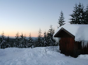
5.04 mi / 500 ft gainA short hike from the sno-park, the snow shelter is within an hour's reach of the trailhead. Make sure to print a trail map of the area's routes ahead of time, or take a picture of the map provided in the parking lot, as the network of trails can get you a little lost.From the parking lot, make s...Read more


