Old Fort, North Carolina
Top Spots in and near Old Fort
-
Brevard, North Carolina
Looking Glass Rock
4.65.43 mi / 1572 ft gainThis is a really nice, moderately difficult hike along a cascading creek, up switchbacks, and through wildflower fields. A couple miles in, you'll reach a helipad that is used for rescuing injured rock climbers - Looking Glass Rock is a popular destination for world class climbing. There is a sma...Read more -
Elk Park, North Carolina
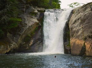
Elk River Falls
4.60.35 mi / 62 ft gainThe coordinates for the parking area are 36.198288, -81.970137. You'll see a parking area that's dirt/gravel on the right side of the road. At the far end of the parking lot is a sign that says Elk River Falls with an arrow pointing up the hill. From this point its about a .2 mile long walk to th...Read more -
Cleveland, South Carolina
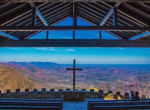
Photograph Fred W. Symmes Chapel (Pretty Place)
Getting there Fred W. Symmes (aka Pretty Place) Chapel is perched near the top of Standing Stone Mountain at 3000 feet above sea level. That being said, expect a long and winding drive up the mountain. It takes about 30 minutes starting from the bottom of the mountain to arrive to the chapel. Th...Read more -
Greenville County, South Carolina
Hike the Jones Gap Loop
5.05.5 mi / 2000 ft gainStart on the Jones Gap Trail (blue), which will lead you alongside the Saluda River. After 2.5 miles, take the Old Springs Branch Trail (orange) to loop back to the lot.For a challenging, more strenuous hike, with great views of the Gap, check out Rim of the Gap Trail. It is not advised to take c...Read more -
Greenville County, South Carolina
Hike the Pinnacle Pass/Rim of the Gap Loop
11.5 mi / 2345 ft gainThe Trailhead: Located at Jones Gap State Park in Marietta, SC of northern Greenville County. Follow the trail across an iron bridge that crosses the Middle Saluda River, and be sure to register at the Ranger’s Station/Gift Shop on the far side of the gap. The trail head(s) are located directly o...Read more -
Greenville County, South Carolina
Hike to Rainbow Falls and Pretty Place
5.05.96 mi / 1844 ft gainJones Gap State Park in the Upstate of South Carolina is one of the most beautiful parks in the state offering a good range of moderate and challenging hiking and backpacking trails through the Mountain Bridge Wilderness Area. Jones Gap also provides superb primitive camping sites along the rocky...Read more -
Unicoi, Tennessee
Pinnacle Mountain Trail
8.81 mi / 2700 ft gainPinnacle Mountain is a long, grinding climb to the top. The singletrack winds up 1,500 feet of elevation for nearly 5 miles with few downhill sections. Once at the top, take a rest and climb the fire tower that overlooks the Downtown Johnson City area, Elizabethton, Erwin, and the rest of the Buf...Read more -
Brevard, North Carolina
Hike to John Rock
5.05 mi / 1000 ft gainThis 5 mile loop begins at the Pisgah Center for Wildlife Education and State Fish Hatchery near Brevard, NC. Ample parking is available adjacent to the trailhead with bathrooms and water accessible. Grab a map from inside as well. To start the hike, look at the education center, to the left is t...Read more -
Canton, North Carolina
Skinny Dip Falls
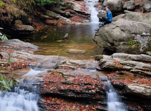
4.81.03 mi / 148 ft gainPark at the Looking Glass Rock Overlook. After enjoying the view of Looking Glass Rock, gear up and head to the right side of the parking area (right side if your back is to the overlook). On the opposite side of the road you'll see a mile marker and a little trail to the left of the marker. Foll...Read more -
Unicoi, Tennessee
Pinnacle Mountain Fire Tower via Fire Tower Road
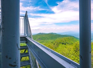
5.03.47 mi / 663 ft gainPinnacle Mountain hosts one of the nicest fire towers on the East Coast of the United States. The fire tower is relatively new, sturdy, and has a large 360 degree viewing area at the top. The tower overlooks the Downtown Johnson City area, Elizabethton, Erwin, and the rest of the Buffalo Mountain...Read more -
Greeneville, Tennessee
Hike to Margarette Falls
5.02.7 mi / 715 ft gainTo reach the trail head, take exit number 39 to Erwin/Jonesborough and turn onto State Route 81/107 west and stay on this for 6.5 miles. Then you will turn left to stay on Route 107 and continue on for 16 more miles. Then you will take a left on Route 351 and drive 4.5 miles. Then you will take a...Read more -
Blowing Rock, North Carolina
Camp and Paddle at Price Lake
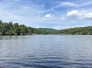
This campground is all kinds of amazing, and if you get one of the sites in the A loop, you will have lakefront property (just be warned, if I see you there, I'll have to crash with you ;-). Price Lake is a gorgeous lake right off the Blue Ridge Parkway in North Carolina and perfect for canoeing...Read more -
Canton, North Carolina
Graveyard Fields-Black Balsam Knob Circuit
4.49.83 mi / 1522 ft gainWhen the weather is in your favor, these treeless mountain tops will have your jaw on the floor with layers upon layers of Blue Ridge Mountains. This hike can be done in one day, but with panoramic views at multiple points, you'll want to take your time along this link of trails. This ~10-mile l...Read more -
Canton, North Carolina
Explore Lower Falls at Graveyard Fields
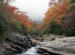
4.3Graveyard Fields got it's name years ago from wind-thrown tree trunks that gave the appearance of a graveyard, until 1925 when an intense fire swept through the area, destroying the stumps. The forest has been recovering ever since.The parking area for Graveyard Fields is located at milepost 418....Read more -
Blowing Rock, North Carolina
Price Lake Loop Trail
5.02.23 mi / 387 ft gainPrice Lake Loop Trail is a loop trail that takes you by a lake located near Blowing Rock, North Carolina.Read more -
Blowing Rock, North Carolina
Boone Fork Trail
4.05.06 mi / 1030 ft gainBoone Fork Trail is a loop trail that takes you by a waterfall located near Boone, North Carolina.Read more

