Top Spots in and near White Sands National Monument
-
Las Cruces, New Mexico
5.0
9.92 mi
/ 3458 ft gain
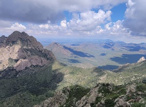
Organ Peak Trail is an out-and-back trail where you may see beautiful wildflowers located near Las Cruces, New Mexico. This is one of the longer and more challenging hikes in the Organ Mountains. An early start is recommended to keep heat down during the warmer months as well trekking poles and p...
Read more
-
Las Cruces, New Mexico
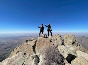
The Organ Needles Trail in Las Cruces, New Mexico is a challenging hike that rewards with stunning views. This 5.88-mile round trip trail is rated as difficult, with a steep incline and rocky terrain. The trail begins at the Baylor Canyon Road trailhead and ascends to the Organ Needle Peak, the h...
Read more
-
Las Cruces, New Mexico
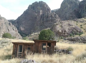
This is a very scenic moderate 3,5 mile hike featuring beautiful views, rare plants and the ruins of the historic Dripping springs resort. Lots of wildflowers in the summer. In the winter you may encounter some snow and ice at the end of the trail. The trail is rather busy on week-ends but not so...
Read more
-
Cloudcroft, New Mexico
5.0
2.51 mi
/ 331 ft gain
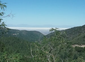
Pleasant hike located in the higher elevations of the Sacramento Mountains. Fairly easy hike through forests and meadows. Very good views of the mountains, Whitesands National Monument, and Cloudcroft. Abundant wildflowers in the summer. Good opportunity to connect to other trails in the area. Mu...
Read more
-
2572-2598 Desert Wind Way, New Mexico
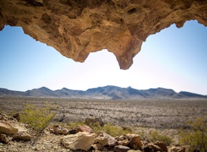
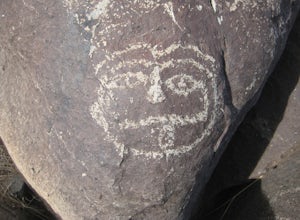
The Dona Ana Mountains offer a variety of outdoor fun. Hiking, rock climbing, wildflowers and petroglyphs.
There are several different ranges to explore with arches, steep cliffs and also easy trails.
The elevation gain changes depending which trails you decide to take.
You can also access the...
Read more
-
Las Cruces, New Mexico
The trail follows the foothills of the Organ Mountains. The terrain is hilly but not very difficult to hike. There are some steep laces and also some sandy places. I have only hiked sections of the trail at different occasions . There are a lot of interesting plants along the trail. The trail is ...
Read more
-
CanAm Highway, New Mexico
To get to Tonuco Mountain North of RadiumSprings , NM from Las Cruces, NM take Interstate 25 to exit 32. Once off the interstate turn left on go under the interstate. Take the first dirt road to your left and drive to the top of the canyon.
If you have a 4 wheel drive vehicle you can descend into...
Read more
-
Las Cruces, New Mexico
Leasburg Slot Canyon is a 2.4 mile trail that offers a unique experience that is close to Interstate 25. The directions will take you to the banks of the Rio Grande where you can park anywhere along the dirt road that is convenient. This hike should only be attempted in the late fall or winter be...
Read more
-
18 Faulkner Canyon Road, New Mexico
The drive in the canyon is very sandy so a good vehicle is required. In the canyon is the black hill where Billy the Kid and 3 of his friends were hiding out. Was not able to find their names inscribed on one of the rocks.
There are also remnants of an old ranch. Nice walk along a sandy arroyo w...
Read more
-
16085-16107 North Valley Drive, New Mexico
Foster canyon is along hwy NM 185 near Buckle Bar Canyon and Faulkner canyon. It is a fairly easy walk in a sandy arroyo. There some interesting rock formations there. Also by climbing some of the hills off the arroyo you will have some good views of the surrounding mountains.
Read more
-
Las Cruces, New Mexico
There is not a designated trail here. You will have to find your own way up the mesa. The climb is rated as moderate is about 2 miles long. There is an elevation gain of about 700 ft. Good views from the top.
Read more
-
Las Cruces, New Mexico
Hiked the canyon after having crossed the Rio Grande in the winter, very little water in the river. I climbed several mountains with very good views of the mountains around us. Many great cacti can be seen here. Hiked about 3 miles round trip. Best hiked in the winter or spring.
Read more
-
Las Cruces, New Mexico
The road to get here is a dirt road, but I was able to do it without a 4x4 or high-clearance vehicle. Once you park off to the left in the little gravel pull-off, you're going to follow the trail that is on the same side of the road. There will be a post that is red at the top (second picture) th...
Read more
-
Tularosa, New Mexico
The site is North of Tularosa, NM and is easily accessible. There is good parking and the trail is not very difficult to walk. There are many petroglyphs to be admired. There are good views of the Tularosa basin and the Sacramento mountains. It is best not to go in the summer as it is very hot an...
Read more
-
Rincon, New Mexico
Started my journey right after I park on the dirt that passes under the interstate. Headed north up the hill passed an old mine and continued until I reached the arroyo. Climbed around the arroyo to see the different petroglyphs. Good views of the Rio Grande valley below.
Read more
-
Vado, New Mexico
Start your hike from the Sierra Vista parking lot. Proceeded NE toward Bishops Cap. At first, the trail goes through some small arroyos and is a little rocky. After about half a mile, the trail is rather flat and goes through some sandy and grassy areas. Enjoy good views of the mountains!
Read more

