Epsom, New Hampshire
Top Spots in and near Epsom
-
Wells, Maine
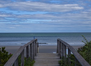
Hike to Laudholm Beach at Wells National Estuarine Reserve
1.5 mi / 0 ft gainFrom the main parking area take the Beach Barrier Trail which takes you through several different types of environment; fields, forests, and marshland before reaching Laudholm Beach to further explore or take a dip.Walk the length of Laudholm Beach if you have time where barrier beaches protect a...Read more -
Alexandria, New Hampshire
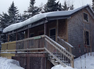
High Cabin
5.04 mi / 1275 ft gainHigh Cabin, located in Cardigan State Forest, is owned and operated by the Appalachian Mountian Club (AMC). It was originally built in 1931 and since renovated in 2004. Renovations included a new roof, siding, bunk beds, a wood stove, and a composting toilet. It comes supplied with wood, bunks(st...Read more -
Wells, Maine
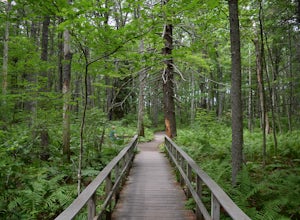
Hike the Carson Trail in Rachel Carson National Wildlife Refuge
4.01 mi / 0 ft gainPull into the well marked Wildlife Refuge off Port Rd. There's several official building as well as an interpretive center and bathroom very close to the parking lot.The only trail, the Carson Trail, is feet from the parking area. It's an extremely well groomed gravel trail easily accessible for ...Read more -
Orange, New Hampshire
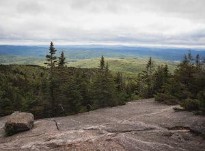
Hike Cardigan Mountain via the West Ridge Trail
4.73 mi / 1200 ft gainCardigan Mountain is located in Cardigan Mountain State forest just outside of Canaan, New Hampshire. Just make sure to go to The Cardigan Mountain state park parking lot, via Cardigan Mountain Road and not the AMC Cardigan Lodge. The trail begins right from the parking lot where there is a port...Read more -
Kennebunk, Maine
Hike the Bridle Path through the Madelyn Marx Preserve
4.01.5 mi / 0 ft gainAfter crossing the Mousam River on Western Ave, see signs and gravel pull-off areas for parking at the Bridle Path trailhead. The Madelyn Marx Preserve is a greater part of the Kennebunk Land Trust home to many preserves in the area (So look for Kennebunk Land Trust signs as well).Hike through op...Read more -
Newbury, Massachusetts
Hellcat Dunes Loop
4.50.98 mi / 20 ft gainPark in the parking area off of Refuge Rd. Take the Dunes Trail, a boardwalk path for the ~1-mile loop. Enjoy the views from an observation deck on three-story-high dunes. This trail is accessible from April-October.Read more -
Dayton, Maine
Cross Country Ski the Trails at Harris Farm
Harris Farm is a great place for beginner cross country skiing or to hone in on already developed skills. They provide rentals ($15pp) and the network of trails is several miles long. The trails range from green (easy) to red/black (more difficult). I personally love hanging out on the blue trail...Read more -
Groton, Massachusetts
Catch a Sunset at Gilbert Hill
5.01 miFrom Rt. I-495 Exit 31, Gibbert Hill has one of the greatest sunsets around Groton, MA area. You will see a lot of cows and even a castle. This is a very easy hike and a not so easy place to park, you have to leave you car on the side of the road, which is totally fine, I guess, it is easy.The wa...Read more -
Jaffrey, New Hampshire
Mount Monadnock via White Dot & White Cross Loop
4.53.7 mi / 1686 ft gainThe White Dot Trail is the shortest, steepest ascent to the summit, while White Cross has a slightly easier grade down with very little difference in distance. Therefore, per the park's rangers, the best way to conquer this loop is White Dot up, White Cross down.The White Dot Trail begins at Mon...Read more -
Jaffrey, New Hampshire
Mount Monadnock via White Dot Trail
4.43.46 mi / 1699 ft gainMonadnock State Park is located in and around the 3,165-ft. Mount Monadnock. Mount Monadnock is crisscrossed by many miles of well-maintained hiking trails. The popular White Dot Trail (2.2 miles) is the shortest but steepest ascent to the summit, accessible from the Monadnock State Park headquar...Read more -
Ashburnham, Massachusetts
Summit Mount Watatic via the Wapack Trail
5.03 mi / 800 ft gainEntering Mount Watatic in your GPS will take you to Rindge State Road (119), continue about two minutes down the road past where the GPS tells you. on the Right hand side you will will see a sign for Mount Watatic Parking area or just enter in coordinates: 42.696796, -71.904521 You will begin the...Read more -
Ipswich, Massachusetts
Photograph Castle Hill
4.0Castle Hill refers to either a 165-acre drumlin surrounded by sea and salt marsh or to the mansion that sits on the hill. Both are part of the 2,100-acre Crane Estate located on Argilla Road in Ipswich, Massachusetts.Take a walk through the public garden or down to the beach. Plenty of beautiful ...Read more -
Jaffrey, New Hampshire
Summit Mt. Monadnock via Marlboro Trail
5.04 mi / 2300 ft gainStart at the Marlboro Trailhead (you can enter this in Google maps) off Shaker Road. There's parking and porta-potty bathrooms. The trail is well-marked with white dashes/M marks all the way up. Once on trail, the initial 800 ft climb is through forested terrain with a few brooks and streams alon...Read more -
Jaffrey, New Hampshire
Hike MT Monadnock via White Arrow Trail
4.3 mi / 1485 ft gainArriving at the Old Toll Road/Halfway House Trail head you will have $5 entrance fee. Starting on the Old Toll road you'll find yourself walking on a gradual incline into the beautiful New Hampshire wilderness. Everything you see and smell is fresh and vibrant. Following the road for 1.1 miles yo...Read more -
Thornton, New Hampshire
Hike the Welch Mountain and Dickey Mountain Loop
5.04.1 mi / 1807 ft gainThis is a very well-marked and traveled trail, marked with yellow blazes. Start off at the trailhead (easy parking, $3 fee) and be sure to go counter-clockwise for the best route. The beginning of the trail meanders along next to a babbling brook and through forested terrain. The climb gets stead...Read more

