Coram, Montana
Top Spots in and near Coram
-
Kalispell, Montana
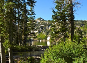
Backpack to Black Lake
7 mi / 1500 ft gainBegin at Camp Misery (elev. 5,717 ft). This is a total misname by the way! It should be titled Camp On The Way To Awesomeness! Anyway, head .6 miles on Trail 8 to the intersection of trail. From here turn right on Trail 68 and hike .7 miles until the intersection where you turn right on Trail 7 f...Read more -
Kalispell, Montana
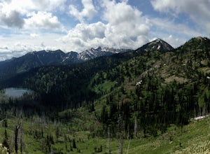
Backpack to Clayton Lake
9 mi / 1500 ft gainFrom the Camp Misery Trailhead (elev. 5,717 ft) take the left Trail 8 for .6 miles. At the junction continue left for a 1.3 mile gently ascent into Jewel Basin. Nearing Twin Lakes continue left on Trail 7 for .6 miles until you reach Trail 55. Continue right, and make sure that after a short .3 m...Read more -
Kalispell, Montana
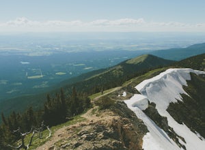
Hike to Summit of Mount Aeneas
4.96 mi / 1700 ft gainThis hike can easily be overlooked since it is in such a geographically rich area, with Glacier National Park and the Bob Marshall Wilderness so close, but it is absolutely a hidden gem that doesn't get enough attention. Mount Aeneas sits at just over 7,500 feet and from the summit it gives amazi...Read more -
Bigfork, Montana
Aneas Loop
3.02.77 mi / 207 ft gainAneas Loop is a loop trail where you may see beautiful wildflowers located near Bigfork, Montana.Read more -
Flathead County, Montana
Hike Glacier View Mountain
5.04 mi / 2880 ft gainDriving north from Columbia Falls, MT for 20 miles, park after the junction of the Camas Road and the North Fork Road. This parking area is directly after the junction on the east side of the road and the trail begins on the west side of the road.The beginning of the trail is started with many sw...Read more -
Bigfork, Montana
Swim in Graves Bay Swimming Hole
To get to this swimming hole you drive south from Hungry Horse on the West Side Road (Forest Road 895) 33.6 miles to the Graves Creek Campground. Park in the small parking lot with the bear box and outhouse, opposite the campground closer to the lake. Follow the path as it leads you past the casc...Read more -
Bigfork, Montana
Explore Graves Creek Falls
Graves Creek Falls are a series of pleasant waterfalls viewable without much effort. To get here From Hungry Horse drive south on the West Side Road (Forest Road 895) 33.6 miles to the Graves Creek Campground. From here turn right into the campground, park and take a short walk of a couple hundre...Read more -
West Glacier, Montana
Explore Avalanche Creek
5.00.7 miAvalanche Creek is one of Glacier National Park's easiest features to access and also one of its most unique. The old-growth cedar forest is home to towering trees, moss-covered boulders, and a rushing stream of glacial water. A small loop trail winds through the lower forest and leads to a bri...Read more -
West Glacier, Montana
Trail of the Cedars
5.00.88 mi / 121 ft gainTrail of the Cedars Trail is a loop trail that takes you by a river located near Lake Mc Donald, Montana.Read more -
West Glacier, Montana
Avalanche Lake via Trail of Cedars
4.95.91 mi / 730 ft gainThis very scenic Glacier National Park hike off of Going-to-the-Sun road is 4.5 miles with a total elevation gain of 730 feet. The hike to Avalanche Lake begins from the Trail of the Cedars trailhead. Be prepared for a lot of incline. Approximately one half mile from the trailhead you’ll reach...Read more -
Whitefish, Montana
Hike Whitefish Mountain via the Danny On Trail
5.07.6 mi / 2250 ft gainThe Danny On Trail starts from the base area of Whitefish Mountain Ski Resort and zig zags its way up to the summit. The trailhead is near the Chalet building/Hellroaring Saloon upper parking lot (there's a big sign). The trail passes through Douglas fir, western larch, spruce and fir trees. The ...Read more -
Flathead County, Montana
Hike Demer's Ridge
7.47 mi / 3420 ft gainThis trail is a point to point, so two cars are necessary. The ending point is where Camas Rd intersects the North Fork Road at the Blankenship Bridge. The starting point for the hike is at Demer's Pit. Driving 22 miles from Columbia Falls, MT, make your way to the parking spot, Demer's Pit. From...Read more -
Browning, Montana
Photography on Logan Pass
5.0Disclaimer: Glacier National Park has closed any off-trail activity in this area. The majority of the photos can be taken on-trail. Please be sure to adhere to the park's policy.With a short window of opportunity for visiting, Logan Pass offers a wealth of photographic options. As the winter sno...Read more -
Browning, Montana
Hidden Lake Overlook
5.02.83 miThe trail starts at the Logan Pass Visitor Center, which is right in the middle of Going-To-The-Sun Road. It can be very busy during the middle of the day, but early morning and early evening will have less of a crowd. It's a pretty short hike in a beautiful wide open alpine meadow. We were gree...Read more -
Browning, Montana
Hike Dragon's Tail Ridge
3.53 mi / 1800 ft gainStarting from Logan's Pass, make your way along the boardwalk that leads to the Hidden Lake Overlook. Depending on the previous winter, there may be quite a bit of snow covering large portions of the boardwalk and trail that leads to Dragon's Tail, so it is suggested that you take any necessary p...Read more -
Browning, Montana
Reynolds Mountain
4.511 mi / 2500 ft gainReynolds Mountain stands high above the Logan Pass Visitors Center. Because of it's easy location, be prepared to get caught in the heavy rush of tourists on the way up. Though most will not be going to Reynolds Mountain, you will still need to "wade" through heavy tourism to reach the trail he...Read more

