Euharlee, Georgia
Top Spots in and near Euharlee
-
Roswell, Georgia
Climb and Chill at Allenbrook
4.0You’re going to be really surprised you’re still in Roswell, or in the Atlanta area at all. When you get out of your car and start walking down the wooden stairs at the start of the trail, the busy sounds of the rushing cars on Atlanta Street fade away into the wind flowing through the Tulip Popl...Read more -
Roswell, Georgia
Hike to the Roswell Mill Ruins via Vickery Creek Trail
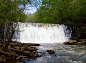
4.43.46 mi / 374 ft gainFrom Riverside Road, the Vickery Creek Trail takes you alongside the creek, then to an intersection where you will turn right. Switch onto Outer Loop Trail at the next intersection, and keep an eye out for marked junctions going forward. The trail will take you to the Roswell Mill waterfall, the...Read more -
Sandy Springs, Georgia
Hike through Big Trees Forest Preserve
4.02 mi / 120 ft gainBig Trees is truly a backyard beauty. The entrance connector brings you through to the beginning of the trails. If you are low on time, try out the Big Trees Loop (1/2 mile) which appears slightly before the major Backcountry trail system. Without going too deep into the preserve, you can still e...Read more -
Roswell, Georgia
Big Creek Freeride
3.5The Big Creek Freeride area is part of the Big Creek recreation area which provides a paved greenway, singletrack mountain biking trails, and two pump tracks.The Freeride area contains a number of downhill mountain biking lines that bottom out at the Greenway toward the back end of the trail syst...Read more -
Atlanta, Georgia
Take a Stroll through Blue Heron Nature Preserve
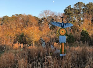
0.7 miBlue Heron Nature Preserve is located directly off of the heavily trafficked Roswell Road in Buckhead. The preserve boasts seven acres of greenery, wetlands, meadows, wildlife, and wildflowers. There is even an educational facility located on the grounds for those extra curious explorers. This...Read more -
Atlanta, Georgia
Hike the Cascade Springs Trail
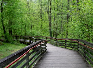
5.01.9 miA quick and local getaway from the hustle and bustle of Atlanta city life, Cascade Springs Nature Preserve offers over 100 acres of forested trails that lead to Utoy Creek and Cascade Falls.The trail starts at the parking area and leads to a boardwalk where old historical structures stand alongsi...Read more -
Alpharetta, Georgia
Bike or Run the Big Creek Greenway
3.516 mi / 200 ft gainThe Big Creek Greenway is a roughly 8-mile stretch of paved trail that runs from its northern Marconi Drive entrance in Alpharetta down to Old Alabama Road in Roswell. There is also an extended bit of the Greenway a little further north in Forsyth County, though these two trails do not connect. T...Read more -
Ellijay, Georgia
Hike the Tumbling Waters Trail
5.01.3 mi / 160 ft gainJust North of Carters Lake lies one of its tributaries, Tails Creek. The Tumbling Waters Trail follows along a scenic stretch of this creek as it cascades its way towards the lake. This trail is moderately trafficked and considered a local favorite. The Tumbling Waters trailhead also contains a...Read more -
Atlanta, Georgia
Morningside Nature Preserve Loop
4.52.01 mi / 154 ft gainPark your car on the residential road and look across the street into the woods for the trail. The trail winds around through a bamboo forest with streams winding in and out. The trail splits and you can either take the high road or low road closer to the river. Both trails meet back up near the...Read more -
Atlanta, Georgia
Eastside Trail of the Atlanta Beltline
4.71.93 mi / 164 ft gainTo visit the Eastside Trail of the Atlanta Beltline, park in the paid public parking (different pricing Monday-Thursday & Friday-Sunday) at the far southeast corner of Piedmont Park, behind the Park Tavern restaurant and brewery. From there, walk to the intersection of Monroe Dr. and 10th St....Read more -
Jasper, Georgia
Mount Oglethorpe
0.69 mi / 49 ft gainMount Oglethorpe, located in Jasper, Georgia, offers a challenging hiking trail that spans approximately 0.69 miles. The trail is marked by a steady incline, making it suitable for intermediate to advanced hikers. The path is well-maintained and clearly marked, ensuring a safe journey for all hik...Read more -
Fort Payne, Alabama
Little River Canyon
1.33 mi / 180 ft gainLittle River Canyon is a loop trail that takes you by a waterfall located near Fort Payne, Alabama.Read more -
Fort Payne, Alabama
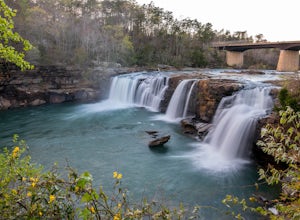
Explore Little River Falls
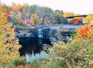
4.0Little River Falls is a popular site within the Little River Canyon National Preserve, a 12 mile long, 600 ft deep canyon.The 45-foot falls can be accessible from two different vantage points – either via a paved but steep path from the parking lot down to an overlook, or by driving to a higher l...Read more -
2126-2144 Ponce De Leon Avenue Northeast, Georgia
Stroll through Deepdene Park
4.02 miDeepdene Park is the eastern most segment of the Olmsted Linear Park system that borders Ponce de Leon Avenue, connecting the Poncey-Highland community to the Druid Hills neighborhood. The parks included in this system are Springdale, Vigilee, Shadyside, Dellwood, and lastly, Deepdene. While the...Read more -
Fort Payne, Alabama
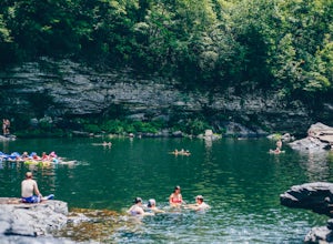
Swim at Little Falls (Martha's Falls)
4.41.5 miLittle Falls, also referred to as Martha Falls and the “Hippie Hole” by the locals, is a popular swimming hole a part of Little River Canyon National Preserve, located along the state line of Alabama and Georgia. Perks include free parking and free admission. Drive up Lookout Mountain and pull i...Read more -
Chatsworth, Georgia
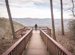
Hike the Gahuti Trail
4.08.1 mi / 1223 ft gainFort Mountain rises prominently from the plateau to the West, serving as the start of the Blue Ridge Mountain range in Georgia. The Gahuti Backcountry Trail circumnavigates the mountain, with several overlooks with views in all directions. At 8.1 miles, this hike is moderately difficult, but can...Read more


