Clarkesville, Georgia
Top Spots in and near Clarkesville
-
Highlands, North Carolina
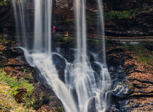
Explore Dry Falls, North Carolina
4.60.42 mi / 95 ft gainDry Falls is located off of Hwy. 64, which has been designated as the Mountain Waters Scenic Byway, and the road does not disappoint. Hwy. 64 is a two lane road which hugs the northern side of Cullasaja Gorge, which has been carved by the Cullasaja River. Besides Dry Falls, Hwy. 64 leads you past...Read more -
Highlands, North Carolina
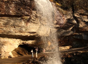
Photograph and Explore Bridal Veil Falls
Bridal Veil Falls is located directly off of the road and is about a 100 feet tall in total. The falls makes for a great place to take pictures under the water falls. The falls itself is small and flows constant all year long getting to the bottom of the falls is not recommended because it is dan...Read more -
Highlands, North Carolina
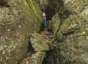
Bouldering Granite City
5.00.3 mi / 96 ft gainAt the foot of Blackrock Mountain just outside of Highlands, North Carolina, lies one of the most unique and secluded natural playgrounds around. Granite City is composed of several massive granite boulders, ranging between 10-40 feet tall. This spot is most popular for bouldering (mostly V0-V2...Read more -
Franklin, North Carolina
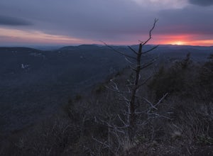
Siler Bald from Wayah Gap
5.03.66 mi / 1060 ft gainThe Appalachian Trail does not need a lot of hype beyond its existing legendary status. However, there are certain parts of it that do stand out as being a little extra special. Siler Bald is one of those spots. A large clearing starting from Snowbird Gap and going all the way up to Siler Bald...Read more -
Highlands, North Carolina
Explore Cullasaja Falls
5.00.3 mi / 200 ft gainThis is an awesome waterfall that offers views from several different spots along the road as well as a quick hike down to the base! The small pull-off area is located towards the top of the falls. There isn't much space (3 maybe 4 cars at a time), but there are additional pull-off areas further ...Read more -
Highlands, North Carolina
Hike the Whiteside Mountain Loop
5.02 mi / 595 ft gainWhiteside Mountain is simply breathtaking, there is no way around it. Views of the mountain from the South expose its sheer granite face, which runs almost its entire length East-to-West. However, the views of the mountain are just the beginning, as this hike climbs to higher heights than just ...Read more -
Franklin, North Carolina
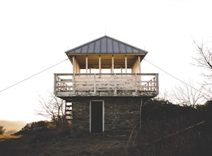
Photograph Wayah Bald Lookout Tower
0.1 mi / 0 ft gainThe Wayah Bald Lookout Tower is located in Nantahala National Forest in one of the oldest part of the protected land. It was first built in the 1920s then it was rebuilt throughout the years until it was finally made out of stone and concrete. The current tower that stands offers great views of t...Read more -
Highlands, North Carolina
Explore Cashiers Sliding Rock
0.2 mi / 70 ft gainThis waterfall is located just outside of Cashiers, NC. The trailhead to the waterfall is right off of the road and has a good amount of parking. The trial itself is very nice and has new steps at the beginning of the trail. The trail is very wide and is mostly flat the entire way there. Once you...Read more -
Salem, South Carolina
Camp on Lake Jocassee
4.7To avoid the regret of cutting your trip too short, go ahead and book a campsite. Come as a walk-in or reserve your site. Either way, you will have to check in at the Park Office. Upon check-in, you will receive your map and general information. Check-in time for camping is 2PM. The only publi...Read more -
Pendleton, South Carolina
Bike the Fant's Grove Trails in the Clemson Experimental Forest
20 mi / 1985 ft gainFant's Grove is part of Clemson University property and is housed inside of the southern end of the Clemson Experimental Forest. The property is managed by Clemson University, and the trail weaves through prescribed burned areas, loblolly pine stands, agriculture fields, wildlife openings and fee...Read more -
Blairsville, Georgia
Nottely Reservoir Trail
2.53 mi / 335 ft gainNottely Reservoir Trail is a loop trail that takes you by a river located near Blairsville, Georgia.Read more -
Cashiers, North Carolina
Hike to Silver Run Falls
0.25 mi / 100 ft gainThe hike to this waterfall is very short and well worth it. The waterfall is about 40 feet tall and has a large volume of water. This makes for a great place to swim. The bottom of the pool is about 15 feet deep and offers cool mountain water. To get there it is just outside of Cashiers, North C...Read more -
Cashiers, North Carolina
Explore Whitewater Falls
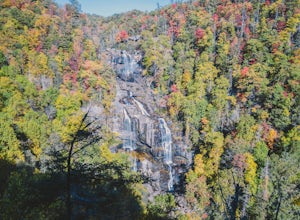
4.00.5 mi / 100 ft gainWhitewater Falls is the highest waterfall east of the Rocky Mountains with the upper falls alone dropping over 400 feet. The walk to the falls is very short and friendly for all ages and abilities - the path is paved so the falls are wheelchair accessible. The falls are beautiful in all seasons b...Read more -
Dawsonville, Georgia
Amicalola Falls
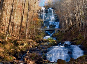
4.30.73 mi / 292 ft gainAdventurers access the falls through the state park entrance. From the parking lot, hikers follow the clearly marked signs to the base of the falls. The incline begins by the pond at the base of the falls. From the pond, follow the incline along the cascading portion of the falls to the stairs. A...Read more -
Dawsonville, Georgia
Hike to Springer Mountain
3.519 mi / 4346 ft gainBegin your journey from Amicalola Falls State Park. Despite the steep climb, you should park at the base of the falls and climb the steps for a great view of one of the grandest falls in the South. (For more on that hike, see: "Climb the Stairs to Amicalola Falls"). From the top of the falls, fol...Read more -
Cullowhee, North Carolina
Hike to Yellow Mountain Fire Tower via Cloud Catcher Lane
5.01.5 mi / 700 ft gainYellow Mountain Fire Tower features some of the best views, looking out over both the Northern Georgia mountains as well as seeing the flat-lands of South Carolina past the mountain ranges. This hike is pretty well known for its 12-mile round trip trek, starting in Cashiers, NC, however, there's ...Read more

