Silver Plume, Colorado
Looking for the best hiking in Silver Plume? We've got you covered with the top trails, trips, hiking, backpacking, camping and more around Silver Plume. The detailed guides, photos, and reviews are all submitted by the Outbound community.
Top Hiking Spots in and near Silver Plume
-
Conifer, Colorado
Elk Falls Loop
3.512.76 mi / 1893 ft gainBegin on Staunton Ranch Trail for 3.3 miles. Switch to Bugling Elk Trail for the next 1.1 miles, then to Lion's Back Trail for the last mile to the overlook. From here, you can create the loop by backtracking to the Chimney Rock Trail, which then connects with the Elk Falls Trail. To head back to...Read more -
Bailey, Colorado
Payne Creek Trail via Brookside McCurdy Trailhead
4.517.98 mi / 3773 ft gainDay 1: Park at the Payne Creek/Brookside Trailhead (8,040 ft.) right outside Bailey. You'll go on the trail for about a mile before the trail parts to Craig Meadows or Craig Park. If you start this in the nighttime, it's best to camp before you part ways on the trail as it's a little more spaciou...Read more -
Silverthorne, Colorado
Backpack to Upper Slate Lake
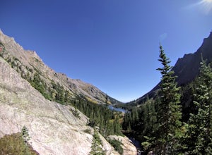
5.028 mi / 1386 ft gainStarting from the Rock Creek Trailhead parking lot, it is an up and down trek to Upper Slate Lake. The trail map states 10 miles each way, but accounting for switchbacks it ends up being closer to 14 long, hard miles.You will be among aspens and pines for the first half as you have a few moderate...Read more -
Evergreen, Colorado
Hike Panorama Point at Corwina Park
4.72.7 mi / 640 ft gainJefferson County, the "Gateway to the Rockies" has dozens of great parks and trails. One of the best, however, is often overlooked, as it is sandwiched between bigger and more popular parks. Corwina Park is a small section located off Hwy. 74, near the village of Kittredge. Sitting between the po...Read more -
Breckenridge, Colorado
Camp at Boreas Pass
9 mi / 1500 ft gainBoreas pass is a high mountain pass in the Rocky Mountains that sits on the Continental Divide at 11,481'. Forest Service Road 33 goes over the pass and has numerous campsites all along its length, with several near the summit that feature breathtaking views of the Tenmile Range and the Breckenri...Read more -
Nederland, Colorado
Hike to Columbine Lake
5.07 mi / 1200 ft gainThe hike is about seven miles, give or take, however it feels longer. The elevation gain is little over 1000 feet. The drive here is about 45 minutes from both Granby and Winter Park, and is definitely worth it. You follow a trail dusted with wildflowers for the majority of the hike, and occasio...Read more -
Evergreen, Colorado
Pence Park's Independence Mountain Trail
4.42.09 mi / 869 ft gainPence Park, part of the Denver Mountain Parks system, is nestled between the mountain communities of Indian Hills and Kittredge on Myers Gulch Road. It's one of those places I always drove right past without bothering to check it out. From the road, it looks the same as any other place in the foo...Read more -
Golden, Colorado
Hike the Sawmill to Maverick Loop
4.32 mi / 450 ft gainFor this adventure, you'll be completing the Sawmill to Maverick loop. It is a short, but gentle trail that will take you through open meadows, to pine forests, and great views of Denver and Golden.Starting from the west parking area, cross the road and hit the Sawmill Trail. This trail starts ou...Read more -
Breckenridge, Colorado
Day Hike to Lower & Upper Mohawk Lakes
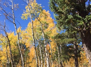
4.67 mi / 1800 ft gainI recently spent the weekend in Breckenridge, and not being from the area, there was one hike that was on my bucket list: Mohawk Lakes. It didn’t disappoint! In late September, the Breckenridge area is full of gorgeous golden aspen trees, providing spectacular long-range views. In summer, abundan...Read more -
Breckenridge, Colorado
Backpack & Fish The Mohawk Lakes
4.06.8 mi / 1940 ft gainThe trailhead is located a few miles out side of Breckenridge Colorado. The trail starts at 10,390' and the first two miles are spent walking through a mix of fir, aspen, and spruce trees until the trail goes parallel to Spruce Creek Road and eventually crosses it and continues over a small dam (...Read more -
Breckenridge, Colorado
Lower Crystal Lake via Crystal Creek Road
5.04.52 mi / 1624 ft gainTo get to the Crystal Lakes start at the Spruce Creek Trailhead. You can hike or drive to the Lower Crystal Lake along Crystal Creek Road. If you choose to drive, you will need a high clearance 4x4 vehicle as you follow along Crystal Creek Road. The road is steep, but when they get to the top it ...Read more -
Breckenridge, Colorado
Hike to & Stay at Francie's Cabin
5.01.09 mi / 1000 ft gainLocated at 11,360' and owned by the 10th Mountain Division Hut Association, Francies Cabin was built in memory of Frances Lockwood Bailey in 1994 and is located just a short distance (5 mile drive, 1.05 mile hike) from town of Breckenridge, Colorado. It has a summer and winter capacity of 20 peop...Read more -
Breckenridge, Colorado
Spruce Creek Loop
4.29 mi / 1001 ft gainSpruce Creek Loop is a loop trail that takes you by a lake located near Breckenridge, Colorado.Read more -
Golden, Colorado
Hike Lookout Mountain
2.3 mi / 675 ft gainBegin hiking up a trail into the forest which eventually opens up into several beautiful spots that look down into the canyon below.Read more -
Golden, Colorado
Hike Mount Galbraith
5.05.8 mi / 1247 ft gainStarting at roughly 6,000 ft. this hike will take you to the Mount Galbraith Loop Trail that circles the summit of the Mountain which peaks at 7,247 ft. Getting there is very simple, from State Highway 93, take Golden Gate Canyon Road west approximately 1.5 miles to the parking area and trailhea...Read more -
Golden, Colorado
Hike Beaver Brook Trail at Windy Saddle Park
5.05 mi / 500 ft gainJust outside of Golden, CO is Lookout Mountain. If you’ve ever driven westbound on i70 from Denver to the mountains, you’ve undoubtedly seen this mountain to your right with antennas on the top. On the north side of Lookout Mountain lies Windy Saddle Park, about a 30 minute drive from Denver. Thi...Read more

