Rocky Mountain, Colorado
Top Spots in and near Rocky Mountain
-
Livermore, Colorado
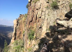
Mt. McConnel Summit Trail Loop
4.26 mi / 1453 ft gainThis 4.3-mile round trip hike gains 1300 feet of elevation before reaching the Mt. McConnel summit. The primitive trail is rated as difficult and has an ascent of many switchbacks, leading up to a wild flower-covered summit. The trail winds along the ridge line around 8,000 feet, offering panoram...Read more -
Grand Lake, Colorado
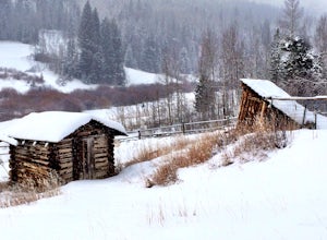
Snowshoe to Rowley Homestead at Snow Mountain Ranch
3.03 mi / 100 ft gainAt Snow Mountain Ranch, you can strap on the snowshoes and heading to an old homestead on the ranch. It is about 3 mile round trip adventure.You snowshoe through the woods and by some of the cabins at Camp Chief Ouray. On the trail, check out the aspen trees. You can see the markings where the e...Read more -
Longmont, Colorado
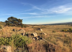
Hike or Trail Run on Rabbit Mountain, CO
4.03.95 mi / 472 ft gainThis is a great hike/trail run in Boulder County. It is located between Longmont and Lyons and is part of Boulder County Open Space. Rabbit Mountain has over 5 miles of trails and 2,733 acres of beautiful open space. The views are incredible as most of your hike you are looking out at the entire ...Read more -
Walden, Colorado
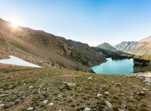
Backpack to Kelly Lake In State Forest SP
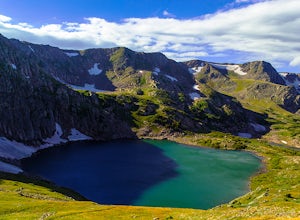
13.2 mi / 2624 ft gainRound trip will take you along 13.2 beautiful miles of Northern Colorado backcountry. Starting from the trail head which can be found within the entrance of the park (near the horse ring and car camping), you'll head into some beautiful backcountry. Before you reach the woods, a 4x4 trail will be...Read more -
Boulder, Colorado
Catch the Sunrise on Sugarloaf
4.51 mi / 400 ft gainTo get there from downtown Boulder, head west on CO 119 and almost 4.5 miles after you have left Boulder, turn right onto Sugarloaf Road. 4 miles after the turn from CO 119, turn right onto Sugarloaf Mountain road (located at the top of the road). If the road starts descending, you've gone too fa...Read more -
Nederland, Colorado
Snowshoe or Cross-Country Ski at Caribou Ranch
4.54.2 mi / 750 ft gainThe Caribou Ranch Open Space is about two miles north of the town of Nederland. From Nederland, at the town’s roundabout, head west on CO 72 for about two miles. Turn left onto CO 126 at the sign for Caribou Ranch Open Space. Follow the dirt road for about .8 miles until you see the large parking...Read more -
Loveland, Colorado
Climb Green Ridge in the Roosevelt National Forest
9.8 mi / 2400 ft gainGreen Ridge is a fantastic series of summits in the Front Range that make for excellence training hikes, but is often forgotten as it lies outside of the nearby Bobcat Ridge Natural Area and just inside of Roosevelt National Forest. The summit itself at 7,402' is fantastic, featuring a nearly 900...Read more -
Loveland, Colorado
Hike the Valley Loop Trail in the Bobcat Ridge Natural Area
4.4 mi / 500 ft gainThe Valley Loop Trail in the Bobcat Ridge Natural Area begins at the main entrance of the Natural Area, just off W County Road 32 C near Masonville, west of Fort Collins and the Horsetooth Reservoir.To get there take West County Road 38 E west from Fort Collins over and around the Horsetooth Rese...Read more -
Loveland, Colorado
Hike the D.R. Trail in the Bobcat Ridge Natural Area
3.76.2 mi / 1050 ft gainD.R. Trail, named for David Rice Pulliam who donated the land to create the Bobcat Ridge Natural Area, is a 3.1 mile spur off the Valley Loop Trail that climbs roughly 1,000' into Mahoney Park before it intersects with the Powerline and Ginny Trails. To get to the start of the trail, take the Val...Read more -
Loveland, Colorado
Hike the Powerline Trail in the Bobcat Ridge Natural Area
3.8 mi / 1100 ft gainPowerline Trail is a 1.9 mile spur off the Valley Loop Trail in the Bobcat Ridge Natural Area that climbs 1,100 feet from the valley floor to Mahoney Park.To get to the start of the trail, take the Valley Loop Trail .9 miles in the Bobcat Ridge Natural Area from the main entrance of the Natural A...Read more -
Nederland, Colorado
Hiking the Indian Peaks Wilderness' Lost Lake
4.34.5 mi / 1000 ft gainLost Lake of the Indian Peaks Wilderness area is a scenic short hike (about 3 hours) with a lot to see. The trailhead is tucked at the end of a road that passes through Eldora, a charming village of cabins and old abandoned buildings. You will pass by the lost "town" of Hessie on foot, which is w...Read more -
Nederland, Colorado
Snowshoe Lost Lake
5.02.7 mi / 791 ft gainDriving through the towns of Nederlands and Eldora alone is a beautiful experience. Once you come up to Hessie Trailhead, you'll already be in a daze because you'll be staring at Eldora Mountain and will see some ski runs in the distance.Getting to the trailhead early is best. Parking starts alon...Read more -
Nederland, Colorado
Snowshoe to Jasper Lake
5.011 mi / 2000 ft gainStarting at 9100 feet, the Hessie trailhead is easily accessible by both 2 and 4 wheel drive cars (depending on how far you want to travel down the road). The trail is fairly easy and often packed down snow up to the cut off point to the Devil's Thumb Bypass, which allows a bypass of Lost Lake an...Read more -
Nederland, Colorado
King Lake via Hessie Trailhead
5.011.32 mi / 2375 ft gainThe normal route from the east side is via the Hessie trailhead outside Nederland Colorado. From the west it is most often accessed via the short trail from Rollins pass, which is open in the summer. As noted above, it is also a lake and area ripe for creating your own adventure. The description ...Read more -
Nederland, Colorado
Hike to the Lost Lakes via the Hessie Trail
4 mi / 1000 ft gainAccessed by Hessie Trailhead, Lost Lake is a relatively moderate 4 mile round-trip hike with about 1,000 feet of elevation. The core of the hike is uphill and on a gravel path, 2/3rds of the hike runs parallel to a rushing waterfall. After parking your car, head towards the Hessie Trailhead. Yo...Read more -
Nederland, Colorado
Drive the Peak to Peak Highway
4.555 mi / 705 ft gainThe Peak to Peak Highway is a 55-mile stretch of road that winds its way from Nederland to Estes Park (or Estes Park to Nederland). This road connects to many points of exploration, Indian Peaks Wilderness Area and Rocky Mountain National Park to name a couple, but the drive itself is an adventur...Read more

