Littleton, Colorado
Top Spots in and near Littleton
-
Conifer, Colorado
Davis Ponds Trail
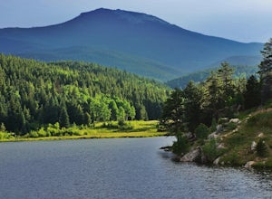
4.02.31 mi / 295 ft gainDavis Ponds Trail is a loop trail that takes you by a lake located near Conifer, Colorado.Read more -
Conifer, Colorado
Elk Falls Loop
3.512.76 mi / 1893 ft gainBegin on Staunton Ranch Trail for 3.3 miles. Switch to Bugling Elk Trail for the next 1.1 miles, then to Lion's Back Trail for the last mile to the overlook. From here, you can create the loop by backtracking to the Chimney Rock Trail, which then connects with the Elk Falls Trail. To head back to...Read more -
Golden, Colorado
Hike the Elk Range Trail
2.5This is an incredible and beautiful hike that is just off of Route 6 but feels a million miles away. Drive up Douglas Mountain Road for the west park access (and I do mean UP - it's a quick elevation gain), and you'll run right into the Centennial Cone Park entrance. There is a bathroom and a dec...Read more -
Franktown, Colorado
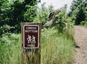
Hike the Creek Bottom Trail
5.04.1 miThe West Side of Castlewood Canyon is the more "rugged" side of the park, it has a dirt road, gravel parking lots, and only vault toilets. Luckily, this also means this is a less popular side of the park, making for less crowded trails and easier parking! Park at the first trailhead, for the Hom...Read more -
Franktown, Colorado
Hike the Rim Rock Trail
4.98 miThe West Side of Castlewood Canyon is the more "rugged" side of the park, it has a dirt road, gravel parking lots, and only vault toilets. Luckily, this also means this is a less popular side of the park, making for less crowded trails and easier parking! Park at the first trailhead, for the Hom...Read more -
Franktown, Colorado
Hike the Rim Rock / Creek Bottom Trail Loop
5.04.54 miThe West Side of Castlewood Canyon is the more "rugged" side of the park, it has a dirt road, gravel parking lots, and only vault toilets. Luckily, this also means this is a less popular side of the park, making for less crowded trails and easier parking! Park at the first trailhead, for the Hom...Read more -
Evergreen, Colorado
Private and Tranquil Retreat at Beaver Brook Watershed
4.0Note: This is NOT the Beaver Brook Trail in Genesee Park/Lookout Mountain! If you enjoy the scenery and ambiance of Evergreen, but Evergreen Lake has become too crowded for your tastes, Beaver Brook Watershed (owned by the City of Golden) is an excellent alternative. It’s a small, secluded area a...Read more -
Pine, Colorado
Little Scraggy Peak Loop
5.012.18 mi / 1621 ft gainLittle Scraggy Peak Loop is a loop trail that takes you past scenic surroundings located near Buffalo Creek, Colorado.Read more -
Pine, Colorado
Dispersed Camp at the Buffalo Creek Area in Pike National Forest
3.850 miles from Denver, nestled in Pike National Forest, there are dozens of free dispersed camping sites. With quick access to the Colorado Trail and Buffalo Creek Mountain Bike Area, these campsites make for a perfect weekend getaway. The campsites begin on Forest Road 550, and are clearly marked...Read more -
Franktown, Colorado
Inner Canyon Trail
5.02.17 mi / 213 ft gainThe Inner Canyon Trail begins at the Canyon Point Parking Lot. There are a few trails that leave from this lot, so make sure you're following signs for "K." Right away, you'll descend down a few dozen stairs into the canyon itself. You'll quickly cross a bridge and be on your way. This trail is...Read more -
Franktown, Colorado
Lake Gulch & Inner Canyon Loop Trail
4.01.85 mi / 203 ft gainThis loop is a combination of two different trails - the Lake Gulch Trail (L) and the Inner Canyon Trail (K). Both of these trails leave from the Canyon Point Parking Lot, inside the east entrance to the park. I personally like the Inner Canyon Trail a lot more, so I like to start off from the ...Read more -
Sedalia, Colorado
Hike Devils Head Fire Lookout
4.72.8 mi / 951 ft gainThis is one of my favorite hikes near Denver and the lookout itself is over 100 years old! On the road to the trailhead there are many spots for camping and other activities.From Sedalia, CO head down Highway 67 for about 10 miles. Turn south onto Rampart Range Rd and continue for about 9.5 miles...Read more -
Boulder, Colorado
Hike the Flatirons Vista Loop Trail
4.73.3 miFrom the parking lot, take South Flatiron Vista Trail for 2.4 miles, where you'll cross onto North Flatiron Vista Trail. In 1 mile, take the connector trail back to the trailhead. To shorten the loop to 2 miles, hike South Flatiron for just 1 mile to Prairie Vista Trail, which leads back to the c...Read more -
Golden, Colorado
Hike the Mountain Lion Trail
6.7 mi / 1230 ft gainThere are three parking lots with direct access to the Mountain Lion Trail. The main one is off of Crawford Gulch Road, but any of them are good starting points! This loop has pretty similar elevation gain and loss profiles no matter which way you go, so you can go any direction. This adventure ...Read more -
Golden, Colorado
Hike Racoon Trail to Panorama Point
4.03.3 mi / 750 ft gainSummer is a magical time of year in the Rocky Mountains. One great way to experience this stunning beauty is through hiking Raccoon Trail to Panorama Point at Golden Gate State Park. Raccoon Trail is 3.3 mile moderately difficult hike which can be completed in under an hour, although it will like...Read more -
Franktown, Colorado
Hike the Canyon View Nature Trail, Castlewood Canyon
4.52.4 miThis is a well maintained, easy trail best hiked in spring and fall. Conditions make this trail great for families. The park is also popular for bird watching and rock climbing.Read more

