Leadville, Colorado
Top Spots in and near Leadville
-
Crested Butte, Colorado
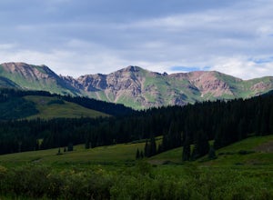
Hike Oh Be Joyful Pass
16 miFrom Crested Butte, drive north on Gothic Road and turn left on Slate River Road. Drive 4.5 miles on the dirt road and look for the Oh-Be-Joyful Campground which will be on your left. Drive about 0.5 miles to the campground at the bottom of the hill, by a wide river. This trail begins by a quick...Read more -
Evergreen, Colorado
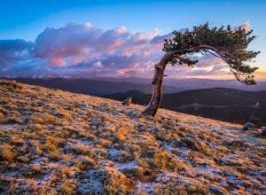
Photograph Ancient Bristlecone Pines on Mt. Goliath
5.0On the way to the summit of Mt. Evans sits a small 160 acre preserve of some of the world's oldest living trees. The Mount Goliath Natural Area protects a rare site of Bristlecone Pines that make excellent photographic subjects.Immediately after parking you're surrounded by a miniature forest ful...Read more -
Idaho Springs, Colorado
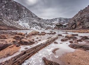
Lower and Upper Chicago Lake
4.59.22 mi / 2270 ft gainFrom the parking lot, stay to the right of Echo Lake and you will run into the Chicago Lakes Trailhead. Follow the switchbacks down and across Chicago Creek. After crossing the creek, follow the sign indicating that the trail follows the dirt road and hang a left; from here, you'll reach the Idah...Read more -
Idaho Springs, Colorado
Explore Echo Lake Park
4.01.2 mi / 88 ft gainLocated at the base of Mt. Evans Road, Echo Lake sits next to Squaw Pass Road, providing a great jumping-off point for numerous adventures. The park serves as a trailhead for hiking or snowshoeing into the Mount Evans Wilderness, offers picnic areas, and includes a nearby campground with 17 site...Read more -
Idaho Springs, Colorado
Hike to Idaho Springs Reservoir
3.9 mi / 800 ft gainThis is a great hiking area an hour outside of Denver, Colorado. It's still easily accessible in the winter and most of the time it can be hiked without snowshoes. Starting at the Echo Lake parking lot, hike around the right side of the lake until you reach a fork in the trail. Follow the path on...Read more -
Evergreen, Colorado
Hike the Resthouse/Lincoln Lake Trail
4.5While the Mt. Evans Wilderness never has a shortage of visitors, thanks to its proximity to Denver, it is possible to find a more private hike if you know where to look. Lincoln Lake Trail, accessible from Echo Lake year-round, is not as glamorous as its sister trail, Chicago Lakes, but is a wond...Read more -
Berthoud Pass, Colorado
Ski or Snowboard Berthoud Pass Colorado
Berthoud Pass is 55 miles from Denver making it one of the closest places to get out and backcountry tour in the winter. At 11,370 Berthoud Pass crosses the continental divide. From the top of the pass you can do shuttle runs down the south side of the pass. Or, you can venture on the East or Wes...Read more -
Berthoud Pass Parking Lot, Colorado
Mount Flora
5.06.29 mi / 1788 ft gainColorado’s Rocky Mountains offer hikes of all lengths, sizes and difficulties. Mt. Flora stands at a lofty 13,146 ft and is a great intro to climbing peaks in Colorado. Roundtrip, this hike is 6.3 miles and will take you (in the summer) through fields of alpine wildflowers as you climb into Color...Read more -
U.S. 40, Colorado
Parry Peak
11.82 mi / 4209 ft gainThe trek to Parry Peak crosses three other peaks (Colorado Mines Peak, Mt. Flora, and Mt. Eva) along the Rocky Mountains. Begin your hike around sunrise as inclement weather often rolls in during the late afternoon. The trail is extremely rocky and steep. From the Berthoud Pass parking lot, fol...Read more -
Winter Park, Colorado
Snowshoe Mount Flora
6.2 mi / 1738 ft gainMy friend Austin and I hiked up to Mt Flora last year on what was probably the coldest day ever. Ever? It was 9 degrees at the Berthoud Pass parking lot and we had 32mph winds nearly the whole way. We estimated the temp to be around -28ºF with the windchill... brrrr!DirectionsFrom the Berthoud Pa...Read more -
2203-2407 County Road 12, Colorado
Camp at Kebler Pass
4.5Camping on Kebler Pass begins at around GPS: 38.89575, -107.214655. The pass is only available during the warmer summer months but is quite the treat. We went in August to catch an eclipse and the rolling free hills made it a great place to view from. You pass a reservoir on your way in where man...Read more -
Carbondale, Colorado
Camp at Prince Creek
3.0From Colorado State Highway 82, turn south onto Highway 133 (toward Carbondale). Continue south past the Carbondale Main Street roundabout. After two miles, turn East onto Prince Creek Road. Follow this four miles to where the pavement ends. After passing through a cattle gate, BLM land lines the...Read more -
Carbondale, Colorado
Mountain Bike Prince Creek
Turn south off Colorado State Highway 82 onto Highway 133 toward Carbondale. Continue south past the Carbondale Main Street roundabout. After two miles, turn East onto Prince Creek Road. Follow this four miles to where the pavement ends. This is the best place to park to start biking or running.F...Read more -
Lake George, Colorado
Camp and Fish at Eleven Mile Canyon
4.4Located below the dam of the Eleven Mile Reservoir, Eleven Mile Canyon is a scenic spot for camping, fishing, hiking and climbing. There are four different campgrounds to choose from (Cove, Riverside, Spillway and Springer), though only one campground remains open during the off season. Getting t...Read more -
Fraser, Colorado
Summit Byers Peak
8.8 mi / 2774 ft gainThe drive to the start of the trail is okay, having a high clearance vehicle would make the drive easier, but is not necessary. Free parking is available along the side of the road.The trail starts on a closed service road at a gate and requires you to either hike or bike up the dirt road (2 mil...Read more -
Winter Park, Colorado
Snowshoe to Broome Hut
1.5 mi / 729 ft gainTake I-70 from Denver and then US 40, go all the way to Mile marker 240 of US 40 and park in the area at the side of the road. The Second Creek trail head is just behind the parking area and is easy to find.The trail climbs from a start at 10,600ft and finishes up at 11,325ft at the hut, but you ...Read more

