Laporte, Colorado
Top Spots in and near Laporte
-
Loveland, Colorado
Hike the Valley Loop Trail in the Bobcat Ridge Natural Area
4.4 mi / 500 ft gainThe Valley Loop Trail in the Bobcat Ridge Natural Area begins at the main entrance of the Natural Area, just off W County Road 32 C near Masonville, west of Fort Collins and the Horsetooth Reservoir.To get there take West County Road 38 E west from Fort Collins over and around the Horsetooth Rese...Read more -
Loveland, Colorado
Hike the D.R. Trail in the Bobcat Ridge Natural Area
3.76.2 mi / 1050 ft gainD.R. Trail, named for David Rice Pulliam who donated the land to create the Bobcat Ridge Natural Area, is a 3.1 mile spur off the Valley Loop Trail that climbs roughly 1,000' into Mahoney Park before it intersects with the Powerline and Ginny Trails. To get to the start of the trail, take the Val...Read more -
Loveland, Colorado
Hike the Powerline Trail in the Bobcat Ridge Natural Area
3.8 mi / 1100 ft gainPowerline Trail is a 1.9 mile spur off the Valley Loop Trail in the Bobcat Ridge Natural Area that climbs 1,100 feet from the valley floor to Mahoney Park.To get to the start of the trail, take the Valley Loop Trail .9 miles in the Bobcat Ridge Natural Area from the main entrance of the Natural A...Read more -
Laporte, Colorado
Hike the 3 Bar and Oh Tee Loops at Eagle's Nest Open Space
5 mi / 150 ft gainTo get to Eagle's Nest Open Space drive on Highway 287 between Laramie, Wyo. and Fort Collins, Colo. As you continue down 287, look for the Forks restaurant and rest stop in Livermore, Colo. Turn here onto Red Feather Lakes Road. After a few hundred feet on Red Feather Lakes Road, look for the E...Read more -
Loveland, Colorado
Hike the Devil's Backbone in Colorado
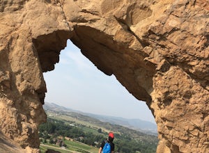
4.32.5 miThe Devils Backbone Open Space offers great hiking in the Front Range foothills. The main feature is the rock formation running along the western boundary of the park, but the open space also supports a large wildlife and plant population. Here, you'll find great opportunities for year-round hiki...Read more -
Windsor, Colorado
Windsor Lake Loop Trail
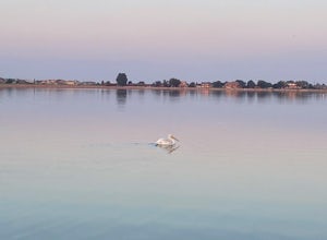
4.02.28 mi / 36 ft gainWindsor Lake Loop Trail is a loop trail that takes you by a lake located near Windsor, Colorado.Read more -
Livermore, Colorado
Mt. McConnel Summit Trail Loop
4.26 mi / 1453 ft gainThis 4.3-mile round trip hike gains 1300 feet of elevation before reaching the Mt. McConnel summit. The primitive trail is rated as difficult and has an ascent of many switchbacks, leading up to a wild flower-covered summit. The trail winds along the ridge line around 8,000 feet, offering panoram...Read more -
Bellvue, Colorado
Poudre Canyon Run
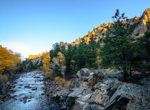
5.026.2 mi / 1800 ft gainStretching 126 miles from its source in the Rocky Mountain National Park, the Cache La Poudre (pronounced: Poo-ter) river provides host to an entire treasure trove of outdoor recreational activities. From Fly Fishing and rafting to camping and photography. Carved away by thousands of years of flo...Read more -
Wellington, Colorado
Climb Table Mountain in the Red Mountain Open Space
4.05 mi / 1200 ft gainTable Mountain sits smack dab in the middle of Red Mountain Open Space, an area known to geologists (and settlers) as "The Big Hole", a singular and unique landform that peaks into the "basement" rocks that underly northern Colorado and Southeastern Wyoming. Soapstone cliffs and bright red Dakota...Read more -
Wellington, Colorado
Hike the Bent Rock Trail at Red Mountain Open Space
2.6 mi / 200 ft gainTo get to Red Mountain Open Space from Fort Collins, take Highway 287 to Highway 1. Follow Highway 1 until you see County Road 15, get off there. This is where it gets confusing, so hang on. You will follow CR15 for a few miles until CR78, take a left onto CR78. Then take a right on CR17, then a ...Read more -
Wellington, Colorado
Hike the K-Lynn Cameron Trail in the Red Mountain Open Space
5.4 mi / 800 ft gainThe K-Lynn Trail is a 2.4 mile loop trail that goes west off of the Ruby Wash Trail on the western side of the Red Mountain Open Space. To get there, take the Bent Rock Trail from the Red Mountain Open Space parking lot where the Red Canyon / Antelope Valley road dead-ends.Once on the Bent Rock T...Read more -
Wellington, Colorado
Hike the Mahogany Loop Trail at Soapstone Prairie Natural Area
7.4 mi / 330 ft gainTo get to Soapstone Prairie from Fort Collins, take Highway 287 north out of town, then turn right onto Highway 1. Continue on Highway 1 until it meets with County Road 15. Take County Road 15 north all the way to Rawhide Flats Road, which leads directly into Soapstone Prairie. As you begin to ap...Read more -
Estes Park, Colorado
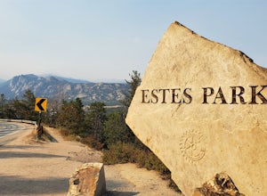
Photograph at The Estes Park Sign
This sign is on the mountainous decline just before you reach town. There's a small parking lot that fills up quick in peak season, but most people only spend a few minutes here on their way in to Estes Park and Rocky Mountain National Park. It is easy enough to have people take your picture, jus...Read more -
Red Feather Lakes, Colorado
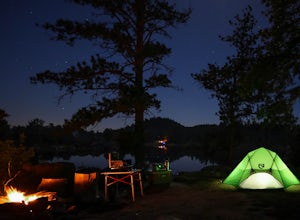
Camp near Lost Lake (in the Red Feather Lakes area)
I need to start by saying I stayed here on Memorial Day weekend, a very busy camping weekend in Colorado. Online searches for a suitable campsite were useless, everything was booked. It is hard to drive 2 plus hours to an area and hope you find a place for dispersed camping. Thankfully a friend t...Read more -
Estes Park, Colorado
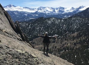
Climb at Lumpy Ridge
Lumpy Ridge is mostly a traditional climbing area with most climbs being two or more pitches after a mile to 3+ miles of mostly flat walking. From climbers left to right the larger areas consist of Sundance Buttress, The Bookend, The Bookmark, The Book, and Twin Owls. There are smaller formatio...Read more -
Estes Park, Colorado
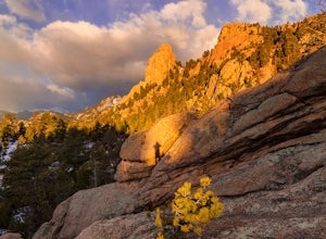
Lumpy Ridge to Gem Lake
4.33.12 mi / 950 ft gainBegin by parking at the Lumpy Ridge trailhead, which is a couple miles outside of Estes Park on McGregor Avenue. At the trailhead, there are numerous signs indicating hiking trails, climbing routes, and other information about the area. After parking start hiking on the trail to the right of the ...Read more

