Jefferson, Colorado
Top Spots in and near Jefferson
-
Nederland, Colorado
Upper Diamond Lake via Fourth of July Trailhead
4.88.12 mi / 2037 ft gainThe trail begins at the 4th of July trailhead, which is located near the Eldora ski area and can be crowded during the summer and weekends. The road is rough in places but passable by any car when dry. From the parking area begin hiking the Arapaho pass trail, which will gently gain elevation thr...Read more -
Nederland, Colorado
Backpack to Caribou Lake
4.08.2 miThis is one of the most beautiful hikes I have ever done in Colorado. It is a great trip for photographers, fisherman or anyone who enjoys mountain views, forests filled with wildlife and peaceful meadows. Distances: Arapaho Pass: 3.2 miles, Caribou Lake: 4.2 miles, Caribou Pass: 6.4 miles, Meado...Read more -
Nederland, Colorado
Hike the Arapaho Traverse
8.3 mi / 3500 ft gainBegin at the Fourth of July Trailhead. Day parking is free and overnight parking is $5. Fourth of July is a popular trailhead and to ensure parking, you should arrive early in the morning (6am-ish... cause, I mean, you gotta 7 hour day in front of you). Follow the Fourth of July trail from the ...Read more -
Nederland, Colorado
Hike to Diamond Lake in the Indian Peaks Wilderness
5.05.7 mi / 1361 ft gainDiamond Lake is located in the Indian Peaks Wilderness. This is a super popular destination, so make sure you arrive early to get a parking spot (and be sure to follow all parking rules, they do give out tickets at this trailhead and others nearby). The drive to the trailhead is about 4 miles dow...Read more -
Divide, Colorado
Pikes Peak National Forest Trail 375/375B
3.91 mi / 289 ft gainPikes Peak National Forest Trail 375/375B is a loop trail that takes you by a lake located near Divide, Colorado.Read more -
Buena Vista, Colorado
Summit Mount Huron
6 mi / 3500 ft gainThere are some dispersed campsites along side the 4x4 road that leads to the trailhead. Ideally you can sleep here to get an early start to your hike in the morning, to avoid the afternoon storms that frequent the mountains. The 4x4 is rough in spots, though my Subaru Outback did make the trek un...Read more -
Nederland, Colorado
Snowshoe or Cross-Country Ski at Caribou Ranch
4.54.2 mi / 750 ft gainThe Caribou Ranch Open Space is about two miles north of the town of Nederland. From Nederland, at the town’s roundabout, head west on CO 72 for about two miles. Turn left onto CO 126 at the sign for Caribou Ranch Open Space. Follow the dirt road for about .8 miles until you see the large parking...Read more -
Independence, Ohio
Hike Mountain Boy Ridge from the Top of Independence Pass
5.06 miThe trailhead is to the Independence Pass viewing deck is located at the Summit parking area, which is about 20 miles from Aspen and 24 miles west of Highway 24 on the Leadville side. At the parking area you will notice a paved walkway that takes you to the viewdeck, which is a easy five minute w...Read more -
Independence, Ohio
Hike Lost Man Pass via Independence Lake
5.04.5 mi / 1200 ft gainPark at the pull out just west of independence pass. From there, begin on the Linkin's Lake Trail. The trail is generally easy to follow (although it can be muddy as it is a wet area) and climbs 900 feet in the 1.8 miles to independence lake. From Independence lake it is about 0.5 miles and 400 f...Read more -
Independence, Ohio
Watch the Sunset from Independence Pass
1.0Start in the town of either Aspen or Twin Lakes and continue on Interstate 82 to the top of Independence Pass. Along the way, keep your eyes peeled for the Ghost Town of Independence, fields of wildflowers and the occasional moose, elk or deer. Continue on to the top of the pass where you will fi...Read more -
Independence, Ohio
Photograph the Milky Way on Independence Pass
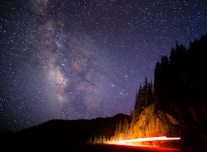
From Aspen CO, drive up highway 82 towards Twin Lakes and stop at the top of the pass.Once you reach the continental divide there will be a sign that says Independence Pass with an elevation of 12,095 feet. Here you can park the car for free and use the bathroom area.To photograph the milky way y...Read more -
Independence, Ohio
Photograph Fall Colors Along Independence Pass and Twin Lakes, CO
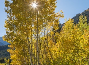
5.0While this is a more of a photography adventure and a fall drive to take through Colorado, there are also many areas to hike along the way. The drive can start from really anywhere in the general area. From the front range area of Colorado, head up I70 and get off toward Twin Lakes around Copper....Read more -
Independence, Ohio
Drive Independence Pass
5.032 miWhether you are driving or biking, the elevation gain is significant, it's over 4,000 ft. The road is fairly narrow so being cautious is important. The highway itself is seasonal; it's closed for winter due to icy conditions. We stopped along the Grotto trailhead to hike around and get some views...Read more -
Woodland Park, Colorado
Red Rocks at Woodland Park
4.31 mi / 100 ft gainIn Woodland Park driving on HWY 24 towards Divide, you will see signs for HWY 67 which is where you'll need to get to. The Road will fork towards the end of town (left being 24 towards Divide, Right being 67). Stay right at the fork onto 67. You will then drive about 2 miles until you see a sign ...Read more -
Pitkin County, Colorado
Sunset Hike to Twining Peak
4 mi / 1700 ft gainTwining Peak is a ranked 13er located 2 miles north of Independence Pass. The hike involves around 1700 feet of elevation and is mostly off-trail with some class 2 scrambling (class 3 can be had if you look hard enough). Independence Pass is a prominent and popular pass on Highway 82 between Twin...Read more -
Meredith, Colorado
Hike to Chapman Lake
1.6 miFrom downtown Basalt, drive up the Fryingpan River Road 28 miles and turn right on CR #504, also known as Elliot Way, just before Norrie Colony. Drive across the river and up the switchbacks for approximately 3 miles. Take the left fork, continue 1 mile and take the right fork approximately 1/2 m...Read more

