Carbondale, Colorado
Top Spots in and near Carbondale
-
Basalt, Colorado
Backpack & Fish at Lake Charles
11 mi / 1700 ft gainI decided to make an Outbound listing for this because the AllTrails listing is incredibly inaccurate. Hopefully you're reading this one! Your adventure starts at the trailhead of Fulford Cave / Fulford Cave Campground in Yeoman Park. Yeoman Park is just past Sylvan Lake State Park and is consid...Read more -
Aspen, Colorado
Camp Difficult Campground, Aspen
This is a great backup campground if all of Maroon Bells campgrounds are full, which in all reality is highly likely. If you're looking to beat the crowds, this is a good number campground to consider. This campground is right off the highway, 5 miles away from the town of Aspen, easy to find, an...Read more -
Carbondale, Colorado
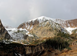
Camp at Paradise Divide
At a literally breathtaking 11,250 feet, Paradise Divide offers seclusion and scenery that can't be beat. Just fifteen miles outside of the world renowned ski resort Crested Butte, this area boasts wildflowers, wildlife, stunning peaks, and opportunities to watch amazing sunrises and sunsets pain...Read more -
Basalt, Colorado
Hike to Eagle Lake, Colorado
5.05.5 mi / 1036 ft gainIf you find yourself back in the Lime Creek area just outside of Eagle, Colorado and south of Sylvan Lake State Park - you should make the time to get yourself up to Eagle Lake! The hike starts off of Brush Creek Road and follows a property line in the forest of Aspens and towering wildflowers fo...Read more -
Crested Butte, Colorado
Hike Rustler's Gulch
5.09 mi / 1748 ft gainFrom Crested Butte, continue 6 miles past the town of Gothic to Rustler's Gulch Road. Turn right on the road, cross the East River to get to a small parking area near the river. If you don't have 4WD, park here and hike another 1/2 mile to the trailhead. It's a pretty steep hike. If you do have 4...Read more -
Aspen, Colorado
Backpack to Copper Lake
10 miLooking for a wildflower hike, we decided on Copper Lake in the Maroon Bells Wilderness as a place to base camp for 4 nights. It is 5 miles from the Trailhead, which is off Gothic Road above Crested Butte (2WD Accessible).Copper Lake is this beautiful alpine lake, situated right at treeline, with...Read more -
Crested Butte, Colorado
Hike Gothic Mountain
6.5 mi / 3025 ft gainThe Gothic mountain trailhead starts at 9600' about 10 miles outside Crested Butte, Colorado. A four wheel or all wheel drive vehicle is recommended to make it to the trail head. Take trail 403 which will eventually turn into Gothic Mountain trail around mile 2.5. The single track trail winds thr...Read more -
Meredith, Colorado
Hike to Chapman Lake
1.6 miFrom downtown Basalt, drive up the Fryingpan River Road 28 miles and turn right on CR #504, also known as Elliot Way, just before Norrie Colony. Drive across the river and up the switchbacks for approximately 3 miles. Take the left fork, continue 1 mile and take the right fork approximately 1/2 m...Read more -
Rifle, Colorado
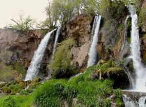
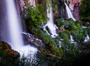
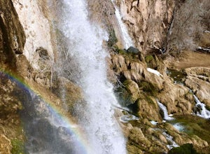
Hike through Rifle Falls State Park
5.01.5 mi / 70 ft gainRifle Falls State Park is situated just 14 miles north east of major Colorado highway I-70. The park offers a wide variety of activities including hiking, fishing, biking, photography, camping, and spelunking (for the especially adventurous).There are several trails at Rifle Falls, the most popul...Read more -
Rifle, Colorado
Explore Rifle Falls
4.6RIfle Falls is located up Rifle Canyon just outside of the town of Rifle on I-70 in Southern Colorado. After driving by the sign for this gem many times on my drives from Utah to Colorado I made a short detour to check out the falls and have some lunch.The state park is small with a some short tr...Read more -
Rifle, Colorado
Rifle Falls
5.00.63 mi / 85 ft gainRifle Falls is a loop trail that takes you by a waterfall located near Silt, Colorado.Read more -
Crested Butte, Colorado
Hike to Judd Falls
3.02.5 mi / 220 ft gainStarting at 9600 feet, just outside the small town of Gothic is the trail head for Judd Falls. The parking lot is on the side of the road and getting to this area is completely possible with a passenger car. The trailhead includes bathrooms and is particularly uncrowded on weekdays and in the lat...Read more -
Crested Butte, Colorado
Conundrum Hot Springs via Copper Creek
22.5 mi / 4000 ft gainPlease Note: Conundrum Springs camping requires an overnight permit. You must get a permit in order to camp at the springs. If you're looking for an incredibly challenging hike, Copper Creek to Triangle Pass to Conundrum Springs is the hike for you! When you plug in "Conundrum Springs" into you...Read more -
Crested Butte, Colorado
The Copper Creek Trail to Copper Lake
5.011.53 mi / 2264 ft gainThe Copper Creek Trail to Copper Lake is an out-and-back trail that takes you by a waterfall located near Crested Butte, Colorado.Read more -
Aspen, Colorado
Weller Lake Trail
4.01.17 mi / 312 ft gainWeller Lake Trail is an out-and-back trail that takes you by a lake located near Aspen, Colorado.Read more -
Aspen, Colorado
Hike or Snowshoe Castle Creek
6 miAt the round-a-bout that leads into the town of Aspen, take the Castle Creek Road exit. Follow this road for 12 miles until you get to the ghost town of Ashcroft. The road itself is very scenic, so be prepared to pull over and whip out your camera!During winter, the road ends at Ashcroft and a cr...Read more

