Colorado
Looking for the best camping in Colorado? We've got you covered with the top trails, trips, hiking, backpacking, camping and more around Colorado. The detailed guides, photos, and reviews are all submitted by the Outbound community.
Top Camping Spots in and near Colorado
-
Fruita, Colorado
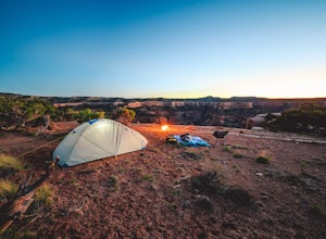
Backpack in the Black Ridge Canyons Wilderness
4.2 mi / 1000 ft gainIf you're looking to backpack outside of the highly publicized areas of Colorado (aka the Rockies), head out to Western CO for some amazing experiences. Located 4 hours west of Denver along I-70 is the McInnis Canyon National Conservation Area (NCA). Overseen by the Bureau of Land Management (BLM...Read more -
Crested Butte, Colorado
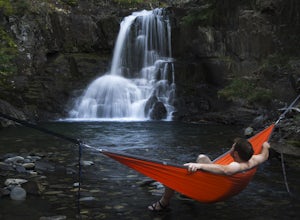
Explore the waterfalls of Oh Be Joyful Creek
If you're not already camping there, park at Oh Be Joyful Campground, about 5 miles up County Road 734 from downtown Crested Butte. There's parking on either side of the river crossing, but you're going to have to get your feet wet anyway, so might as well park in the first parking lot and walk a...Read more -
Kremmling, Colorado
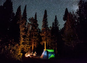
Camp Near Little Muddy Creek, Routt National Forest
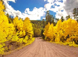
5.0If you are looking to get away from the crowds then this is the site for you. Located in the Routt National Forest, this spot offers everything from a seasonal lake (I went out of season) to free range sheep.Because of all the aspen trees, this place will be glowing with color in the fall. You wi...Read more -
Mesa County, Colorado
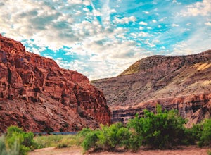
Backpack along the Gunnison River in the Dominguez-Escalante NCA
5.03.4 miIf you're looking to take your first backpacking adventure, but want something that is manageable yet thrilling, this is what you're looking for. Located along the Gunnison River in Western Colorado, the Dominguez-Escalante National Conservation area is easy to access yet full of adventure and be...Read more -
Durango, Colorado
Climb Fuller Peak
3.0Begin by hiking the Ice Lakes Trail for 3.5 miles, which will take you to Ice Lake. From here, you can identify the obvious, delta-shaped mountain to climber's left, known as Fuller Peak (13,761ft). Hike cross country, directly toward the base of the North Ridge (right skyline), walking past Full...Read more -
Allenspark, Colorado
Hike to Thunder Lake
12 mi / 2275 ft gainStarting at the often-busy Wild Basin TH, the trail passes through dense forests as it follows the North Fork of the Saint Vrain River through the southernmost section of Rocky Mountain National Park. The trail passes alongside the small Copeland Falls before continuing west towards Calypso Casca...Read more -
Crested Butte, Colorado
Hike Rustler's Gulch
5.09 mi / 1748 ft gainFrom Crested Butte, continue 6 miles past the town of Gothic to Rustler's Gulch Road. Turn right on the road, cross the East River to get to a small parking area near the river. If you don't have 4WD, park here and hike another 1/2 mile to the trailhead. It's a pretty steep hike. If you do have 4...Read more -
Idaho Springs, Colorado
Watch the Sunrise at Guanella Pass
5.01 mi / 100 ft gainFrom Denver, take i70 to Georgetown and simply follow the signs through town to the top. This pass can also be accessed from the south via US Highway 285 at the town of Grant. Guanella Pass is closed in the winter, typically from about the last week in November through the last week of May. Watch...Read more -
Idaho Springs, Colorado
Camp at Chinns Lake
Take the road as if you are going to St. Mary's Glacier, but you will take a left off the road (next to a very nice house) before the road makes a sharp right turn to go up hill. The road is a smooth dirt road for about a mile, but gets very rocky after that and you will need a good off road vehi...Read more -
Gypsum, Colorado
Explore Hardscrabble Mountain
Depending where you choose to access the Hardscrabble area from, this can be a fairly easy day hike or an overnight camping trip. If looking for a shorter day hike, access the Hardscrabble area by way of Hardscrabble Mountain Rd. From the town of Eagle, head South on Sylvan Lake Rd. In 5 miles, t...Read more -
Vail, Colorado
Backpack to Bubble Lake
3.013 mi / 3600 ft gainThe Gore's are a rough and remote section of the Eagle's Nest Wilderness. What this trip may lack in overall miles, it more than makes up for in elevation gain, scrambling, boulder hopping, and overall hard miles on the trail. Every trip I have had the pleasure of taking into the Gore Range has...Read more -
Westcliffe, Colorado
Summit Kit Carson Peak
12.4 mi / 6323 ft gainThere are a couple different trailheads that lead to Kit Carson Peak, but the one from Willow Creek Trailhead will give you the opportunity to peak another fourteener, Challenger Point, and let you pass through and/or camp at Willow Lake, which is a beautiful destination by itself. If approaching...Read more -
Buena Vista, Colorado
Mt. Elbert via Black Cloud Trail
4.510.69 mi / 4967 ft gainDirections: Heading south from Leadville from U.S. 24: West on CO 82 for 10.5 miles to a hidden right turn that leads to a trail head. If you make it to the Mt. Elbert Lodge, you have gone just a bit too far. The parking lot (aka: dirt access) should be relatively empty as everyone tends to hik...Read more -
Durango, Colorado
Columbine Pass via Purgatory Flats
5.034.52 mi / 6932 ft gainThis hike begins at the Purgatory Flats Trailhead across from the Purgatory resort. The register is about a hundred yards from the Trailhead and is located next to a trail map. From here you will begin your descent down into the flats, which is roughly a 600-700 foot descent over the course of ju...Read more -
Coalmont, Colorado
Camp at Dumont Lake, CO
4.5Dumont Lake is 22 miles southeast of Steamboat Springs, just minutes off of U.S. Highway 40 (Rabbit Ears Pass). As you turn off the highway and drive down the dirt road, you get great views of Rabbit Ears Peak.The campground is made up of 14 sites. Almost all of the sites have a view of the meado...Read more -
Carbondale, Colorado
Camp at Prince Creek
3.0From Colorado State Highway 82, turn south onto Highway 133 (toward Carbondale). Continue south past the Carbondale Main Street roundabout. After two miles, turn East onto Prince Creek Road. Follow this four miles to where the pavement ends. After passing through a cattle gate, BLM land lines the...Read more

