Arvada, Colorado
Top Spots in and near Arvada
-
Boulder, Colorado
Rattlesnake Gulch Trail
3.49 mi / 1093 ft gainRattlesnake Gulch Trail is a loop trail that takes you by a river located near Eldorado Springs, Colorado.Read more -
Boulder, Colorado
Rock Climb Supremacy Rock in Eldorado Canyon
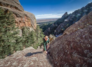
5.0This is a great spot for beginner climbers, as long as you have an experienced climber with you to anchor the top rope and belay you. It is in a beautiful state park, Eldorado Canyon, in Boulder, Colorado. This canyon is famous for rock climbing and attracts climbers from around the country. Many...Read more -
Morrison, Colorado
Hike Mount Falcon
4.03.7 miJust a short drive from Denver up US-285 sits Mount Falcon Park, a 2,248 acre open space park managed by Jefferson County. With over 12 miles of hiking trails and stunning views of Denver and the Front Range, this park is perfect for getting in a quick adventure when you don’t feel like driving t...Read more -
Evergreen, Colorado
Hike Panorama Point at Corwina Park
4.72.7 mi / 640 ft gainJefferson County, the "Gateway to the Rockies" has dozens of great parks and trails. One of the best, however, is often overlooked, as it is sandwiched between bigger and more popular parks. Corwina Park is a small section located off Hwy. 74, near the village of Kittredge. Sitting between the po...Read more -
Boulder, Colorado
Shanahan Ridge Trail
4.03.84 mi / 715 ft gainStarting on the edge of a neighborhood in South Boulder, this 3.8 mile loop begins its 869 foot elevation gain by meandering through a pine forest. You can 'choose your own adventure' by exploring the handful of trails that meet up with the Shanahan Ridge Trail, such as the South Mesa Trail, Shad...Read more -
Boulder, Colorado
Boulder's Skyline Traverse
5.014.77 mi / 4583 ft gainHave you ever reached the bottom of a hike with some friends and thought, 'That was nice, but I'd still like to hike more... a lot more.'? Then the Skyline Traverse is for you. Instead of hiking just Green Mountain or Bear Peak, the Skyline Traverse links South Boulder Peak, Bear Peak, Green Mou...Read more -
Golden, Colorado
Hike the Mountain Lion Trail
6.7 mi / 1230 ft gainThere are three parking lots with direct access to the Mountain Lion Trail. The main one is off of Crawford Gulch Road, but any of them are good starting points! This loop has pretty similar elevation gain and loss profiles no matter which way you go, so you can go any direction. This adventure ...Read more -
Golden, Colorado
Hike Racoon Trail to Panorama Point
4.03.3 mi / 750 ft gainSummer is a magical time of year in the Rocky Mountains. One great way to experience this stunning beauty is through hiking Raccoon Trail to Panorama Point at Golden Gate State Park. Raccoon Trail is 3.3 mile moderately difficult hike which can be completed in under an hour, although it will like...Read more -
Boulder, Colorado
Mars Blocks via Bear Canyon Trailhead
4.89 mi / 1923 ft gainThe Bear Canyon Trailhead is just one of many starting points for this hike, one could also start at NCAR, North Fork Shanahan, or any point on the Mesa Trail. For the purposes of this adventure, I'll start at Bear Canyon Trailhead in South Boulder. This hike will take you about 2-4 hours dependi...Read more -
Evergreen, Colorado
Pence Park's Independence Mountain Trail
4.42.09 mi / 869 ft gainPence Park, part of the Denver Mountain Parks system, is nestled between the mountain communities of Indian Hills and Kittredge on Myers Gulch Road. It's one of those places I always drove right past without bothering to check it out. From the road, it looks the same as any other place in the foo...Read more -
Boulder, Colorado
Woods Quarry via NCAR
4.23.28 mi / 755 ft gainYou can start from Chautauqua Park, but I prefer to start at NCAR, especially since there is ample parking and you can take a bathroom break inside before hitting the trail. From the intersection of Table Mesa Drive and Broadway in Boulder, drive west on Table Mesa to its end at the NCAR buildin...Read more -
Boulder, Colorado
Catch a Boulder Sunrise from NCAR
A great place to watch the sunrise in Boulder is at NCAR, the National Center for Atmospheric Research. Park in the parking lot at the top of the hill, and if you're feeling up to it, you can walk south for about 10 minutes to an adjacent hill with beautiful views. Either way, you will want to ge...Read more -
Golden, Colorado
Hike to Forgotten Valley
4.33.6 mi / 852 ft gainThere are over 35 miles of hiking trails in the park. The twelve trails in Golden Gate Canyon State Park are named after an animal and marked with the animal’s footprint.For a 2.6 round trip hike, start at the Burro Trailhead in Golden Gate Canyon State Park. You’ll immediately cross over a lit...Read more -
Boulder, Colorado
Scramble Angel's Way
5 mi / 1000 ft gainAngel's Way is an amazing 8 pitch rock climb scramble (5.2) that is tucked away in Skunk Canyon, hidden from the crowds of Chautauqua. The best part of this scramble is you only need your climbing shoes and chalk-bag. It is similar to the 'Free Way' on the Second Flatiron. I would encourage ev...Read more -
Boulder, Colorado
Trail Run Near Boulder - NCAR Hill Climb
4.52 mi / 700 ft gainThe NCAR Hill Climb, so named because it ends at the National Center for Atmospheric Research, is popular with cyclists, but is a great choice for runners as well. Follow the NCAR - Table Mesa Trail to the top, with beautiful views of the Flatirons and surrounding hills during any season.Make sur...Read more -
Golden, Colorado
Summit Windy Peak via the Burro Trail
4.06.35 mi / 1825 ft gainThe Burro Trail starts at the Bridge Creek Trailhead Parking Lot and leads off to the left. While this trail is incredibly well marked it wouldn't hurt to grab a map at the visitors center before you start! From the parking lot you'll travel along the trail for 0.7 miles until you reach your firs...Read more


