Walnut Creek, California
Walnut Creek, California, is the perfect destination for adventurers looking for the best trails and activities. From hikes to attractions, the area offers a variety of top adventures. Popular attractions in and near the area include the Shell Ridge Open Space, Mount Diablo State Park, and Lime Ridge Open Space. These locations offer activities such as hiking, biking, and horseback riding. Visitors can also take a stroll along the Iron Horse Regional Trail or explore the trails at the Las Trampas Regional Wilderness. With so many activities available, Walnut Creek is the perfect place to explore and enjoy nature.
Top Spots in and near Walnut Creek
-
Inverness, California
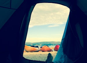
Kayak Camping in Point Reyes
4.9Like camping in remote locations? Love oysters? This is it! Tomales Bay offers boat-in only campgrounds along the east side of the peninsula. We departed from Chicken Ranch Beach, which is on the west side of Tomales Bay. We jumped in our kayaks and headed north in the bay for a quick breather at...Read more -
La Honda, California
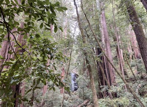
Hike through Portola Redwoods State Park
4.87 miLike redwood hikes? We do too, they're always very scenic and take you away from the hustle and bustle of the bay area. Not to mention, they also stay cool during the summer months. If you want a hike in the middle of the peninsula, this is a great bet.When starting this hike, head out from headq...Read more -
Sanborn County Park, California
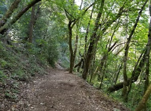
Hike Sanborn County Park via the San Andreas Trail
4.04.2 mi / 1282 ft gainThis is a moderately rated 4.2 mile trail that winds through the redwoods west of Saratoga. It features a dirt trail with tall trees and a creek. The hike is very tranquil and there is lot s of greenery. There are big rocks in the creek that can you can sit on. People often meditate here as i...Read more -
Los Gatos, California
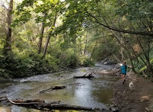
Hike Los Gatos Trail to Jones Trail Loop
3.8 mi / 511 ft gainThis trail winds its way along the Los Gatos Creek and ends at the Lexington Reservoir before looping back to the start. It is 3.8 miles and makes for a great way to get exercise and relax in nature. You can hear the creek as you hike, and can even go down to it. There is a lot of green foliage t...Read more -
Saratoga, California
Skyline-to-the-Sea Trail
4.530.8 miWant to experience one of the bay area's most memorable backpacking trips? We've got the details to get you out on the trail. To start the trek, drop your car at the Castle Rock State Park Parking Lot, which is located ~2.5 miles south of the junctions of Highways 35 and 9 off of Highway 35. Not...Read more -
Saratoga, California
Backpack Castle Rock State Park
4.7Castle Rock Trail Camp has a different policy than other backcountry camps in the area (i.e. campsites along Skyline to the Sea). This campground is open all year and is available on a first come, first served basis. If you can, grab a spot a Frog Flat Camp. To get to the camp, park your car at t...Read more -
Los Gatos, California
Hike the Saratoga Gap Trail
4.64.7 miThe Saratoga Gap Trail is relatively lightly trafficked trail that is good year round, although waterfalls peak in late winter and spring. Overall, this 4.7 mile partial loop hike is moderate, with about 1000 feet in elevation change. Trailhead elevation is about 3090 feet. The featured hike desc...Read more -
Santa Rosa, California
Hood Mountain Summit Via Lower and Upper Johnson Ridge Trails
5.95 mi / 2054 ft gainHood Mountain Summit via the Lower Johnson and Upper Johnson Ridge Trails is a 6 mile out-and-back trek located in Santa Rosa, CA. The trailhead starts at the Pythian Road parking lot, accessed from Highway 12. The hike takes 3.5 to 4 hours to complete and is considered strenuous. All trails are...Read more -
Inverness, California
Hike the Estero Trail
5.08 mi / 200 ft gainJune sunshine blazes on your shoulders during this scenic stroll through the Point Reyes Seashore. The trail is alive and awash with colorful wildflowers around every corner.Beginning at the trailhead, just off Home Ranch Road, with a convenient parking lot and bathroom, you'll wade through a hal...Read more -
Santa Rosa, California
Gunsight Rock via Hood Mountain Trail
5.07.91 mi / 2372 ft gainHike to Gunsight Rock through Hood Mountain Regional Park to get a view overlooking Sonoma and Napa Valley. In order to get to the trailhead take Highway 12 to Los Alamos Rd, the road will then turn into Timberline Dr, this will take you to the trailhead. There is a parking fee of $8. From the p...Read more -
Santa Rosa, California
Hiking, Swimming, and Fishing in Wine Country
5.0Annadel State Park is located in the historic Valley of the Moon, just 60 miles north of San Francisco, in Sonoma. This popular 5,200 acre park features a wonderful variety of options to explore, boasting views of the Sonoma Valley, rolling meadows of wildflowers, and direct access to 26 acre Lak...Read more -
San Jose, California
Hike the Quicksilver Trail
4.35.1 mi / 915 ft gainThe trails are well maintained and offer good visibility. The trail can be muddy after it rains, and does not have much shade (so bring extra water in the summer). Dogs are allowed on this trail but must be kept on leash. Keep your eyes peeled for wildlife - this trail is frequently used for bir...Read more -
Point Reyes Station, California
Drake's Beach, Pt. Reyes
5.0Named after the famed explorer, Sir Francis Drake, Drakes Beach is part of the scenic Point Reyes National Seashore. If you're looking to spend a day and an evening at the beach, grab some snacks and some firewood and head out to Drakes Beach. Key things to remember with the bonfire: Build th...Read more -
Santa Rosa, California
Taylor Mountain Loop
4.24.89 mi / 1096 ft gainFrom the northern entrance to the park, you can access an 18-hole disc golf course as well as a number of trails. The Eastern Trail takes you up a steep 1,000 feet to the top of Taylor Mountain, where you can see most of Sonoma County laid out before you. Mt. St. Helena is visible in the distance...Read more -
San Jose, California
Explore Santa Teresa County Park
4.58.3 mi / 2053 ft gainThe Santa Teresa County Park loop is perfect for wildlife viewing! Be ready to see deer, coyote, hawks, turkeys, pigs and cows. The trail is rated as moderate - be cautious with mud if you are visiting the park after a rain shower. Dogs are allowed in the park, but must be kept on leash. There i...Read more -
Inverness, California
Marshall Beach Trail
5.02.41 mi / 305 ft gainMarshall Beach Trail is an out-and-back trail that provides a good opportunity to see wildlife located near Inverness, California.Read more

