Tehama County, California
The best Trails and Outdoor Activities in Tehama County, California are a must-visit for outdoor adventures. One of the top trails is the Yana Trail, a moderate difficulty trail that features a scenic hike along the Sacramento River. Along the trail, you'll find unique rock formations and views of the river. Another must-visit is the Ishi Wilderness, a rugged landscape with steep canyons, high ridges, and a variety of wildlife. Here, you can enjoy hiking, backpacking, and horseback riding. The Sacramento River Bend Outstanding Natural Area is also a popular attraction. It offers bird-watching, fishing, boating, and hiking with beautiful views of the river and surrounding landscapes. These outdoor activities and attractions make Tehama County a top destination for those seeking scenic outdoor adventures.
Top Spots in and near Tehama County
-
Shasta County, California
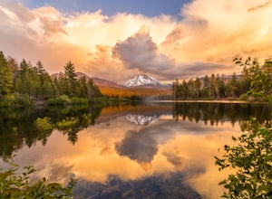
Photograph Lassen Peak
4.8Located in Northern California, Lassen Volcanic National Park is an astoundingly beautiful, diverse, yet under-appreciated park in the national park system.Manzanita Lake, located at the northwest park entrance, holds the largest campground in the park, and affords a gorgeous, photograph worthy v...Read more -
Shasta County, California
Camp out at Manzanita Lake Cabins in Lassen Volcanic NP
Deep in the Lassen National Forest is the beautiful and surprisingly one of the least visited National Parks, Lassen Volcanic National Park. On the north entrance of the park, you will find the beautiful Manzanita Lake Cabins and Campground with the gorgeous blue lake in the foreground. Getting ...Read more -
Shingletown, California
Manzanita Lake Loop
4.01.88 mi / 121 ft gainManzanita Lake Loop Trail is a loop trail that takes you by a lake located near Old Station, California.Read more -
Old Station, California
Bumpas Hell to Cold Boiling Lake
4.05.32 mi / 1007 ft gainBumpas Hell to Cold Boiling Lake Trail is an out-and-back trail that takes you by a lake located near Old Station, California.Read more -
Redding, California
Camp at Shasta Campground
Shasta Campground offers 27 tent/trailer campsites, picnic tables, paved loop road, vault toilets, OHV staging area, potable water, and fire rings. To get to the campground head along Keswick Reservoir, below Shasta Dam. Take I-5 north from Redding about 10 miles to Shasta Dam Blvd. Follow Shas...Read more -
Shasta County, California
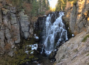
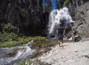
Kings Creek Falls Trail
4.02.49 mi / 495 ft gainKings Creek Falls Trail is an out-and-back trail that takes you by a waterfall located near Old Station, California.Read more -
French Gulch, California
Hike to Whiskeytown Falls in Whiskeytown National Recreation Area
2.8 mi / 787 ft gainComing from Redding pass the visitor center and heading down highway 299. Make a left turn on Crystal Creek Road. Drive about 3.75 miles and on your left will be the Mills Creek Trailhead. Start hiking. You will start headed downhill towards the creek. You will cross Crystal Creek on a footbridge...Read more -
French Gulch, California
Hike to Crystal Creek Falls in Whiskeytown National Recreation Area
0.6 miFrom Redding pass the visitor center on highway 299 and pass the lake. Make a left turn on to Crystal Creek Road. Follow this road for about 2 miles. There will be signs to make a left turn to Crystal Creek Falls. This is less of a hike and more of a walk. The trail is paved. It is less than a ha...Read more -
Redding, California
Houseboat Lake Shasta
1 mi / 1 ft gainLake Shasta sits at the foot of infamous Mt Shasta, past the major Northern California city of Redding. From the Bay Area you can count on at least a 3.5 hour drive to get to waters edge, but the drive goes by quickly just cruising on HWY 5. There are multiple Marinas on Shasta but the largest is...Read more -
Shasta County, California
Devastated Area Interpretive Trail
2.00.5 mi / 16 ft gainDevastated Area Interpretive Trail is a loop trail that is good for all skill levels located near Old Station, California.Read more -
Plumas County, California
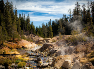
Boiling Springs Lake Loop
2.38 mi / 449 ft gainThe hike to Boiling Springs Lake starts at the Warner Valley Trailhead and is only a 3 mile roundtrip hike. It's a fairly easy hike that starts through the valley and then winds up through the forest and eventually opens up to the lake. First thing you'll notice as you approach the lake is the ...Read more -
Plumas County, California
Drake Lake Trail
4.6 mi / 840 ft gainThe hike starts at the Warner Valley Trailhead and winds up the mountain until you reach the lake. The first 2 miles or so are very pleasant walk through the woods until you reach the last portion which is essentially straight up the mountain side. This portion of the trail can be very slippery...Read more -
Pacific Crest Trail, California
Devils Kitchen Trail
5.05.06 mi / 525 ft gainYour hike to Devils Kitchen will start from Warner Valley Campground. The hike starts out thorough the valley and eventually winds through the forest and ends at the top of the Devils Kitchen site. You'll then hike down the hill a bit and get to explore the area! There are pretty specific walkin...Read more -
Pacific Crest Trail, California
Camp at Warner Valley
Warner Valley Campground is at the end of Warner Valley Road. It's 16 dollars a night at a first come first serve basis. As far as the campground it self, there are a few bathrooms and each site has a fire ring and a picnic table. There are 17 sites which isn't a ton but since it's a fairly unuse...Read more -
Shasta County, California
Seven Lake Loop in Lassen Volcanic NP
11.54 mi / 1545 ft gainThis hike is one of my favorites for when I only have a weekend to get my nature fix. To start off, visit either the Loomis Museum, Loomis Ranger Station, Butte Lake Ranger Station, Kohm Yah-mah-nee Visitor Center, Warner Valley Ranger Station, or Juniper Lake Ranger Station and pick up a wildern...Read more -
Oroville, California
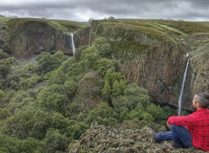
Hike to Phantom Falls
4.64.2 mi / 850 ft gainDropping off a 135 ft cliff is a very well hidden waterfall with no trails leading to it. But if you do find it, it is an epic natural wonder.It is best to come here in the winter months, after a lot of rain. But it is also well worth coming in the spring when the wildflowers on Table Mountain ar...Read more

