Santa Monica, California
The best Trails and Outdoor Activities in Santa Monica, California offer a variety of top outdoor adventures. The Temescal Canyon Loop is a must-visit with its 2.6-mile trail that offers stunning ocean views and a scenic waterfall. For a more challenging hike, the Los Liones Trail is a 7.3-mile trail that takes you through lush greenery and offers panoramic views of the Pacific Ocean. The Santa Monica Beach bike path is a 22-mile long flat trail perfect for cycling, running, and walking. If you're into bird watching, the Ballona Wetlands is a great spot. For rock climbing, head to Point Dume in nearby Malibu. Remember to respect the outdoors and leave no trace behind. Enjoy your outdoor adventures in Santa Monica!
Top Spots in and near Santa Monica
-
Los Angeles, California
Cabrillo Beach
Cabrillo Beach located in San Pedro, California is a great spot to bring the whole family. There are tide pools at the beach as well as the Cabrillo Marin Aquarium where the kiddos can get tours and more information about the sea life they're seeing. There is a parking lot at the Cabrillo Beach...Read more -
Altadena, California
Thalehaha Falls
1.71 mi / 679 ft gainThe trails starts in a foothill neighborhood of Altadena CA at the corner of Pleasantridge Dr. and Rubio Vista Rd. This is one of the better entries into the Angeles National Forest because it is one of the lesser known. Find a place to park on the street and head out on the trail into Rubio Cany...Read more -
Whittier, California
Sycamore Canyon Trail in Turnbull Canyon
2.03.47 mi / 627 ft gainThe Sycamore Canyon Park Trailhead can be found at the end of the dirt parking lot off Workman Mill Road. The entrance is off a small road which is pretty easy to miss, but there is a sign off the main road. Soon after you start on the trail, the path opens up onto a larger dirt road for vehicle ...Read more -
Altadena, California
Eaton Canyon to Idlehour Trail Camp
4.510.99 mi / 3291 ft gainIdlehour is nestled deep in the Angeles National Forest, so it feels like you're in the heart of some untapped wilderness instead of six miles away from a bustling metropolis. The trail camp is accessible by foot through a variety of locations, but the most popular route is through Eaton Canyon, ...Read more -
Pasadena, California
Eaton Canyon Falls via Eaton Canyon Trailhead
4.23.54 mi / 528 ft gainThe hidden forty-foot-tall Eaton Canyon Falls fills an amphitheater at the top of Eaton Canyon Trail, tumbling into a wide pool that you can rest alongside or wade in. Normally the water is waist deep, but during this recent trip, we found the water only to stop at our ankles as it tends to fluct...Read more -
Westlake Village, California
Climb at Echo Cliffs
1.3 miThe hike to the crag is about 1.3 miles one way and takes roughly 45 minutes. The approach starts at the Backbone / Mishe Mokwa trail head off Yerba Buena Rd. After walking a couple minutes you'll see a sign pointing left for the backbone trail or straight for Mishe Mokwa. Continue straight and ...Read more -
Malibu, California
Leo Carillo State Beach
4.5Leo Carrillo State Park has 1.5 miles of two sandy beach areas, tide pools, and numerous coves and sea caves. This year-round paradise offers privacy and ocean access for anglers, divers, surfers, wildlife watchers, beachcombers, and campers. If you're headed here for day-use, there are also tide...Read more -
Malibu, California
Sandstone Peak
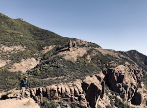
4.83.03 mi / 971 ft gainIf you live in Los Angeles, Sandstone Peak is a must! The hike to the summit can be done on a 2 mile hike up and back on Sandstone Peak Trail, or a 6.5 mile hike up and back on Backbone Trail. The shorter trail is more popular, yet both are equally rewarding. You won't believe the views from the...Read more -
Malibu, California
Balanced Rock via Sandstone Trailhead
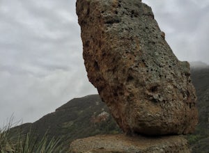
5.04.36 mi / 1125 ft gain...From the PCH, make a left turn on Yerba Buena road (turn right if you're coming South) for about 6 miles until you get to the dirt parking area. If the lot is full, there's extra parking on the side of the road. FYI, Balanced Rock can also be accessed by starting at the Mishe Mokwa trailhead,...Read more -
12869 Yerba Buena Road, California
Mishe Mokwa Trail to Sandstone Peak
5.07.06 mi / 1755 ft gainTake Yerba Buena road to the trailhead. It is less zigzagged and shorter distance from PCH. Parking is easy provided that you start early in the morning. If the lot is full, you can always park on the side of the road. Bathroom is available at Sandstone Peak Trailhead parking lot, just 0.8 miles ...Read more -
Stevenson Ranch, California
Mentryville: Pico Canyon Trail
7.07 mi / 1388 ft gainMentryville: Pico Canyon Trail is an out-and-back trail that takes you past scenic surroundings located near Stevenson Ranch, California.Read more -
Whittier, California
Hellman Park Trail
3.04 mi / 850 ft gainThis trail is great if you're looking for a quick, but intense workout. The hike itself is only 4 miles out- and-back and can be easily completed within a couple of hours. However, be prepared for a steep and steady incline for the first 1.5 miles. The trail itself is pretty wide, and if you sho...Read more -
Los Angeles County, California
Switzer Falls
3.43.66 mi / 728 ft gainJust off the Angeles Crest highway, you’ll find one of LA’s best waterfalls, Switzer Falls. There is a parking lot just next to the trailhead. If you go on the weekend and run into a crowd, there’s parking near the highway, adding a little distance to your trek. Once you’ve walked through the Sw...Read more -
Los Angeles County, California
Bear Canyon via Switzer Falls Trailhead
6.67 mi / 1273 ft gainParking: Parking is available at the Switzer Falls Picnic Area, or in the two overflow lots on the hill. You will need an Adventure Pass to leave your car parked here. Make sure to follow posted signs - there are some parking spots that do not allow overnight parking. Amenities: Bear Canyon has...Read more -
Altadena, California
Gabrieleno Trail: Switzer Falls to Hahamonga Watershed
5.010.14 mi / 814 ft gainGabrieleno Trail: Switzer Falls to Hahamonga Watershed is a point-to-point trail that takes you by a waterfall located near La Canada Flintridge, California.Read more -
Malibu, California
Grotto Trail
2.64 mi / 492 ft gainWho doesn't enjoy a hike that offers water, scenic views, boulder hopping and a subterranean cave? I know I do! The Grotto Trail begins at Circle X Ranch, which looks a bit like a small cowboy western store, and is approximately 6 miles from the Highway 1 (PCH). The parking is a tad tight, fittin...Read more

