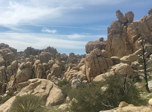
San Bernardino, California
San Bernardino, California, is home to some of the best trails and outdoor activities. For those seeking outdoor adventures, the Pacific Crest Trail is a must-visit. This challenging trail offers scenic views of the San Bernardino Mountains, with its towering peaks, alpine lakes, and unique rock formations. Another top trail is the Rim of the World Scenic Byway, which boasts panoramic views of the surrounding landscape. For those interested in water activities, the Santa Ana River Trail offers opportunities for fishing and kayaking. Nearby, the San Bernardino National Forest is a haven for bird watching and wildlife spotting. These are just a few examples of the outdoor attractions in and near San Bernardino, making it a top destination for those who appreciate the great outdoors.
Top Spots in and near San Bernardino
-
Monrovia, California
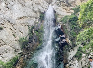
Monrovia Falls
3.71.46 mi / 459 ft gainMonrovia Falls is closed indefinitely due to the Bobcat Fire and mudslides. Read more on the CityofMonrovia.org website. The Monrovia Falls are at the end of the main trail located in Monrovia Canyon Park. The park is easy to locate and has ample parking. Keep in mind you do have to pay a fee of...Read more -
Arcadia, California
Hermit Falls Trail
4.82.49 mi / 1014 ft gainNote: Hermit Falls is Temporarily Closed From Roberts Camp, many hikers will head to Sturtevant Falls, which is an amazing 60-foot waterfall. But, if you choose to head in the opposite direction on First Water Trail, you’ll be rewarded with a fresh water swimming hole at this 35-foot tumbling wa...Read more -
Arcadia, California
Sturtevant Falls
4.61.61 mi / 423 ft gainThis trail is currently closed. Visit the Forest Service website for updates. As you head down to Roberts Camp, a historic set of historic cabins, you’ll head out on a steep, paved road for approximately 0.6 miles. Once you reach the camp, head over the bridge and keep an eye out for the sign f...Read more -
Arcadia, California
Mt. Wilson Loop from Chantry Flat
5.012.74 mi / 4852 ft gainMt. Wilson is one of the more difficult mountains in the San Gabriel to hike, making this adventure Intermediate. While 5,700 feet doesn't seem that tall, the mountain has a prominence of almost 5,300 feet, meaning that hike is steeper and longer than some of the other popular mountains that star...Read more -
Morongo Valley, California
Big Morongo Canyon Trail
11.65 mi / 1401 ft gainBig Morongo Canyon Trail is a loop trail where you may see wildflowers located near Morongo Valley, California.Read more -
Trabuco Canyon, California
Bell Canyon Trail
3.86 mi / 102 ft gainBell Canyon Trail is an out-and-back trail where you may see wildflowers located near San Juan Capistrano, California.Read more -
San Juan Capistrano, California
Hike the Pinhead Peak Trail at Ronald W. Caspers Wilderness Park
4.02 mi / 220 ft gainRonald W. Caspers Wilderness Park is the perfect place to getaway from the hubbub of LA. Enjoy the scenic drive north on Ortega Highway before reaching the entrance gate to the park. Parking Fees are currently $3 on Weekdays and $5 on Weekends. Camping Fees vary depending on your group size. The...Read more -
Hemet, California
Hike South Fork Trail
5.4 mi / 1056 ft gainBegin by following the unsigned but visible trail on the south side of the turnout. You climb steadily through bushes and past granite boulders. At half a mile, you pass over to the western slope of the hill where the trail bends southeast, providing your first look of the river valley far below....Read more -
Pioneertown, California
Pioneertown to Big Bear via Burns Canyon Road and 2N02
18.8 mi / 3287 ft gainThe Pioneertown to Big Bear trail via Burns Canyon Road and 2N02 is a unique hiking route in Pioneertown, California. This trail is known for its diverse terrain and stunning views. The trail starts in the historic Pioneertown and winds its way up to Big Bear, a popular mountain resort. The tra...Read more -
Palmdale, California
Hike to Vetter Mountain and the Fire Lookout Tower
2.8 mi / 550 ft gainIf you're looking for an easy mountain to hike, and perhaps give the kids something interesting to learn about at the top, then Vetter Mountain may fit the bill. At 5,908', and with a trailhead at about 5,350', this 1.4 mile (one way) hike only climbs about 550' vertical. The trailhead is loca...Read more -
Palmdale, California
Camp at Chilao Campground
4.3While not as popular as shady Buckhorn Campground up the road, Chilao offers the better views and greater chances of scoring a peaceful and private campsite. There are two campsites located here (and two group camps down in the valley). Sites are first come, first serve, and cost $12 (bring exact...Read more -
Palmdale, California
Camp at Manzanita Loop in Chilao Campground
5.0Chilao Camp is located at an elevation of 5,300 feet, in the San Gabriel Mountains, and is divided into two different loops called the Manzanita and Pine.This specific adventure is for the Manzanita Loop, which is pretty much known as the more scenic loop, mainly because the area overlooks the Bi...Read more -
Mountain Center, California
Tahquitz Peak via Devils Slide Trail
5.08.31 mi / 2238 ft gainTahquitz Peak via Devils Slide Trail is a moderately trafficked 8+ mile out and back trail located near Idyllwild, California. This trail is one of the most popular hikes in the San Jacinto area that features a fire lookout tower at the peak and amazing views of the valley below. At an elevation...Read more -
Mountain Center, California
Mount San Jacinto via Devil's Slide
4.514.57 mi / 4475 ft gainMt. San Jacinto is the second tallest peak in Southern California at 10,834’. Although this route requires a fair amount of work, the effort is more than rewarded by the expansive views, forest, meadows, and dramatic topography. You will need an Adventure Pass ($5/day) to park at Humber Park, as...Read more -
Whittier, California
Hellman Park Trail
3.04 mi / 850 ft gainThis trail is great if you're looking for a quick, but intense workout. The hike itself is only 4 miles out- and-back and can be easily completed within a couple of hours. However, be prepared for a steep and steady incline for the first 1.5 miles. The trail itself is pretty wide, and if you sho...Read more -
Pioneertown, California
Indian Trail Loop at Pipe's Canyon
6.16 mi / 892 ft gainIndian Trail Loop at Pipe's Canyon is a loop trail where you may see beautiful wildflowers located near Pioneertown, California.Read more


