Running Springs, California
Top Spots in and near Running Springs
-
Azusa, California
Smith Mountain Trail is an awesome day hike located near Glendora, California. This out-and-back trail offers great views of the Los Angeles National Forest and the potential for continuation to Bear Creek for even more variety of scenery.
Smith Mountain is a moderately strenuous hike with an el...
Read more
-
Palm Springs, California
South Carl Lykken Trail - North Section is an out-and-back trail that takes you by a waterfall located near Palm Springs, California.
Read more
-
Azusa, California
4.3
3.36 mi
/ 607 ft gain
Take Hwy 2 out of La Canada north along Angeles Crest Highway. Follow this for quite some time enjoying the fine views in all directions. After traveling through two consecutive tunnels continue to the Islip Saddle parking lot (on left). There will be a vault toilet & a picnic table. Display ...
Read more
-
Lake Elsinore, California
The San Juan Trail is located off the Ortega Highway (Hwy 74) in Southern Orange County. It is done frequently as a long, 11 mile climb that is rewarded by an almost continuous descent of 3400ft. The out-and-back trail head is back Hot Spring Canyon Rd from the San Juan Fire Station. It can also ...
Read more
-
Corona, California
When you think of Orange County, you think of beaches, boardwalks, but what you may not know is that there are some great hikes in our very own backyard! My favorite is a fairly strenuous day hiking adventure that only the strong survive. Not to dissuade any interested parties, since this is a ...
Read more
-
Corona, California
To start, directions on how to get to the trail there are two different ways, the most common , which I will explain, being through Rancho Santa Margarita you will head east on Santa Margarita Parkway, turn left at the dead end (into a parking lot for a shopping center) on Plano Trabuco Road, thi...
Read more
-
Los Angeles County, California
The trailhead is immediately off of Angeles Crest Highway CA-2 at Islip Saddle. It's just a touch over 2 miles to reach the summit, through which you'll be hiking among the pine tree forest practically the entire way up (part of this trail doubles as the Pacific Crest Trail). The summit is larg...
Read more
-
-
Palm Springs, California
This is a short but sweet trail close to the Araby and Garstin Trails. Great views of Palm Springs and the San Jacinto Mountains. Parking area is off of Lansdale Street. From here, head down the Earl Henderson Trail and you will see where in connects with the Shannon Trail. You can choose to swit...
Read more
-
-
Palm Springs, California
5.0
1.03 mi
/ 154 ft gain
Andreas Canyon in Indian Canyons is located very close to Palm Springs in the Agua Caliente band of Cahuilla Indians Reservation. It is one of the few places with abundant shade and running fresh water in an otherwise dry desert landscape. Enjoy a longer hike to a waterfall (Seven Falls) or stay ...
Read more
-
Palm Springs, California
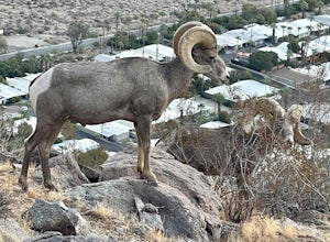
A very scenic 4-mile round trip with a rewarding waterfall after a 2.5-mile hike/stroll. Lucky visitors may catch a glimpse of the Peninsula Big Horn Sheep (an endangered species), mule deer or other wild animals still roaming the high ground above the canyon. Less visited, Murray Canyon has its ...
Read more
-
Palm Springs, California
5.0
8.85 mi
/ 2844 ft gain
Murray Hill is the highest point in the surrounding trail system. You can access it from Araby Trail or anyone of the others in the area. It's about 9 miles round-trip and a healthy 2,850 vertical feet gain.
From the top of the Shannon Trail bear right until you reach the Wildhorse Trailhead. Go...
Read more
-
Palm Springs, California
This hike takes you up to Bob Hope’s massive mushroom shaped house. The neighborhood also includes a house where Steve McQueen lived and the Elrod House featured in the James Bond film “Diamonds are Forever”. It’s a fairly easy hike up to Bob’s but really climbs after you pass the estate.
You c...
Read more
-
-
Palm Springs, California
Coffman Trail, located in Palm Springs, California, is a popular hiking destination. The trail is approximately 3.56 miles long and is rated as moderate in difficulty. It begins at Andreas Canyon Road and winds its way up the mountainside, offering panoramic views of the surrounding desert landsc...
Read more

