Porterville, California
The best Trails and Outdoor Activities in Porterville, California, offer a variety of scenic outdoor adventures. One of the top trails to explore is the River Island Country Club Trail. This trail offers a moderate difficulty level, making it perfect for those who enjoy a good workout while taking in the beautiful views. The trail meanders along the Tule River, offering stunning views of the water and surrounding vegetation. Another must-visit trail is the Bartlett Park Trail, known for its unique rock formations and panoramic vistas. For those interested in bird watching, the nearby Pixley National Wildlife Refuge is a prime spot. These outdoor attractions in and near Porterville are sure to satisfy your adventurous spirit.
Top Spots in and near Porterville
-
Sequoia National Park, California
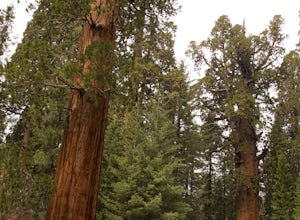
Hike through the Giant Forest in Sequoia NP
5.02 mi / 154 ft gainTake a drive to Sequoia National Park and take in the beautiful views of the second oldest national park. If you go in the winter or early spring time, be sure to check the weather beforehand and be prepared for the cold.If you are an avid traveler to national parks, I'd recommend that 2 weeks b...Read more -
Kernville, California
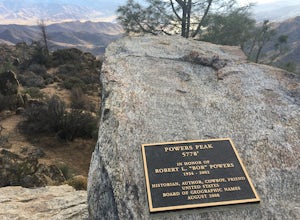
Hike up Powers Peak in Kernville
10 mi / 3200 ft gainHigh Level Details: ~10 Miles Round Trip~3,200 feet total elevation gain for tripTrailhead elevation: 2,811 feetHighest Point on the trail: Powers Peak, 5,778 feetEstimated Time to complete: 4-5 hoursNo water source along the way, so bring plenty of water Dog friendly? Yes! We love bringing Linco...Read more -
Sequoia National Park, California
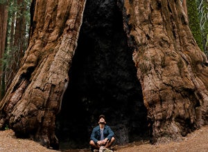
Hike the Congress Trail
5.03.1 mi / 500 ft gainWhile the General Sherman Tree is the main attraction in this area, the Congress Trail allows you to get away from the majority of the crowd and explore the giant sequoias at your leisure. The vast majority of visitors only walk to and from the General Sherman Tree. The trail starts out from the ...Read more -
Sequoia National Park, California
Hike to Emerald Lake, Sequoia National Park
4.510.4 mi / 2200 ft gainBegin this hike at the Alta Peak Trailhead in the Sequoia National Park. The trail initially takes you east-southeast through a loosely forested area that is stark and arid. Around 1.5 miles in you'll cross a small creek, but this creek may dry up in the late spring/summer. Shortly after the cree...Read more -
Sequoia National Park, California
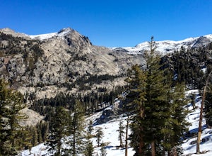
Hike to Pear Lake via the Lakes Trail
5.012.4 mi / 2300 ft gainThe Lakes Trail to Pear Lake can be done as either an overnight stay or a day hike. For overnight, you'll need to get a permit but there are beautiful camping spots available at both Emerald Lake and Pear Lake. As a day hike, plan to spend all day since you'll undoubtedly pause at each lake for...Read more -
Sequoia National Park, California
Backpack to Big Bird Lake & Moose Lake
30 mi / 8000 ft gainThis trip requires a wilderness permit. You can get one at the Lodgepole Visitor Center where you can also rent a bear canister or use the bathroom before heading out.Wolverton Trailhead -> Big Bird Lake (~12 miles)The start of the trail is on the left side of the parking lot and towards the m...Read more -
Three Rivers, California
Hike Little Baldy
5.03.5 mi / 700 ft gainA short hike with impressive views of Sequoia National Park, the Little Baldy trail is the less touristy version of Moro Rock. When we hiked it on a beautiful Sunday morning in the summer, we had the entire summit to ourselves. Even if other hikers had been up there, it would have still felt em...Read more -
Sequoia National Park, California
Mount Silliman, Sequoia NP
5.011.24 mi / 4449 ft gainThere is available parking at the campgrounds at the Lodgepole Visitor Center. Lodgepole's elevation starts at 6720 ft. Twin Lakes Trailhead starts right at the base, which you will be following to get to Mount Silliman. Along Twin Lakes Trail are several campgrounds for your journey, you can go...Read more -
Bakersfield, California
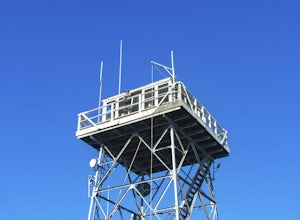
Oak Flat Lookout
4.0/ 80 ft gainSpend a few nights under the stars in a unique piece of outdoor history. The Oak Flat Lookout, constructed in 1934, was once staffed by rangers providing critical wild life management services on watch for wildfires in the surrounding Sequoia National Forest through the 1980s. The Oak Flat lookou...Read more -
Tulare County, California
Tokopah Falls
4.23.77 mi / 617 ft gainThis hike starts from the Lodgepole area of Sequoia National Park. Parking is easy at the easternmost end of the paved road prior to entering the campground. From the south side, the trail starts off by crossing the Marble Fork of the Kaweah River to the north side. It then loosely follows the r...Read more -
Kern County, California
Remington Hot Springs
2.00.27 mi / 36 ft gain...One thing about hot springs is that no matter where it may be, they always bring an attraction of people. I can honestly say I don't think I've ever been to a hot spring that didn't gather more then 20+ people in a single sitting. I mean, in all seriousness aside, what's not to like about a ba...Read more -
Kern County, California
Remington Ridge Trail
11.45 mi / 3927 ft gainTo get to the trailhead, take Highway 178 and turn onto Borel Road, then turn onto Kern Canyon Road and follow the road. It might be easiest to put the Hot Springs into Google Maps and use that to navigate you to the parking lot. Park in the lot and walk across the road, where you'll see a sign l...Read more -
Bakersfield, California
Hike the Mill Creek Trail to Breckenridge Road
7.5 mi / 3000 ft gainStarting at about 2000 elevation this hike is very gentle and nice for the first 2 miles. On the third mile it is a steep climb with short lengths of level ground the rest of the way. The junction at Breckenridge Road is at about 5500 elevation. If you hit the trail in the winter, there are some ...Read more -
Tulare County, California
Hike to the Summit of Big Baldy, Kings Canyon National Park
4.55 mi / 650 ft gainThis short and easy trail to the summit of Big Baldy in Kings Canyon National Park is not to be missed if you are in the area.The trail winds through forest and boulders as it climbs the north shoulder of Big Baldy. When you think you have reached the end, and you see people sitting down with the...Read more -
Tulare County, California
Hike the Sugar Bowl Loop in Kings Canyon NP
4.56.5 mi / 1480 ft gainFirst and foremost, to get to this trailhead you need to drive down a 2-mile, one lane dirt road that is quite steep. It is highly recommended you do this in an AWD or 4WD vehicle, especially since the road can be muddy from snowmelt or after a recent rain. We have a 2WD car but used chains for e...Read more -
Hume, California
Big Stump Loop Trail
5.01.71 mi / 305 ft gainBig Stump Loop Trail is a loop trail where you may see wildflowers located near Dunlap, California.Read more

