Jenner, California
Jenner, California provides plenty to see and do for adventure-seekers. Here, you can find top trails, outdoor activities, and must-visit scenic spots. One of the best attractions is the Jenner Headlands Preserve, a spectacular nature reserve with sweeping coastal views and plenty of wildlife. You can also visit the Goat Rock State Beach, which is known for its stunning views and vast tidepools. The Jenner River is also a great spot for kayaking, fishing, and swimming. For a unique experience, head to the Jenner Visitor Center where you can learn more about the area's history and its wildlife. There are plenty of other activities to enjoy in and near Jenner, California, so come explore and enjoy the beauty of this region.
Top Spots in and near Jenner
-
Novato, California
Schwindt, Indian Valley, and Waterfall Trail Loop
3.51 mi / 594 ft gainSchwindt, Indian Valley, and Waterfall Trail Loop is a loop trail that takes you by a waterfall located near Novato, California.Read more -
San Geronimo, California
Roys Redwood Preserve Loop
5.02.37 mi / 430 ft gainRoy's Redwoods Preserve is an easily missed pocket of Redwoods off Nicasio Valley Road in Marin County. Don't miss it: heading North on Sir Francis Drake Blvd turn right onto Nicasio Valley Rd--the gate for this little park is about a half mile up on the right. From the main entrance you enter a ...Read more -
Novato, California
Buck Gulch Falls Trail
5.01.26 mi / 203 ft gainBuck Gulch Falls (also known as Fairway Falls) is an easy, scenic hike that takes you through a beautiful forest on your way to a 15-foot waterfall. This little neighborhood treasure is tucked away in Novato, CA at the end of Fairway Drive and there is ample parking near the trailhead. If you v...Read more -
Petaluma, California
Upland Game Bird Hunting/ Clay Shooting
I’m sure all you hunters and are well aware that there are few, if any, hunting opportunities in San Francisco or Marin County. However, many of you don’t know that an epic hunting club exists just an hour North of San Francisco. At the Black Point Game Bird Club, you can hunt ring-necked pheasan...Read more -
Bolinas, California
Point Reyes' Wildcat Camp via Coast Trail
5.011.19 mi / 1926 ft gainIn order to make this trip possible, go to recreation.gov and make a reservation for Wildcat Camp (available year-round). On your way to the trailhead, make sure to stop by the Bear Valley Visitor Center to grab your camping permit. For more information, visit: http://www.nps.gov/pore/planyourvis...Read more -
Bolinas, California
Bass Lake via Palomarin Trailhead
4.26.11 miFollow the Coast Trail from Palomarin Trailhead to Bass Lake. It's a fairly easy ~2.5-3 miles to the Lake. As soon as you pass the lake, on the left you will see a narrow unmarked dirt trail. Take this trail and you'll get to a nice clearing with easy lake access (this will be a great spot for lu...Read more -
Bolinas, California
Glen Camp Loop via the Palomarin Trailhead
4.715.72 mi / 3091 ft gainDay 1 Before heading to the trailhead, make sure to stop by the Bear Valley Visitor Center to pick up your permit. To stay overnight in Point Reyes, you must stay at one of the trail camps. Camping anywhere else in the park is not allowed. Permits for the trail camps can be booked up to 6 mo...Read more -
Bolinas, California
Backpack to Coast Camp in Point Reyes via Palomarin Trailhead
20.5 mi / 2705 ft gainSpanning from just north of the small town of Bolinas (about an hour north of San Francisco) across Inverness ridge and to the top of Tomales Point, Point Reyes National Seashore is as stunning park featuring breathtaking ocean views and solitude among the grassy hillsides and forested ridges. Th...Read more -
Bolinas, California
Alamere Falls via Palomarin Trailhead
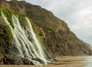
4.513.54 mi / 1614 ft gainAlamere Falls is the tallest waterfall in the bay area. It is known as a tide fall because it empties directly into the Pacific Ocean. This is extremely unique because there are only 34 tide falls in the world and two in California, the other being McWay Falls in Big Sur. Enjoy stunning views of...Read more -
Lake County, California
Hike to Wright Peak near Clearlake California
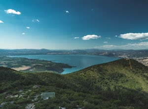
7.6 mi / 1853 ft gainHiking to Wright peak offers some of the best views of Clear Lake, California's largest natural freshwater lake. Located just about 2.5 hours north of San Francisco, this hike is accessible and easy to follow. To get to the trailhead, follow the 101 north to Hopland. Then take the 175 west towar...Read more -
Yountville, California
Bike the Napa Valley Wine Trail
12.5 mi / 100 ft gainThe Napa Vally Vine Trail is an ongoing project of the Napa Valley Vine Coalition which has the stated goal of creating a 47 mile long bike trail along the entire length of Napa Valley. Currently 12.5 miles of trail is available between downtown Yountville and Kennedy Park in the city of Napa. Yo...Read more -
Saint Helena, California
Lake Hennessey Loop
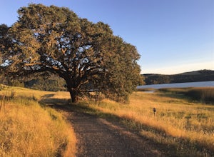
5.06.53 mi / 764 ft gainThe "lollipop" hike starts at the "Ranch House" parking lot off of Chiles Pope Valley Road - alternatively, you can access from Conn Valley Road for a shortened 5.6-mile loop. You turn off Chiles Pope Valley Road onto Moore Creek Trail, drive past a private house (you can see it on the map) and t...Read more -
San Rafael, California
Terra Linda Sleepy Hollow Ridge Trail
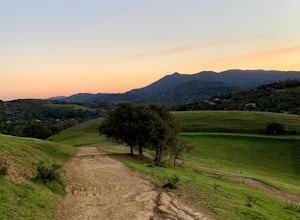
5.05.85 mi / 1089 ft gainThis San Rafael neighborhood trail is quite popular, but there is plenty of room for everyone and the parking is easy. After you park at the trailhead, you walk (or bike) up a relatively short and steep path that takes you to the beginning of the trail. This hike takes you along a scenic ridge ...Read more -
Kelseyville, California
Camp at Clear Lake State Park
Clear Lake State Park is only two hours from downtown San Francisco and Sacramento. The state park offers amazing opportunities to photograph deer in the area and pick blackberries for breakfast on a morning stroll. On my visit I saw over 15 deer and one buck in full velvet. The sunrise and sunse...Read more -
Fairfax, California
Carson Falls
4.03.75 mi / 863 ft gainAre you tired of crowds on your hikes? First, shame on you for getting up so late and moving so slowly. Did you really need Philz before you got on the trail? Ok, now that you’ve been thoroughly chastised, let’s start planning a hike to the less-frequented Carson Falls. Like any of the falls in ...Read more -
Napa, California
Alston Park Loop Trail
2.76 mi / 184 ft gainAlston Park Loop Trail, located in Napa, California, is a 2.76-mile loop trail that offers a moderate level of difficulty for hikers. The trail is primarily used for hiking, walking, and running and is accessible year-round. The trail is well-maintained and clearly marked, making it suitable for ...Read more


