Inverness, California
Inverness, California is a top location for all kinds of outdoor activities. From scenic hikes and trails to must-visit attractions, the area offers something for everyone. The best trails and outdoor activities in and near Inverness include Point Reyes National Seashore, Tomales Bay, Samuel P. Taylor State Park, Bolinas Lagoon, and Limantour Beach. Point Reyes National Seashore is ideal for hiking, with a variety of trails suitable for all skill levels. Tomales Bay is an excellent spot for kayaking and fishing. Samuel P. Taylor State Park is perfect for camping, horseback riding, and picnicking. Bolinas Lagoon is perfect for bird watching and wildlife viewing. Limantour Beach is great for beachcombing and beach activities. Additionally, there are many other attractions in and near Inverness worth visiting. No matter what type of outdoor experience you are looking for, Inverness has something for you.
Top Spots in and near Inverness
-
Jenner, California
Camp at Stillwater Cove
4.0It's a short walk down to the beach and there is a nice trail that follows along the creek. Campground features include potable water, restrooms with coin -operated showers, flush toilets, and electrical outlets. There is also a dump station. Please note: there are no RV hook-ups. Check out more...Read more -
Pacifica, California
Mori Point Loop
4.82.54 mi / 276 ft gainStart at the parking lots close to the pier, where bathrooms are also available. Walk along the pier to watch the sunset as it begins. Next, walk along Sharp Park Beach to discover the plethora of wild flowers and friendly locals always ready to guide you on your walk. Take the stairs up to the...Read more -
Saint Helena, California
Hike the Lake Hennessey Loop
5.06.4 mi / 900 ft gainThe "lollipop" hike starts at the "Ranch House" parking lot off of Chiles Pope Valley Road - alternatively, you can access from Conn Valley Road for a shortened 5.6-mile loop. You turn off Chiles Pope Valley Road onto Moore Creek Trail, drive past a private house (you can see it on the map) and t...Read more -
Pacifica, California
Rockaway Beach
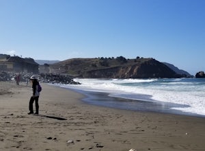
5.0Rockaway is a dark sandy beach located in the south of Pacifica, CA. It has numerous hiking trails around it, most notably Mori Point. The Mori Point trail will take you through the hills and overlooks Rockaway Beach. There are paths to come down to the beach. There are biking paths and park...Read more -
Pacifica, California
Surf at Pacifica State Beach
4.5If you're looking for a place to surf and Ocean Beach isn't quite your speed or Santa Cruz is too far, head to Pacifica, specifically Linda Mar. Linda Mar is usually more wind protected and user-friendly than ocean beach. Break out your longboard or hybrid board and head to this beach. There is e...Read more -
San Bruno, California
Sweeney Ridge via Sneath Lane
4.53.88 mi / 646 ft gainStarting from the parking lot on Sneath Lane Trail, you’ll head through the gate and continue on the path up Sweeney Ridge. This is a 5.7 mile out-and-back trek. There is a 600 ft. elevation gain, which comes mainly in the first 1.5 miles of the trail. Your legs and lungs may hurt a bit, but if t...Read more -
Oakland, California
Sibley Volcanic Trail Labyrinths
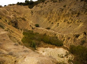
3.52 mi / 144 ft gainFrom Skyline Blvd, pull into the staging area for Sibley Volcanic Regional Preserve, you'll see the sign. Parking here is usually easy to find. You'll find an unstaffed visitor center with a restroom, park maps and informational displays featuring the history and geology of the park. Sibley is a...Read more -
Martinez, California
Muir Farm And Mount Wanda: John Muir Nature Trail
2.59 mi / 512 ft gainMuir Farm And Mount Wanda: John Muir Nature Trail is a loop trail located near Martinez, California.Read more -
Calistoga, California
Hike Mount Saint Helena
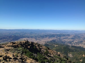
4.310 mi / 2100 ft gainDrive north from Napa following Rt 29, through Calistoga and up into the forest. After passing the sign for Robert Louis Stevenson State Park, and just over the crest, there is a parking area on the right side of the road, opposite the trailhead on the left. Parking fills up by mid-morning so get...Read more -
Jenner, California
Bolete Mushroom Hunting
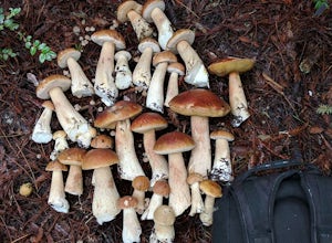
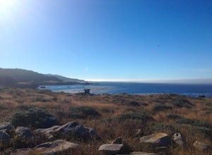
Salt Point State Park is a state park in Sonoma County, California, United States. The park covers 6,000 acres (2,400 ha) on the coast of Northern California, with 20 miles (32 km) of hiking trails and over 6 miles (9.7 km) of a rough rocky coast line including Salt Point which protrudes into the...Read more -
Jenner, California
Hike the Central Trail
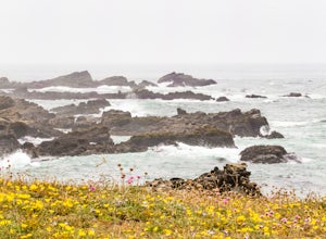
3.6 mi / 800 ft gainSalt Point State Park, about 90 miles north of San Francisco, features rugged, windswept coastline and dramatic forests of cypress, pine and redwoods. The Central Trail is a great way to experience much of the inland portion of the park including a unique highland Prairie where elk graze and are ...Read more -
Oakland, California
East & West Ridge Loop
4.53.47 mi / 833 ft gainTucked away in the hills of Oakland, you will find one of the homes of California's Coastal Redwoods. Created by a unique geographical circumstance, this forest breathes winds funneled through the Golden Gate across the bay, which created environment opportune for Redwood growth. These Redwoods a...Read more -
Jenner, California
Camp and Dive at Salt Point State Park
4.7Camping at Salt Point Sate Park is a dream. You have your choice of camping by the sea at Gerstle Cove campground, or tucked up into the forest at the Woodside campground…and you can’t go wrong with either choice.The rugged and beautiful coastline here is a popular destination for abalone diving ...Read more -
Jenner, California
Abalone Diving at Salt Point State Park
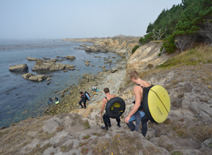
5.0Jenner is a great spot to head out in calm water with your abalone gear. The dives will be in depths of 10 to 15 ft. of water, with visibility usually in the 5-20 ft. range. Spend a little time doing your homework before entering the water and you'll be able to find easier entry areas.When you he...Read more -
Half Moon Bay, California
Devil's Slide Bunker
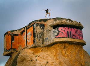
4.3The Devil's Slide Bunker is perched out on a point the defiantly juts out into the ocean. The Bunker is covered in constantly changing graffiti, which provides a stunning contrast to the gorgeous seaside. Hop on Highway 1 South. Just south of Pacifica there is a tunnel. Once you go through the t...Read more -
Jenner, California
Hike the Salt Point Trail
3.73 mi / 100 ft gainThere are numerous points at which you can enter the trail from Highway 1, but on the north it begins as the Salt Point / Stump Beach Parking area and proceeds 1.2 miles to the Visitor Center (and south entrance) at the Gerstle Cove State Marine area, one of the first underwater state parks in Ca...Read more


