Coronado, California
The best Trails and Outdoor Activities in Coronado, California offer a variety of scenic outdoor adventures. One of the top trails is the Silver Strand State Beach trail. This is a flat, easy trail that runs along the beach, providing stunning ocean views. The trail is perfect for walking, running, or cycling. Another must-visit trail is the Coronado Beach Walk which offers panoramic views of the Pacific Ocean. For a more challenging hike, head to the Cabrillo National Monument trails. Here, you'll find rocky terrain and steep inclines, but the reward is breathtaking views of San Diego Bay and the Pacific Ocean. Besides hiking, Coronado also offers kayaking and paddleboarding in Glorietta Bay and surfing at Coronado Beach. Whether you're a hiker or a water sports fan, Coronado has something for everyone.
Top Spots in and near Coronado
-
San Diego, California
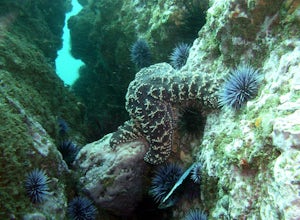
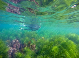
Dive La Jolla Shores
4.5While it doesn't get the attention of La Jolla Cove's green fields, the shores are one of the best parts about San Diego.Driving up to the large parking area it's immediately clear you've come to the right place as there's almost always divers suiting up in the early morning. A dive shop down the...Read more -
San Diego, California
La Jolla Cove
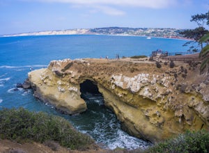
4.8La Jolla Cove is one of the most photographed beaches in San Diego, located on the coast just south of Torrey Pines Natural Reserve. La Jolla Cove is also one of the best spots in San Diego for snorkeling and scuba diving. This calm cove is ecologically protected with many animals making their ho...Read more -
San Diego, California
Swim in La Jolla Cove
4.9La Jolla Cove is an iconic destination in San Diego for visitors and locals alike. Anyone visiting San Diego knows La Jolla Cove is famous for sea lions, beautiful sunsets, sea caves, kayaking, diving, etc etc. The entire area is a great place to eat, drink, relax and spend a day enjoying the Cal...Read more -
San Diego County, California
Photograph Scripp's Pier
4.9Parking is easy, there are tons of random street you can park on just a little walk away. Be sure to arrive on scene at least an hour before sunset. Make sure to look up the sunset time and the weather forecast. Clouds will make for the most dramatic images with the most color from the sunset. Ex...Read more -
San Diego, California
Swing on the La Jolla Tree Swings
3.0From Torrey Pines Rd, turn left onto La Jolla Shores Drive. After about 1/4 of a mile down start to look for parking preferably near UCSD Coastal Apartments. Once parked walk along the UCSD apartments until you see Discovery way. Make a left at Discovery where you will then cross the street. You ...Read more -
Santee, California
Oak Canyon in Mission Trails Regional Park
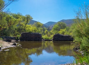
5.03.22 mi / 249 ft gainStarting on Father Junipero Serra Trail, drive 0.7 miles west to the Old Mission Dam parking lot on the left. The park closes the gates at 7pm, so make sure to park early, or plan your hike in such a way that you don't get locked in! If you think you'll need longer, you can park out on the main r...Read more -
Santee, California
Cowles Mountain via Big Rock Road
4.54.32 mi / 1109 ft gainStart by plugging 8125 Arlette St, Santee, CA into your GPS. This takes you to Big Rock Park, a convenient parking spot for the Cowles Hike. From here you want to walk through the park, and around the right side of the tennis court. This will take you to the fenced entrance to the hike. Head sout...Read more -
Santee, California
Crystal Cave
4.00.46 mi / 59 ft gainStarting at 8100 Mesa road, you will see parking along the side of the road in a few places, take advantage where you find it. Pass over the trail gate that marks the start of the journey. This will be a quick trip, as the total distance is less than a mile out and back. Head a quarter mile or ...Read more -
Santee, California
Kwaay Paay Trail
2.4 mi / 846 ft gainPark your car in the small gravel parking lot at the southwest corner of Father Junipero Serra Trail and Bushy Hill Drive (this is especially important if you plan to take the sunset hike, so you'll be outside the locked park gate when you descend). There will be other hikers parked there, but I'...Read more -
Santee, California
Cowles Mountain via Big Rock Trail
4.04.86 mi / 1207 ft gainStarting somewhat near sea-level, Cowles Mountain via the Big Rock Trail climbs about 1000 ft in elevation. This trail is about 5 miles total, out and back. Arrive at Big Rock park which has good parking. At the park you will walk to the left of the tennis courts past the limits (the fence) of...Read more -
San Diego, California
Surfing at Black's Beach via the Main Gate
5.01 mi / 650 ft gainWith arguably some of San Diego’s best waves, Black’s Beach can be found in the vicinity of the University of California San Diego campus, at the southern end of Torrey Pines State Beach and north of La Jolla Shores. Stately eight-figure mansions now line the bluffs where pastures and the Black f...Read more -
San Diego, California
Black's Beach via the Ho Chi Minh Trail
4.30.61 mi / 259 ft gainFinding the actual trail is 80% of the adventure. Once you turn down La Jolla Farms Road you will follow it for about 3/4 of a mile and there won't be anything too apparent that you are there, except a few cars parked along the street. Make sure to plug in the directions from the map so you know ...Read more -
San Diego, California
Black's Beach via the Gliderport
4.30.7 mi / 269 ft gainPark at the Torrey Pines Gliderport, which is conveniently empty before sunrise. The hike down to Black's Beach features a steep hike down a winding path of natural and manmade steps along the cliff face, but stay left and cruise the bluff for endless opportunities to observe, reflect and explor...Read more -
San Diego, California
Torrey Pines Gliderport
4.5Park at the Torrey Pines Gliderport and walk to the railing over the cliffs. From there you can see north to Black's Beach and the Torrey Pines golf course. To the south you can see La Jolla Shores and La Jolla cove. Walk the path down to Black's Beach if you want some exercise. There is food and...Read more -
San Diego, California
Torrey Pines Beach Trail Loop
4.72.15 mi / 374 ft gainThe beach trail brings you from the parking lot across the lodge from the bluff down to the beach. You can choose to visit the Red Butte, the Razor Point, and the Yucca Point trails along the way. Of the other trails, this trail seems to provide a complete walkthrough of geological features; it a...Read more -
San Diego, California
Razor Point, Beach Trail, & Broken Hill Trail Loop
5.03.21 mi / 440 ft gainThe parking area for all of Torrey Pines State Natural Reserve is located right off North Torrey Pines Road (where the location is for this hike), about 20-30 minutes north of San Diego. It's $10 to park, and there was also a smaller parking lot at the top of the hill if you want to avoid the ini...Read more

