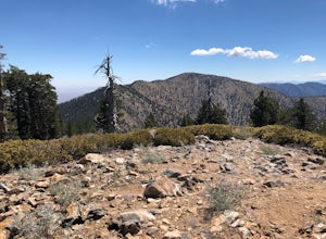
Altadena, California
Altadena, California is a great place for outdoor adventurers, offering a range of scenic trails and activities. Must-visit attractions include the Eaton Canyon Natural Area, the Santa Anita Canyon Trail, and the Altadena Crest Trail. Nature can explore the Eaton Canyon Nature Center and learn about the local wildlife. Hikers can take on the challenging trails of the San Gabriel Mountains and enjoy the stunning views. The Pasadena Arboretum is a great spot for a picnic or a leisurely stroll. There are also plenty of opportunities for fishing, horseback riding, and camping. With so much to do, Altadena is the perfect place for an adventure!
Top Spots in and near Altadena
-
Pearblossom, California
Cooper Canyon Falls via Burkhart Trail
5.03.01 mi / 755 ft gainBurkhart Trail is well-defined and easy to follow through an unbelievable old growth of Jeffrey pines, incense-cedars and surprisingly, redwoods! At 0.25 miles, there is a steep spur trail near a large pile of boulders that leads to a popular swimming area, often frequented by guests of the campg...Read more -
Azusa, California
Smith Mountain Trail
6.69 mi / 3189 ft gainSmith Mountain Trail is an awesome day hike located near Glendora, California. This out-and-back trail offers great views of the Los Angeles National Forest and the potential for continuation to Bear Creek for even more variety of scenery. Smith Mountain is a moderately strenuous hike with an el...Read more -
San Fernando, California
Pacoima Park Natural Wash Park
0.54 mi / 13 ft gainPacoima Park Natural Wash Park makes for a wonderful & pleasant walk. The entrance to the park is located at the corner of Newton St and 8th St and runs up to Foothill Blvd in San Fernando California. The park is ADA accessible and allows for dogs on leash. There are also picnic tables and dr...Read more -
Los Angeles, California
Kenneth Hahn Recreation Area Loop
2.85 mi / 328 ft gainThe Kenneth Hahn Recreation Area is just outside of downtown LA, a perfect location for hiking, trail running, and biking. The trail loops up to the top of a hill, where hikers get sweeping views of LA. Dogs are allowed, but must be kept on leash. This is also a great location for trail running...Read more -
Azusa, California
Lewis Falls
1 mi / 732 ft gainLocated deep in the Angeles National Forest above Azusa, this short but at times challenging hike rewards you with a beautiful fifty-foot waterfall. The base of the waterfall is only a foot at its deepest, so I wouldn't rush to bring a bathing suit with you. Protected by the heavy forestry around...Read more -
Los Angeles, California
Watts Towers
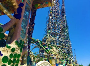
3.0Watts Towers are a quick 15-20 minute ride from Downtown Los Angeles on the Metro. Since I love weird, interesting things, plus the towers are in my backyard, I had to take a trip to check them out! When getting off the train, I half expected to see the towers spiraling off in the distance. After...Read more -
Culver City, California
Culver City Stairs
4.11.32 mi / 344 ft gainThe Culver City Stairs are an outdoor staircase designed into the trails leading up to the Baldwin Hills Scenic Overlook. This particular staircase is uniquely constructed to blend into the landscape and is comprised of 282 uneven stairs. The stairs vary in height from 3 inches to nearly 2 ft...s...Read more -
Los Angeles County, California
Mt. Williamson via Islip Saddle
4.16 mi / 1519 ft gainThe trailhead is immediately off of Angeles Crest Highway CA-2 at Islip Saddle. It's just a touch over 2 miles to reach the summit, through which you'll be hiking among the pine tree forest practically the entire way up (part of this trail doubles as the Pacific Crest Trail). The summit is larg...Read more -
Azusa, California
Little Jimmy Trail Camp
4.33.36 mi / 607 ft gainTake Hwy 2 out of La Canada north along Angeles Crest Highway. Follow this for quite some time enjoying the fine views in all directions. After traveling through two consecutive tunnels continue to the Islip Saddle parking lot (on left). There will be a vault toilet & a picnic table. Display ...Read more -
La Verne, California
Marshall Canyon Trail
4.05.99 mi / 722 ft gainFor this adventure you can choose to start in a multiple of places; for the easiest parking use Oak Mesa Park located next to Oak Mesa Elementary School. From the parking lot cross the soccer field towards the bridge on the north east end of the school. Once across the bridge follow Los Robles ea...Read more -
La Verne, California
Cattle Canyon Trail
6.7 mi / 1066 ft gainWithin the San Gabriel Mountains from Highway 39 and along East Fork Road is Cattle Canyon. To go through Cattle Canyon, you can access the trail head just south of the Bridge to Nowhere trail head along East Fork Road right after it intersects with Glendora Mountain Road. There is a small parkin...Read more -
La Verne, California
Bridge to Nowhere via East Fork Trail
4.49.65 mi / 1798 ft gainThe trail on this 10-mile hike is predominately slow and steady, but can be a little rocky, so be prepared to scramble. When you’re fording the river, the water level can range from knee to chest high, especially in the wet months. A good pair of waterproof hiking boots is helpful, but water shoe...Read more -
Los Angeles, California
Sepulveda Basin: Upstream Of Balboa
4.03.7 mi / 75 ft gainSepulveda Basin: Upstream Of Balboa is a loop trail that takes you by a river located near Encino, California.Read more -
Los Angeles, California
Canyonback Nike Loop
4.06.02 mi / 1693 ft gainCanyonback Nike Loop is a loop trail that takes you by a river located near Encino, California.Read more -
Pearblossom, California
Devil's Punchbowl and Devil's Chair
4.57.37 mi / 1870 ft gainWhat a hidden gem! A martian landscape full of faultline desert rock formations and joshua trees against a mountainous backdrop of the San Gabriels. Devil's Punchbowl Natural Area features a 1 mile well-marked, well-maintained single track loop trail inside the Punchbowl (great for kids) and a 7 ...Read more -
Dawson Saddle, California
Hike to Throop Peak, Mt. Hawkins, and Mt. Burnham
8 mi / 2000 ft gainThe trailhead, or pair of trailheads actually, is at a location on the Angeles Crest Highway (CA-2) called Dawson's Saddle. There are a couple of parking areas along the side of the highway, and each of the pair of trailheads begins at either end of this parking area. The trailheads aren't mark...Read more


