West Dolores Campground
Book this listing through our partner Recreation Gov
About West Dolores Campground
Overview
West Dolores Campground is located on the West Dolores Road (Forest Road 535), which branches north from Colorado Highway 145 about 20 miles northeast of Dolores. It is a great place to relax and enjoy the outdoors by hiking, biking and fishing.Recreation
The West Dolores River offers fishing for brown, rainbow, cutthroat and brook trout. A day-use parking area is available on-site. Several parcels of private property are found along the river. Visitors are asked to stay on the trail and not trespass.Mountain biking is allowed on Forest Roads 532 and 535. Forest Service Trail 624 begins three miles south of the campground.
Facilities
The campground offers single-family sites, a few of which have electric hookups. Each site is equipped with a picnic table and campfire ring. Vault toilets and drinking water are provided.Natural Features
The campground is situated on the banks of the West Dolores River, which has its headwaters in the nearby Lizard Head Wilderness. A shady forest of spruce, ponderosa pine and Douglas fir covers the campground. The campground is at an elevation of 7,800 feet.Nearby Attractions
Southwestern Colorado, part of the Four Corners region, contains more than 4,000 archaeological sites and 600 cliff dwellings. Mesa Verde National Park is an hour and a half south of the campground, close enough for a day trip. Other sites within the region include the Anasazi Heritage Center in Delores, Canyon of the Ancients and Hovenweep National Monument.Burro Bridge campground is loacated 19 miles north of the campground offering Horse camping and a trail from the campground into the Lizard Head Wilderness.
West Dolores Campground Reviews
Have you stayed here? Be the first to leave a review!
Top Spots in or near Rico
Summit Centennial Peak in the La Plata Mountains via Sharkstooth Trailhead
Hesperus, Colorado
6 mi
/ 2162 ft gain
From the western end of the town of Mancos, follow CR 42 north until it enters the national forest and becomes FR 561. Go right on FR 350 and keep right at any junctions (there are two of them) until you reach the signed Sharkstooth Trailhead about 19 miles from Mancos.
Enjoy your drive through a beautiful aspen forest, and if you are here in spring, you’ll even see some wildflowers and butter...
Hike Wilson Peak aka Coors Peak
Placerville, Colorado
4.0
The mountain peak that turns blue when Coors and Coors Light bottles and cans are ice cold is real. No, it is not called Coors Peak. But it is in Colorado, where Coors was born. The snow-capped mountain in the Coors logo is really Wilson Peak near Telluride, Colorado.If you want to crack a Coors on the Coors Peak, be prepared for an intense, long haul. It is a no-joke hike. Roundtrip to su...
Mountain Bike Galloping Goose
Ophir, ColoradoThe Galloping Goose Trail near Telluride, Colorado is a bike ride along what once was a historic train route. Plus it’s family friendly and the scenery is phenomenal.The starting point is at the top of Lizard Head Pass at an elevation of 10,200 feet. The scenery, from wildflowers to colorful mountains, is nothing short of stunning. The bike tour is a 16-mile mostly downhill ride that goes by se...
Stand Up Paddle at Trout Lake
San Miguel County, Colorado
5.0
Trout Lake is large enough to provide a good cardio workout without getting crowded and small enough to tour around for hours. It's a perfect lake for SUPing with friends, SUP games, SUP yoga and even SUP fishing.
Hike Point Lookout Trail
Mancos, Colorado
5.0
2.3 mi
/ 400 ft gain
This trail is located within Morefield Campground in Mesa Verde National Park. The parking lot also serves as the parking lot for the amphitheater, so it's pretty huge - unless there's a program going on you shouldn't have to worry about finding a spot.
The trail starts out nice and level, facing north. It meanders through a field before taking a sharp right turn and beginning the slow series ...
Mystic Falls
San Miguel County, Colorado
4.2
2.39 mi
/ 138 ft gain
I've been visiting Telluride, CO for the last 20 years, and I'd never once heard of this place. Mystic Falls is not marked on any map I've ever seen. And even some locals seem to have never heard of it. So I feel like I lucked out on this last trip to Telluride when a friend found a blog post and a picture that described a phenomenal, hidden waterfall within 20 minutes of the town of Telluride....
Camping and Lodging in Rico
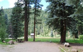
Dolores, Colorado
Mavreeso Campground
Overview
Mavreeso Campground is located on the West Dolores Road (Forest Road 535), which branches north from Colorado Highway 145 about ...
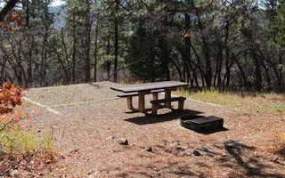
Dolores, Colorado
Target Tree Campground
Overview
Target Tree Campground is located 7 miles east of Mancos on the north side of Highway 160 at an elevation of 7,643 feet. It is t...
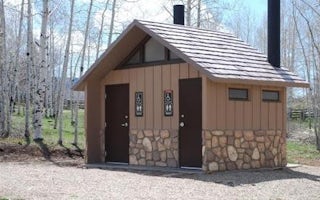
Mancos, Colorado
Transfer Group Campground
Overview
Transfer Campground, located approximately 11 miles north of Mancos, Colorado in the San Juan National Forest, is known for its ...
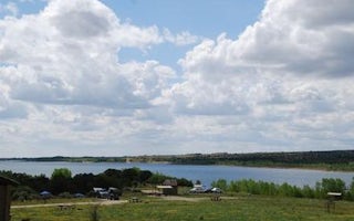
Dolores, Colorado
House Creek
Overview
House Creek Campground is located on the shores of McPhee Reservoir near the town of Dolores in southwestern Colorado. Visitors ...
Rico, Colorado
Cayton Campground
Overview
Cayton Campground is located along the San Juan Skyway (Colorado Highway 145) and the Dolores River. Visitors enjoy the area for...
Dolores, Colorado
Mcphee Recreation Complex
Overview
McPhee Recreation Complex is located on the south shore of McPhee Reservoir near the town of Dolores in southwestern Colorado. V...
Unfortunately, we don't have up-to date pricing data for this listing, but you can check pricing through Recreation Gov.
Book NowAdd your business today to reach The Outbound's audience of adventurous travelers.
Community
© 2024 The Outbound Collective - Terms of Use - Privacy Policy


