Upper Sage Flat
Book this listing through our partner Recreation Gov
About Upper Sage Flat
Overview
Take the family to Upper Sage for a pleasant camping trip along the banks of Big Pine Creek. Here, visitors can experience the beauty of the creek that runs along the base of a narrow canyon. Visitors can swim or fish, in the creek that is stocked annually with trout, or head to a nearby lake for power boating.Recreation
Rainbow, brown, brook and alpers trout swim in the stream, enticing anglers. Hikers are fans of the Big Pine Creek Trail, a 1.5-mile footpath that provides access to the John Muir Wilderness trails.Facilities
Parking aprons are paved and most are 40 feet long. Amenities include flush toilets, drinking water, picnic tables and campfire rings.Natural Features
The campground is sprawled out along Big Pine Creek beneath shady Jeffrey pines and cottonwoods, just 9 miles west of the town of Big Pine.Inyo National Forest is home to many natural wonders, including Mt. Whitney, Mono Lake, Mammoth Lakes Basin, and the Ancient Bristlecone Pine Forest atop the White Mountains.
Bristlecone pines rank as the oldest trees in the world and have achieved immense scientific and cultural importance.
Nearby Attractions
Head to the neighboring John Muir Wilderness for incredible views of Palisades Glacier, the southern-most glacier in the country. Nearby Tinemaha Reservoir provides additional fishing opportunities.Upper Sage Flat Reviews
Have you stayed here? Be the first to leave a review!
Top Spots in or near Big Pine
Big Pine Lakes via North Fork Trail
Bishop, California
5.0
12.69 mi
/ 3196 ft gain
The North Fork Big Pine Creek Trail offers some of the best high alpine scenery in the Sierras. As the peaks of the Palisades pierce the sky with its craggy span of summits you will find it is as picturesque and dramatic as any in California. Nestled beneath these giant peaks are the glacier scoured basins, namely the largest Palisade Glacier, holding the scenic turquoise waters of Big Pine Lak...
Fourth Lake via Big Pine Creek North Fork Trail
Big Pine, California
4.0
12.6 mi
/ 3205 ft gain
From Big Pine, you'll turn onto Crocker St. to head towards the mountains. Once you are about 11 miles down the road you will see a sign and a turnoff on the right for trailhead parking. That is where you are going to want to park if you are staying overnight but you can continue to where the road dead-ends if you are just doing a day hike. There are bear boxes their to store anything extra you...
First and Second Lake via Big Pine Creek North Fork
Bishop, California
5.0
9.57 mi
/ 2392 ft gain
The North Fork of Big Pine Creek is often cited as having the most unbelievable scenery reachable in a single day. And it's hard to disagree.
The Big Pine Creek North Fork trail is just minutes outside of Big Pine off the 395. If going in the winter, access to the trailhead can be closed off, so always be sure to check conditions with the governing agency before going.
From the start, this tr...
Long Lake via Bishop Pass
Bishop, California
5.51 mi
/ 991 ft gain
Directions
The trailhead for Long Lake starts by South Lake outside Bishop, CA. You'll want to take Line Street, which is the 168, West out of Bishop. Approximately 14 miles up, you'll want to merge left towards South Lake. This junction is well-signed if you keep an eye out for it. Head the rest of the way up until the road dead-ends in the overnight hiker parking.
The Approach
To ge...
Climb Columbine Peak's NE Ridge
Bishop, California
15 mi
/ 5000 ft gain
Directions This Bishop Pass Trail starts by South Lake outside Bishop, CA. You'll want to take Line Street, which is the 168, West out of Bishop. Approximately 14 miles up, you'll want to merge left towards South Lake. This junction is well-signed if you keep an eye out for it. Head the rest of the way up until the road dead-ends in the overnight hiker parking. The Approach Your first goal ...
Backpack into the Palisades from Bishop Pass
Bishop, California
18 mi
/ 4000 ft gain
Drive up to the trailhead near South Lake from the town of Bishop (you can get directions at the Ranger Station when you get a permit). The hike goes from approximately 9,000 ft. to 13,000 ft. over the course of 9 miles.The first approximately 6 miles are on trail to the top of Bishop Pass. From here you go cross country, staying around 12,000 ft., over talus fields, finally climbing another 1,...
Camping and Lodging in Big Pine
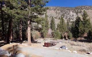
Big Pine, California
Big Pine Creek Campground
Overview
Big Pine Creek Campground, surrounded by sprawling meadows and towering trees, is perfectly situated in the scenic Big Pine Cany...
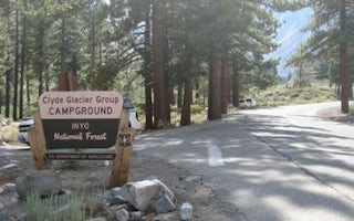
Big Pine, California
Big Pine Canyon
Overview
Big Pine Canyon Recreation Area includes two group campground sites. Named for glaciers that can be seen at the end of the valle...
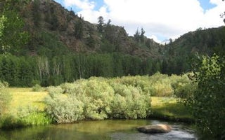
South Lake Road
Table Mountain (Inyo)
Overview
Table Mountain Group Campground is located 18 miles southwest of Bishop, California, along the South Fork of Bishop Creek. Here,...
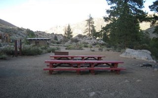
Bishop, California
Bishop Park Group
Overview
Families, friends and special interest groups enjoy Bishop Park for its access to prime fishing and its serene setting on Bishop...
Big Pine, California
Cedar Flat Group Campground
Overview
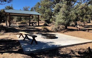
Cedar Flat Group sites are popular with academic institutions for geology field trips. With no nearby light sources, the night s...
White Mountain Road
Grandview Campground
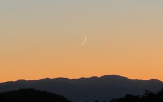
Grandview Campground is nestled in low hills covered with Pinyon and Juniper. A large open area in the middle of the campground gives a t...
Unfortunately, we don't have up-to date pricing data for this listing, but you can check pricing through Recreation Gov.
Book NowAdd your business today to reach The Outbound's audience of adventurous travelers.
Community
© 2024 The Outbound Collective - Terms of Use - Privacy Policy


