Thielsen View Campground
Book this listing through our partner Recreation Gov
About Thielsen View Campground
Overview
In the shadow of majestic Mount Bailey on the west shore of Diamond Lake, this campground takes its name from the view of the unforgettable peak of Mt. Thielsen. Thielsen View Campground is a favorite with families and anglers.Recreation
This campground is a great location for many recreational opportunities. Diamond Lake is stocked annually with 300,000 rainbow trout. If fishing is not your thing, the campground is on the John Dellenback trail. This paved trail is an 11-mile loop around the lake. If you prefer to travel by foot, Mount Bailey and Rodney Butte trails are less than a five-minute drive to the trailhead.Facilities
Thielsen View Campground has a boat ramp, free for campers staying in Thielsen View. Water spigots and gray water sumps are located throughout the campground. Each loop has at least two vault toilets. The closest RV dump station is at the resort’s gas station. The fee is $5 to use the resort’s dump or campers may use the Forest Service dump station in Diamond Lake or Broken Arrow Campgrounds. There are 60 sites in the campground. The 20 sites in C loop are reservable and the A and B loops are available on a first-come, first-served basis.Natural Features
The mixed conifer canopy generously shades most sites during the warm summer days. All campsites are very close to Diamond Lake, which offers great sunrises over Mount Thielsen.Nearby Attractions
Mount Bailey, Mount Thielsen, Pacific Crest Trail, Dellenback Trail, Diamond Lake Resort, Diamond Lake Stables, and Lemolo Lake and Resort are all nearby. Visitors may also want to take some time to visit nearby Crater Lake National Park, the only national park in Oregon! The amazing Crater Lake area offers a glimpse into the volcanic history of the area.Thielsen View Campground Reviews
Have you stayed here? Be the first to leave a review!
Top Spots in or near Douglas County
Base of Mt. Thielsen via Mt. Thielsen Trail
Crescent, Oregon
4.7
7.26 mi
/ 1926 ft gain
The Trail begins at Mt. Thielsen Trailhead/Sno Park and takes you up through a vast forest of pines. As you ascend, Diamond Lake will slowly start to peak through. Continue straight at mile marker 1.6 and keep an eye out for Mt. Thielsen ahead. Just before entering Mount Thielsen Wilderness around mile marker 2.9, the beautiful peak will be visible from the trail. Enjoy the rather eccentric loo...
Mt. Thielsen Summit
Crescent, Oregon
2.8
8.88 mi
/ 3291 ft gain
It may look quite intimidating from the base and surrounding areas but this hike/climb to the summit is quite straightforward and the standard route is non-technical. That being said, there are areas with some significant exposure with 2200 foot drops on its north and east faces that will definitely get your heart pumping should you chose to explore those areas. The spire summit itself is rathe...
Mt. Bailey and Hemlock Butte Cabin
Douglas County, Oregon
11.09 mi
/ 3192 ft gain
The trail starts at 5200 feet and climbs through the forest for 1.6 miles to an opening with a great view off diamond lake and the beautiful and very recognizable Mt. Thielsen. There are several small outcropping here that make a perfect spot to stop and get out the backpacking stove for some mountain coffee with a view or a snack. Continue on the trail another .25 miles and begin looking to th...
Clearwater Falls
Diamond Lake, Oregon
4.3
0.15 mi
/ 7 ft gain
This has to be one of the most overlooked waterfalls in Oregon. It doesn't get a lot of publicity, and it's tucked away in south-central Oregon. As such, many people don't pay it much attention. That's too bad.
Clearwater Falls can be found just off Highway 138, near mile marker 69. Clearwater Falls is easily accessed from a nearby parking lot. The path from the parking lot is well developed a...
Whitehorse Falls
Idleyld Park, Oregon
3.0
In June of 2015, I visited as many remote waterfall locations in Oregon as I could find. Whitehorse Falls, located along the Clearwater River in Douglas County, was one of those on my list. It's a small waterfall that is just off highway 138 (about 4.5 miles east of Toketee Falls) in Central Oregon. It's a true hidden gem that doesn't get a lot of visitors or attention. But it should. It's a wo...
Muir Creek Falls
Douglas County, Oregon
5.0
1.08 mi
/ 135 ft gain
Muir Creek Falls Trail is an out-and-back trail that takes you by a waterfall located near Crater Lake, Oregon.
Camping and Lodging in Douglas County
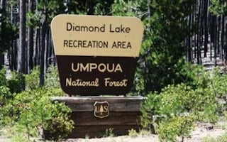
Crescent, Oregon
South Shore Pavilion
Overview
South Shore Pavilion is located on Diamond Lake in the Umpqua National Forest, 85 miles east of Roseburg. The pavilion sits back...
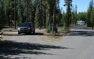
Crescent, Oregon
Broken Arrow Campground
Overview
Set back in lodgepole pine forest at the south end of Diamond Lake, Broken Arrow Campground is a quiet retreat for family and la...
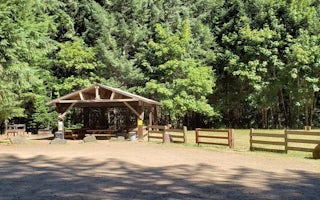
Douglas County, Oregon
Steamboat Ball Field Group Site
Overview
Steamboat Ball Field Group Site sits near the banks of the North Umpqua River under a canopy of forest.
With access to a mul...
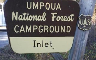
Douglas County, Oregon
Inlet Campground
Overview
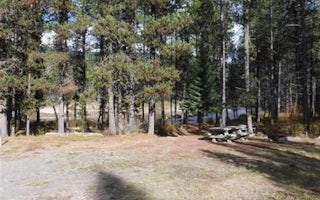
Inlet Campground is nestled along the North Umpqua River where the forest of lodgepole pine, mountain hemlock and Shasta red fir...
Douglas County, Oregon
East Lemolo Campground
Overview
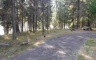
East Lemolo is on the banks of Lemolo Lake, the highest reservoir on the North Umpqua River at an elevation of 4,150 feet.Recrea...
Douglas County, Oregon
Bunker Hill Campground
Overview
This campground clings to the northwest shore of Lemolo Lake beneath the heavily wooded Bunker Hill. Bald eagles often soar abov...
Unfortunately, we don't have up-to date pricing data for this listing, but you can check pricing through Recreation Gov.
Book NowAdd your business today to reach The Outbound's audience of adventurous travelers.
Community
© 2024 The Outbound Collective - Terms of Use - Privacy Policy


