Stony Fork Campground
Book this listing through our partner Recreation Gov
About Stony Fork Campground
Overview
Stony Fork, tucked in a dense forest setting, is located at the foot of Big Walker Mountain beside the Big Walker Mountain Scenic Byway. The East Fork of Stony Fork Creek winds through the campground, providing a serene setting for trout fishing and water play for visitors at the welcoming campground.The 1 mile Stony Fork Nature Trail takes campers through groves of pine and hardwoods, and the campground loop road makes for a scenic walk, too.
Recreation
The Big Walker Mountain Scenic Byway is an incredible drive for viewing blooms of rhododendron, azalea and mountain laurel in spring, and fiery red and gold foliage in fall. Scenic overlooks highlight views of Mount Rogers and many ridges and valleys. A horseshoe pit at the campground provides hours of fun for families. Experienced hikers love the Seven Sisters Trail, approximately 5 miles, which leads from the campground to the top of Little Walker Mountain, then onto the Scenic Byway.Facilities
Volunteer hosts are on hand to answer questions and make campers feel welcome. Campsites are ideal for both RV and tent camping. Warm showers and flush toilets are available, plus parking aprons are paved. Most sites come with electric hookups.Natural Features
Stony Fork sits in a valley of the Appalachians at a 2,400 foot elevation. Its creekside setting provides a peaceful soundtrack of running water. In springtime, wildflowers and rhododendron dot the region with spectacular colors, and fall is reliably scenic with its red and yellow foliage.Nearby Attractions
Within 10 miles of the campground, hike the popular Appalachian Trail, which extends more than 2,175 miles throughout the Appalachian Mountains across 14 states. It is the first trail designated as a National Scenic Trail. There is an outdoor shooting range a few miles from the campground.
Stony Fork Campground Reviews
Have you stayed here? Be the first to leave a review!
Top Spots in or near Wytheville
Hike the High Rock Trail
Wytheville, Virginia
3.0
2.7 mi
/ 636 ft gain
The hike to High Rocks begins at a gravel parking lot up a long winding road, seems like forever but really is only mile or two past the quarry when your turn onto the road.
The out-and-back hike begins by passing through the two large boulders near the back of the parking lot. The trail leads down/towards the left, a grassy area will be down to your left, that's how you know you're on the rig...
Camp at Comers Rock Recreation Area
Elk Creek, Virginia
1 mi
I didn't have any issues putting "Comers Rock Recreation Area" into my phone's GPS (Waze) and arriving exactly where I was supposed to. When you turn off US 21 (aka the Grayson Turnpike/Elk Creek Parkway) to Jefferson National Forest Road 57, you'll see a sign a parking lot that says "road not suitable for passenger cars". Drive at your own risk from here. Though the road is extremely rocky and...
Photograph Dismal Falls
Pearisburg, Virginia
4.5
0.1 mi
/ 0 ft gain
Explorers in Southwest Virginia run into a common problem: local hikes and waterfalls are often saturated with college students out enjoying a warm day. While it's wonderful to have so many people appreciating the beauty of the Jefferson National Forest, it can be difficult to find a remote, quiet place to sneak off to in this part of the state. Dismal Falls offers the perfect combination of re...
Hike the Lake Trail Loop at Hungry Mother SP
Marion, Virginia
6 mi
/ 800 ft gain
Hungry Mother State Park is located in the picturesque Blue Ridge Mountains in Southern Virginia. Located inside the state park is the Lake Trail Loop that winds itself around the man-made reservoir and the park. Hikers can access the trail in numerous locations throughout the park but the easiest way is to utilize one of the parking locations just as you enter the park. They are located along ...
Hike Molly's Knob
Marion, Virginia
5.0
3.4 mi
/ 1100 ft gain
The parking lot is located on the east side of the lake, just before the group lodge on Lake Drive. The Molly’s Knob trail begins just uphill on the right and is marked by white blazes. You can also take an alternate route and follow the Lake Loop Trail (located to the left of the parking area) to the Ridge Trail, and then join the Molly’s Knob Trail, though this will add about 0.2 miles each...
Bike the New River Trail
Draper, Virginia
5.0
57 mi
There are several locations to begin your trek on the New River Trail, but our favorite is the Draper Valley area. The pin on the map will take you right to the parking lot. There is a $5 state park fee and a self-pay envelope station. From here we head south, and after about a mile you catch your first glimpse of the New River. You'll cross several bridges that provide excellent opportunities ...
Camping and Lodging in Wytheville

Wytheville, Virginia
Stony Fork Cabin
Overview
Stony Fork Cabin is a cozy one-bedroom hideaway with most of the comforts of home. Visitors can hike, mountain bike, explore the...
Wytheville, Virginia
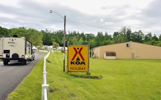
Wytheville KOA Holiday
Picture-perfect scenery awaits you at this KOA, located between the Allegheny and Blue Ridge mountains (just 1 mile off the highway). The...
Speedwell, Virginia
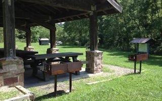
Raven Cliff Picnic Shelter
Overview
Located in Raven Cliff Campground, enjoy this large shelter for your next gathering! Along with the amenities of the shelter, i...
Ivanhoe, Virginia
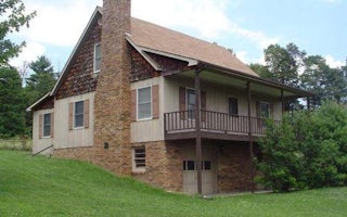
Sunrise Cabin
Overview
Visitors at Sunrise Cabin enjoy outstanding views from the front porch and warm, cozy evenings beside the stone fireplace. Sunri...
Elk Creek, Virginia
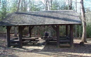
Comers Rock Picnic Shelter
Overview
This historic log picnic shelter was built by the Civilian Conservation Corps. It is located next to Comers Rock Campground in ...
Elk Creek, Virginia
Blue Springs Gap Cabin
Overview
Blue Springs Gap Cabin is located high on a mountaintop near Camp, Virginia, giving visitors the feeling of being on top of the ...
Unfortunately, we don't have up-to date pricing data for this listing, but you can check pricing through Recreation Gov.
Book NowAdd your business today to reach The Outbound's audience of adventurous travelers.
Community
© 2024 The Outbound Collective - Terms of Use - Privacy Policy


