Miller Flat Reservoir Campground
Book this listing through our partner Recreation Gov
About Miller Flat Reservoir Campground
Overview
Miller Flat Reservoir Campground is located one mile south of Miller Flat Reservoir at 8,500 feet elevation, approximately five miles south of Utah Highway 31 -- part of the Huntington/Eccles Canyons National Scenic Byway.Recreation
Lake Canyon Recreation Area is located just north of the campground as is the northern trailhead of the Left Fork of Huntington National Recreation Trail. Cleveland and Huntington Reservoirs are located just minutes north of the campground along U31. Each offers trout fishing opportunities, with a boat ramp available at Huntington Reservoir.Facilities
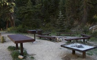
Visitors are allowed to configure their vehicles and trailers as they choose within the site. Group cooking facilities are provided including picnic tables, a fire ring, dutch oven fire pan and utility tables. A vault toilet facility is located about 50 feet from the site. There is no electricity, water, sewer or garbage services.If the group site is not reserved, it is available to visitors on a first-come, first-served basis for $5.00 per vehicle per night. To maintain priority for reservations, first-come, first-served customers may only pay for two nights at a time. The three double family sites in the campground are only available on a first-come, first-served basis for $5.00 per vehicle per night. They are not reservable.
Natural Features
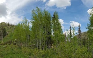
The group site is set in an open meadow with aspen and fir trees bordering the northern perimeter.Nearby Attractions
Potters Ponds, a popular trout fishery is located approximately seven miles south of the campground. The 370-mile Arapeen Off-highway Vehicle Trail System can be accessed directly from the campground by riding north or south along the Miller Flat Road. Maps are available from hosts working in the area.Miller Flat Reservoir Campground Reviews
Have you stayed here? Be the first to leave a review!
Top Spots in or near Mount Pleasant
Bouldering in Joe's Valley, UT
Orangeville, Utah
5.0
The bouldering in Joe's Valley has been a hot spot for climbers from all around the world. Discovered by Utah climbers decades ago it has turned into a mecca for anyone who loves sandstone bouldering. The texture of the rock is very grippy and after a long day can leave you with little skin left on your fingers. Plan on having some of your best bouldering days here.The Valley consists of 3 p...
Climb at Maple Canyon
Fountain Green, UtahRegardless on whether you're northbound / southbound, jump on I-15 and take exit 225 in Nephi. Head east. Continue on this road (100 N) for 14 miles. Then, turn right on 400 S and after a 1/2 mile turn left onto West Side Road. This road will take you along a bunch of farmlands. After about 6 miles, turn right on Freedom road. Keep to your right, and you'll end up at the mouth of the canyon a f...
Maple Canyon Arch Loop
Fountain Green, Utah
2.78 mi
/ 1332 ft gain
If you’re a rock climber, you probably know all about Maple Canyon. It’s unique conglomerate walls attract climbers from all over the world. It’s a Mecca of sorts. The beautiful canyon contains some outstanding hiking as well and this adventure will give you a taste of the entire canyon.
The trailhead is located just south of Mount Nebo and is about a 1.5 hour drive from Salt Lake City. Exit I...
Andrew's Ridge to Mt. Nebo (South Peak)
Nephi, Utah
8.67 mi
/ 5400 ft gain
Andrew's Ridge to Mt. Nebo (South Peak) is an out-and-back trail where you may see wildflowers located near Nephi, Utah.
Mount Nebo via North Rim Trail
Payson, Utah
4.5
8.6 mi
/ 2897 ft gain
Mount Nebo is the tallest of all the mountains in the Wasatch, and also one of the easiest to hike, due to the fact that the trail begins at an elevation of ~9300 ft. The parking area for the trailhead is along a short dirt road, which is precisely marked on the location map.
The trail itself is easy to follow. The dirt road leading to the trailhead is called Mona Pole Rd. The trail leaves the...
Visit the Flooded Thistle Ghost Town
18899-19003 U.S. Highway 89, Utah
3.0
Thistle, Utah was a small community located in Spanish Fork Canyon, founded in 1883. It flourished for a time as a ranching community and eventually became a major stop on the rail line that ran through it. This all changed in 1983 when a massive landslide dammed the Spanish Fork River and flooded the town. Now there are only a few structures remaining, and most can be seen from the road. Most ...
Camping and Lodging in Mount Pleasant
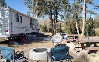
Mount Pleasant, Utah
Lake Canyon Rec Area
Overview
Lake Canyon Recreation Area can be found along Utah's scenic Energy Loop, on top of the Wasatch Plateau. It is located just off ...
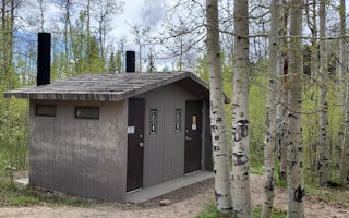
Huntington, Utah
Indian Creek (Ut)
Overview
Indian Creek Campground is located in a high mountain valley surrounded by beautiful peaks, at an elevation of 8,000 feet. Visit...
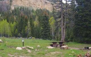
Huntington, Utah
Old Folks Flat
Overview
Old Folks Flat Campground is nestled in beautiful Huntington Canyon along the Huntington Canyon National Scenic Byway on Utah Hi...
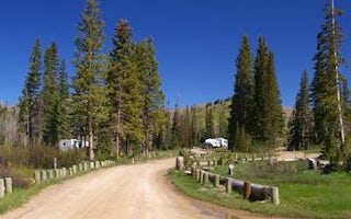
Mount Pleasant, Utah
Potters Pond
Overview
Potters Pond Campground is located in a high mountain valley next to two scenic ponds, at an elevation of 8,900 feet. Visitors e...
Huntington, Utah
Bridges Campground
Overview
Bridges Campground is located in beautiful Huntington Canyon, along the Huntington Canyon National Scenic Byway on Utah Highway ...
Huntington, Utah
Big Rock Group
Overview
Big Rock Group Campground is located in beautiful Huntington Canyon, along the Huntington Canyon National Scenic Byway on Utah H...
Unfortunately, we don't have up-to date pricing data for this listing, but you can check pricing through Recreation Gov.
Book NowAdd your business today to reach The Outbound's audience of adventurous travelers.
Community
© 2024 The Outbound Collective - Terms of Use - Privacy Policy


