Long Point (Ca)
Book this listing through our partner Recreation Gov
About Long Point (Ca)
Overview
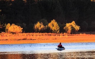
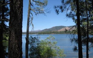
Long Point Campground is one of three in the Antelope Lake Recreation Area. It is situated on the lake's southwestern side, providing clear water views at nearly every location within the campground.Antelope Lake is one of the more remote, quiet lakes in the Sierra Nevada's Plumas National Forest, making it a popular destination for anglers and explorers of all abilities.
Recreation
Due to its prime location on the lake, Long Point is known for great bass fishing. Sailing and other boating activities are also popular at Antelope Lake.Some sites are very near to shallow water and are ideal for wading near the campground; other sites are near deeper water, allowing visitors the opportunity to anchor their boats nearby.
Facilities
The campground offers multiple single-family and larger group campsites, accommodating both tent and RV camping. With Antelope Lake adjacent to the campground on three sides, most sites have a view of the water.Tables and campfire rings with grills are provided, as well as vault toilets and drinking water.
Natural Features
The campground is situated at an elevation of 5,000 ft. and is shaded with plentiful pine and fir trees. It is nestled in the beautiful northern Sierra Nevada mountain range, offering forested woods and scenic vistas as far as the eye can see.Nearby Attractions
Campground is located about 30 miles from the small town of Taylorsville.Long Point (Ca) Reviews
Have you stayed here? Be the first to leave a review!
Top Spots in or near Plumas County
Camp at Cheney Creek Primitive Campsite
Susanville, California
3 mi
Cheney Creek has a bulletin board and toilet but no developed campsites. There is a primitive hike in or bike in campsite at Cheney Creek along the Bizz Johnson Trail, which is beside the Susan River. The primitive self contained camping site is 1.5 miles east of the Devil's Corral Trailhead on the Bizz Johnson Trail or 5 miles west of the Susanville Depot trailhead on the Bizz Johnson Trail. P...
Camp at the Fort Sage OHV Area
Doyle, CaliforniaThe recreation area consists of approximately 29,000 acres of public land that is managed primarily for off highway vehicle use and winter deer range. Vehicle use within the recreation area is limited to designated roads and trails to ensure that the two primary uses remain compatible throughout the future.You can also get more details about the area from our video. Key Coordinates:Widowmaker T...
Little Jamison Falls
Plumas County, California
3.0
1.89 mi
/ 495 ft gain
To get to the falls from the town of Graeagle, CA take Graeagle-Johnsville off Highway 89 towards the town of Johnsville. After 4.5 miles take a left on a dirt road to Jamison Mine Day Use Parking. If you go over the bridge and into the town of Johnsville, you have gone too far. Continue down the road until you reach the parking lot at the end near the old mining buildings.
After parking, fol...
Frazier Falls
Frazier Creek Road, California
4.0
1.06 mi
/ 79 ft gain
Frazier Falls is the ultimate family hike. Because the paved trail is only a mile long round trip, this trail is open to nearly anyone. Because of its relativly easy access and family friendly nature, this trail can get busy during the summer months.
To reach Frazier Falls from the town of Graeagle, Ca, head south on Highway 89 for about a mile and a half until you reach the turnoff for Gold...
Camp at the Calpine Fire Lookout
Calpine, California
5.0
I think all explorers agree there is nothing more serene than being surrounded by nothing but wilderness. If you are one of these said explorers, a trip to Calpine's fire lookout is a must.Calpine is a forest fire lookout tower that was constructed in 1934 and is one of 3 remaining examples of the enclosed windmill-style lookout in California. The lookout was actively used every summer until 19...
Camp at Rocky Point Primitive Camping Area
Susanville, CaliforniaRocky Point has a bulletin board and toilet but no developed campsites. At Rocky Point visitors must pack in and pack out all trash and waste water. A vault toilet is on site. Campers like the opportunity to "circle the wagons" and set up where they want on a large open natural gravel flat near the lake. The mile long shore access dirt road also affords pull offs along the road. Eagle Lak...
Camping and Lodging in Plumas County
Plumas County, California
Lightning Tree
Overview
Lightning Tree Campground (5,800 feet) is one of three family-friendly campgrounds located in the Lake Davis Recreation Area. Th...
Plumas County, California
Lone Rock (Ca)
Overview
Lone Rock Campground is one of three in the Antelope Lake Recreation Area. Nestled in the beautiful northern Sierra Nevada mount...
Plumas County, California
Frenchman
Overview
Frenchman Campground (5,700 feet) sites along the shores of its namesake lake, which boasts 21 miles of shoreline. The campgroun...
Plumas County, California
Spring Creek
Overview
Spring Creek Campground (5,800 feet) is just minutes away from the clear waters of the Frenchman Lake. The landscape provides a ...
Indian Creek Road
Boulder Creek (Ca)
Overview
Boulder Creek Campground is located in the northern Sierra Nevada Mountains, where ancient glaciers gave way to numerous mountai...
Unnamed Road
Black Mountain Lookout
Overview
This facility has been closed for the 2019 season. This is due to the Walker Fire.
Black Mountain Lookout is located on the ea...
Unfortunately, we don't have up-to date pricing data for this listing, but you can check pricing through Recreation Gov.
Book NowAdd your business today to reach The Outbound's audience of adventurous travelers.
Community
© 2024 The Outbound Collective - Terms of Use - Privacy Policy


