Fales Flat Campground
Book this listing through our partner Recreation Gov
About Fales Flat Campground
Overview
Fales Flat Campground is a group facility on Nez Perce Fork of the Bitterroot River. It is also well equipped for equestrian campers. The campground provides access to a variety of hiking and horseback riding trails in the area, as well as a variety of historic sites that denote the presence of the Nez Perce many years ago.Recreation
Fly fishing and wading in the Nez Perce Fork, which runs alongside the campground, are also popular activities.A variety of trails and unimproved roads are great for hiking and horseback riding. Three trails originate near the campground, including the Watchtower Trail and Sheephead Creek Trail which access the Selway-Bitterroot Wilderness and can be hiked as a loop. A steep, 2-mile trail leads to the historic Bare Cone Lookout.
Facilities
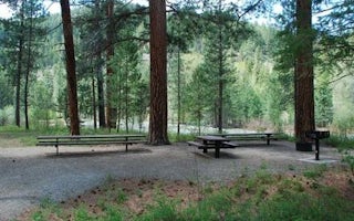
The campground offers one large group site for tent and RV camping. It can accommodate 15 to 100 people. Hookups are not available. Parking surfaces are gravel. The site is equipped with multiple tables and a large campfire circle. Vault toilets are provided. Drinking water and trash collection bins are not available. A few individual and equestrian sites are available at the campground on a first-come, first-served basis. Those sites have access to a horse staging area and hitching racks.Natural Features
The campground is located in a large meadow at the base of Nez Perce Pass along the Nez Perce Fork of the Bitterroot River. The area is believed to have been used by the Nez Perce Nimi'ipuu tribe during its travels to the buffalo country in eastern Montana.Nearby Attractions
The campground is about 23 miles from the town of Conner. A variety of services are offered there.Fales Flat Campground Reviews
Have you stayed here? Be the first to leave a review!
Top Spots in or near Darby
Backpack and Summit Trapper Peak
Darby, Montana
4.0
8.75 mi
/ 3327 ft gain
From Darby, MT, follow MT 473 south for 4 miles to West Fork Bitterroot River Rd. A mile past the Job Corps, at milepost 7, turn right on FS 5634 (Baker Point Rd.). Follow this road 10 miles to the trailhead at about 7000 ft.
The trail begins on a FS trail to Baker Lake. There are fish in Baker Lake and there are ample places to fish from the shore of the lake. There are two possible routes fro...
Whitewater Raft the Selway River
Kooskia, Idaho
47 mi
/ -1128 ft gain
The Selway is one of the original eight Wild and Scenic Rivers designated in 1968. This section of water is run by both private boaters as well as commercial outfitters, and is regulated by a strict permit system that only allows one group to launch per day. This leads to a feeling of solitude for your entire trip through some of the most beautiful pristine remote wilderness in the western st...
Backpack to Little Rock Creek
Darby, Montana
9 mi
/ 1780 ft gain
Little Rock Creek is one of the Bitterroots' best kept secrets. In late spring, the glacier lilies are in full bloom, and sprinkle the valley floor. At that time of year, there may also be quite a bit of snow on the ground, which will require some bushwhacking to stay on the trail.Little Rock Creek Lake is about 4.5 miles in. Once you arrive, you can rest and take a nap on the warm rocks beside...
Whitewater Raft the Main Salmon River
Lemhi County, Idaho
5.0
80 mi
/ -1000 ft gain
The section of the Salmon River between Corn Creek and Carey Creek, known as the "Main" among boaters, flows through the second deepest canyon on the continent (only Hells Canyon is deeper). The Main is one of the best all around river trips in the west and offers a spectacular road-less wilderness setting, big whitewater, amazing campsites, swimming, wildlife, archaeological sites, as well as...
Hike Blodgett Canyon Overlook
Hamilton, Montana
4.7
3 mi
/ 400 ft gain
The drive up forest service road 735 can be a little sketchy. Caution is advised during winter months or if the road is wet or muddy. The road dead ends at the Canyon Creek/Blodgett Overlook trailhead. There is ample parking space and an outhouse.
Begin on the Canyon Creek trail and hang a right at the sign to stay on Blodgett Overlook trail 101. From there, the trail gradually ascends with...
Hike to Mill Creek Falls
Hamilton, Montana
4.5
6 mi
/ 650 ft gain
The trailhead is easily visible from the parking area and ascends into a narrow canyon surrounded by dense forest. Mill Creek is not much more than a trickle at the beginning, but slowly gets larger and follows the trail the entire hike. About a half mile in, cross the log bridge over Mill Creek.Soon the canyon will open up and give way to stunning craggy mountain views towering overhead. There...
Camping and Lodging in Darby
Darby, Montana
Rombo
Overview
Rombo Campground is located in a scenic area along the West Fork Bitterroot River in the mountains of southwestern Montana. The ...
Darby, Montana
Alta Campground
Overview
Alta Campground is located in a scenic forest in the heart of Montana's Bitterroot National Forest. The West Fork of the Bitterr...

Conner, Montana
Medicine Point Lookout
Overview
Medicine Point Lookout is a historic tower located on Medicine Point, west of Sula. It has been restored to reflect a lookout of...
Conner, Montana
Twogood Cabin
Overview
Twogood Cabin offers guests a unique chance to camp in the forest of western Montana, in a rustic, old-time setting. It is avail...
Conner, Montana
Spring Gulch
Overview
Spring Gulch Campground is a well-maintained campground located about 50 feet from the highway, on the banks of the scenic Bitte...
Darby, Montana
Gird Point
Overview
The Gird Point Lookout offers a unique chance to camp on top of a mountain peak in a rustic, old-time setting. It sits high abov...
Unfortunately, we don't have up-to date pricing data for this listing, but you can check pricing through Recreation Gov.
Book NowAdd your business today to reach The Outbound's audience of adventurous travelers.
Community
© 2024 The Outbound Collective - Terms of Use - Privacy Policy


