Sawback, Alberta
Top Spots in and near Sawback
-
Turner Valley, Alberta
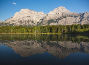
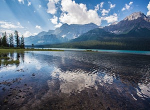
Photograph Wedge Pond
3.00.25 mi / 10 ft gainJust off Highway 1 in Kananaskis Country is a beautiful pond that makes for a wonderful spot to enjoy the first light on the Canadian Rockies. Bring warm clothes as this place can be especially cold. Don't forget a camera and a blanket. I recommend going for sunrise as this is when the lighting i...Read more -
Kananaskis, Alberta
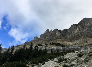
Scramble the Wedge
5 mi / 3444.9 ft gainDrive south on Highway 40 and your adventure begins at Wedge Pond. Parking in the parking lot is easy enough if you're there early enough in the day (before 10:00). The trail up the Wedge starts near the bathrooms, and heads south - not southwest towards the pond. After only a few minutes of walk...Read more -
Field, British Columbia
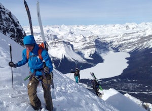
Ski Tour/Snowshoe Mt. Paget
6.8 mi / 8399 ft gainTrailhead: Approximately 5.5km West of the Alberta/British Columbia border sits the Great Divide Lodge. Towards the back left of the main building is the trailhead. Route: The trail is clear from the trailhead and for most of the way to the summit of Mt. Paget. Be aware on your descent if you ...Read more -
Kananaskis, Alberta
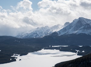
Snowshoe the Kent Ridge North Outlier
3.7 mi / 2395 ft gainAttempt this in a winter with some great snowfall and you might be able to get some great shots of the beautiful cornices that form on the ridge.The trailhead is at the north end of the Sawmill Parking lot right by the outhouses. It heads past a metal gate to a maze of old logging roads. The prop...Read more -
Kananaskis, Alberta
Hike Opal Ridge's South Summit
5.0Opal Ridge is located on the East side of highway 40 in Kananaskis.The trailhead starts at Fortress Gas Station. Park at the North end of the parking lot. The trailhead is easy to spot from here. Follow the creek a couple hundred meters till you reach an open area with power lines. Turn left. Con...Read more -
Field, British Columbia
Hike "A Walk in the Past Trail," Yoho NP
3.02 mi / 396 ft gainThe trail begins towards the backside of Kicking Horse camp area near the washrooms. Please know that access to this area is typically closed between October and June. Look for the large trail sign and be sure to grab a brochure to enjoy the self-guided tour. The brochures may not be available, ...Read more -
Bragg Creek, Alberta
Hike Jumpingpound Summit
3.03.1 mi / 1148.3 ft gainThis is a great short hike that will only take about ½ day. Take Hwy. 1 west and take the exit for the Sibbald Creek Trail. Follow this road until you hit the Powderface Trail. (NOTE: this road is closed from December 1 – May 14 annually). Follow this road for approximately 15km’s. Take note tha...Read more -
Field, British Columbia
Backpack Burgess Pass to the Iceline to Takakkaw Falls
5.042.3 miThis hike begins at a trailhead 1.5 km (0.9 mi) from Field, B.C., Canada. When heading west on the Trans Canada Highway towards Field, turn right 1.5 km before Field onto a small dirt road. Immediately turn left and continue driving straight for 500 m (0.3 mi) to a small open area for parking at ...Read more -
Clearwater County, Alberta
Hike Maze Peak
4.05.3 mi / 2624.7 ft gainThere's not much of a trailhead for Maze Peak - in fact there isn't a trailhead at all. Bring up the start location from this post and pull over on the side of the dirt road once you get to it! The hardest part about this trail is just kind of finding it, really. The good news is that you're goin...Read more -
Parson, British Columbia
Hike to Wapta Falls, Yoho National Park
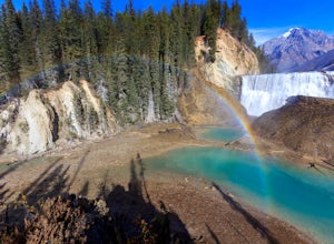
5.02.4 mi / 180 ft gainThis short 1.2 mile hike leads you through a relatively level forest to a spot on the Kicking Horse River where the water crashes off a river-wide cliff, producing almost a guaranteed rainbow at the bottom. The trail starts at the Wapta Falls Trailhead, which is a short drive off the Trans Canadi...Read more -
Kananaskis, Alberta
Hike Alberta's Grizzly Peak
4.0The trailhead is located on the north side of Ripple Creek, the first creek you come across after passing the Grizzly Creek turnoff. There is an easy pull-off on the east side of the highway. You should be able to see the trailhead from the road, which follows the southern slope of the mountain f...Read more -
Field, British Columbia
Explore the Natural Bridge in Yoho NP
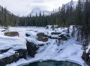
4.5Whether you are traveling north or south on the Trans-Canada Highway in Yoho National Park you will see a sign that directs you west to travel on Emerald Lake Road. When you turn west you will travel about one mile, or 1.6 km, and then you will see the parking area for the Natural Bridge. After p...Read more -
Improvement District No. 9, Alberta
Hike to Hector Lake
5.03.1 miHector Lake is one of the larger lakes in Banff National Park. It is surrounded by the Waputik Range to the west, and offers pristine views of the mountains. Hector Lake is idyllic and peaceful. Most tourists drive past the trailhead on the parkway, which means the hike is not at all busy. An...Read more -
Improvement District No. 9, Alberta
Ski Mt. Hector
8.6 mi / 5275.6 ft gainMt Hector's main route requires a ski mountaineering ascent. It moves through a lot of complex avalanche terrain, across glaciers, and through many terrain traps. Most people will do this route in spring, aiming to be off the mountain before noon. This route should be attempted only by very fit ...Read more -
Improvement District No. 9, Alberta
Climb Achilles Spire
5.0Established in 2012 by Eric Dumerac, Sid Cupido and Chad Casey. This 13-pitch, 300m route of relatively easy climbing provides some decent exposure on a dolomite tower attached to Mount Andromache, Banff National Park. 2 hr approach, expect 8-10 hour day. Approach - Park in the pull out on the ...Read more -
Kananaskis, Alberta
Snowshoe up Gypsum Ridge
3.7 mi / 1378 ft gainIf you have a topographic map of Kananaskis Lakes, the trailhead is just to the east of Blackshale Creek. If you don't have a topographic map of the area, the Google Maps pin on this adventure will help you get there --- you'll see a pretty large opening on the south side of the road. Luckily, th...Read more

