Claremont, California
Claremont, California is home to some of the top hiking trails and outdoor activities in the region. The Claremont Hills Wilderness Park is a must-visit for those who enjoy scenic hikes. The 5-mile loop trail offers stunning views of the San Gabriel Mountains and the Pomona Valley. The trail is moderately challenging with an elevation gain of about 900 feet, making it suitable for intermediate hikers. Another notable trail is the Thompson Creek Trail, a flat, paved path perfect for walking, jogging, and cycling. It runs alongside a beautiful creek and offers views of the San Gabriel Mountains. If you're into bird watching, the Rancho Santa Ana Botanic Garden is a great spot. With a variety of native plants and bird species, it's a top attraction in Claremont. For the best trails and outdoor activities, Claremont, California is a prime destination.
Top Spots in and near Claremont
-
Claremont, California
Claremont Wilderness Loop
4.85.03 mi / 1020 ft gainDrive to the top of Mills Ave in Claremont. There is a main parking area to the left and overflow parking a block south on the right. It costs $3 to park for 4hrs. As the name implies, the Wilderness Loop is a loop that connects to other trails in the Claremont Hills Wilderness. You can choose t...Read more -
La Verne, California
Marshall Canyon Trail
4.05.99 mi / 722 ft gainFor this adventure you can choose to start in a multiple of places; for the easiest parking use Oak Mesa Park located next to Oak Mesa Elementary School. From the parking lot cross the soccer field towards the bridge on the north east end of the school. Once across the bridge follow Los Robles ea...Read more -
Claremont, California
Stoddard Peak Trail
4.05.93 mi / 1129 ft gainOn the way to Mount Baldy and within the trail system of the San Gabriel mountain range is the Stoddard Peak Trail. The Stoddard Peak Trail, which is basically the old Barrett-Stoddard fire road, goes through the Stoddard Canyon into Stoddard Flat, and then eventually leads to Stoddard Peak. The ...Read more -
Claremont, California
Stoddard Canyon Falls (Baldy Slide Waterfall)
0.74 mi / 174 ft gainLocated near the Angeles National Forest, it's a short hike, approx. 0.75 miles roundtrip and just about anybody can go. To get there, input the intersection of Mt. Baldy Rd. and Barrett Stoddard Truck Trail into your GPS. This will bring you to a small dirt parking lot. The trailhead starts a...Read more -
Mount Baldy, California
Sunset Peak via South Trailhead
4.07.16 mi / 1493 ft gainIn order to get to the Sunset Peak Trailhead, utilize Google Maps to take you to the location provided. There is very little parking (only a small pull off along Glendora Ridge Road), but this trail is rarely traveled, so there should be enough space regardless of the time you decide to hike! Jus...Read more -
La Verne, California
Cattle Canyon Trail
6.7 mi / 1066 ft gainWithin the San Gabriel Mountains from Highway 39 and along East Fork Road is Cattle Canyon. To go through Cattle Canyon, you can access the trail head just south of the Bridge to Nowhere trail head along East Fork Road right after it intersects with Glendora Mountain Road. There is a small parkin...Read more -
La Verne, California
Bridge to Nowhere via East Fork Trail
4.49.65 mi / 1798 ft gainThe trail on this 10-mile hike is predominately slow and steady, but can be a little rocky, so be prepared to scramble. When you’re fording the river, the water level can range from knee to chest high, especially in the wet months. A good pair of waterproof hiking boots is helpful, but water shoe...Read more -
Mount Baldy, California
Summit Mt. Baldy
4.812.12 mi / 5958 ft gainLocated only an hour’s drive from Los Angeles is the top of highest mountain in LA County—at 10,064 feet. Bear Flat Trail (also called the Old Mt. Baldy Trail) offers some of the finest scenery and most rewarding views in the San Gabriel Mountains high country. With nearly 6000 ft of elevation g...Read more -
Chino Hills, California
Adobe Loop
3.01.92 mi / 312 ft gainThe best place to park for this hike is at Hunter's Hill park. From there, the trailhead is located on Natalie Road just South of the park. There is a large sign marking the start of the trail, but it does not give a name for either the trail head or the trail itself. For reference, it is the But...Read more -
Mount Baldy, California
Cedar Glen Camp
4.88 mi / 1650 ft gainCedar Glen Camp is a great beginner backpacking trip just outside of Los Angeles, California. Starting from the Icehouse Trailhead (also used for Cucamonga Peak), head out on the Icehouse Canyon Trail from the parking area. The trail will intersect with the Chapman Trail, at which point, you'll t...Read more -
Mount Baldy, California
Cucamonga Peak via Icehouse Canyon
4.611.13 mi / 4157 ft gainStart hiking early, before the sun rises so you can maximize the day out of the heat and to give yourself plenty of time for the hike. As you get to higher elevations, it will be a little cooler and there might be snow on the ground, so be sure to pack layers. This hike requires a permit. If yo...Read more -
Mount Baldy, California
Icehouse Saddle via Icehouse Canyon Trail
3.86.62 mi / 2562 ft gainThe hike is accessible in all seasons, but in winter there can be snow and ice so special equipment may be useful, but not required. In mid-January there were patches of ice on the trail but were easily crossed in boots and trainers. You can take the trail and end at Ice house Saddle or continue ...Read more -
Mount Baldy, California
Ontario Peak and Cucamonga Peak via Icehouse Canyon Trailhead
16.22 mi / 5610 ft gainWe started out at 8am on a Sunday, usually parking at Ice House Saddle can be tricky, I would advise going earlier. We headed out on our journey hiking up to the saddle, when you reach the switchbacks there is a fresh water spring, it's the last place you can get water...so stock up! We pressed o...Read more -
Azusa, California
Fish Canyon Falls
2.04.08 mi / 801 ft gainThis trail is currently closed! Learn more on the U.S. Forest Service website. Follow Encanto Parkway towards the hills until you come to a junction with a sign labeled "trail" that points towards a parking lot to your right. Parking is free, though on weekends it may be difficult to find a spot...Read more -
Mount Baldy, California
Mt. San Antonio (Mt. Baldy) via the Ski Hut Trail
5.09.7 mi / 3990 ft gainMt. San Antonio, or Mt. Baldy as it is known locally, is one of the cans of the challenging "six-pack of peaks" in Southern California. For this one, start before the Manker campground and head up the fire road. This is known as the "Baldy Bowl or Ski-Hut Trail". You'll see some cabins on your l...Read more -
Azusa, California
Smith Mountain Trail
6.69 mi / 3189 ft gainSmith Mountain Trail is an awesome day hike located near Glendora, California. This out-and-back trail offers great views of the Los Angeles National Forest and the potential for continuation to Bear Creek for even more variety of scenery. Smith Mountain is a moderately strenuous hike with an el...Read more
Camping and Lodging in Claremont
Jackson Flats
Lake Campground
Mountain Oak
Coulter Group Campground
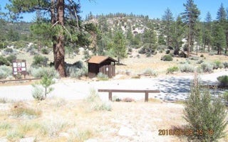
Meadow Group Campground
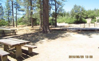
Bandido Group Campground


