
Hike Darby Canyon to the Wind Cave
Alta, Wyoming
Description
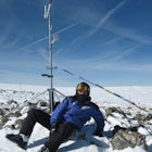
Added by Josh Packer
Spectacular views. Challenging hike. Awesome cave to explore. Well-maintained trail. Wildlife. Wide variety of wildflowers during summer. Beautiful creek. Wild huckleberries to eat along the trail. 6 miles roundtrip. Elevation gain: 1880 feet.
The best time to hike Darby Canyon is May through September, since the snow stays late in spring and comes earlier in fall.
Hiking up Darby Canyon to the Wind Caves provides spectacular views of the Jedediah Smith Wilderness and is a fun, yet challenging hike. It is a popular day hike, and many families will even take their younger children on the adventure. The trail is about 6 miles round trip, so start in the morning or early afternoon to be back before the sunset that night.
One of people's favorite activities along the hike is to pick wild huckleberries between late July and early August. Huckleberries are difficult to grow commercially, so people hiking love to pick them. Make sure to know what huckleberries look like as some berries are poisonous along the hike.
Back to the hike. Once you pass the trailhead, hike up the path and cross the footbridge as seen in the picture above. The trail will start going up the mountainside, and you will cross the boundary into the Jediah Smith Wilderness. You will ascend more than 1,200 feet in less than 2 miles. Along most of the trail you will see a colorful array of wildflowers during summer and fall colors during autumn. Wildlife can also be seen usually in the early morning or later at night.
About halfway up the hike, you will see the Wind Cave across the canyon. It was here that I saw a bear across the ravine on the other side of the canyon luckily, so make sure to have bear spray. Once you are about 2.5 miles in, the trail splits, so stay to the right to reach the cave, and you will cross the creek and climb multiple switchbacks to get there.
You will pass a memorial for 5 hikers that were killed by lightning, so quickly retreat down the mountain if thunderstorms are coming. Once you reach the cave, you'll notice water running out of it. Watch your step as the rocks tend to be slippery. This would be a good time to put on your water shoes if you brought them.
You can explore parts of the cave but will need repelling equipment if you plan on descending the steep drop-offs. There is a passage way from these steep drop offs that connects to a nearby ice cave, which produces a cold wind. This is where the name the "Wind Cave" comes from.
You will get some magnificent views of the valley and forest from the cave. Once you are ready to go back, head back down the same trail you just came up.
Rexburg Directions: Head north on Highway 20 and take Exit 339 towards Driggs and Jackson. Once you pass Driggs, the turnoff for the canyon is about 2 to 3 miles farther down the road. Take a left turn 3/4 of a mile passed the Spud Drive-in Theater onto 3000 S. Follow the road straight, and it will soon turn into a gravel road which takes you into Wyoming. When you hit the "T" in the road, turn right. Follow the road for 2 miles until you come to a fork in the road. Take the left fork, and then follow the road for 2.5 more miles. Taking a right will take you to the girls' scout camp. At the end of the 2.5 miles, you’ll come to the parking lot. Park, and walk up to the trailhead.
From Idaho Falls: Take US 26 east to Swan Valley. Turn left at the square ice cream gas station onto ID 31/Pine Creek Road and follow it until you arrive at Victor. (If you've never had square ice cream, you should definitely check it out.) Then turn left onto ID-31/N Main Street and follow the road until you get to E 3000 S just before Driggs and turn right. The directions are the same as the Rexburg directions from here.
Trailhead GPS Coordinates:
Latitude: 43° 41′ 11.706″ N
Longitude: 110° 58′ 7.596″ W
Cave GPS Coordinates:
Latitude: 43° 39′ 57.684″ N
Longitude: 110° 57′ 21.474″ W
Download the Outbound mobile app
Find adventures and camping on the go, share photos, use GPX tracks, and download maps for offline use.
Get the appFeatures
Hike Darby Canyon to the Wind Cave Reviews

I had a great time hiking this trail! You can actually reach the opening to the Darby Ice Cave if you take a less obvious trail which forks off to the left just before the beginning of the steep ascent to the Wind Cave. Take this trail for about a mile and a half, keeping an eye out for the next big opening in the cliff band up on the right. Scramble up the steep slope and check it out when you see it! If you're up for even more, you can scramble up the cliffs to the left of the Ice Cave opening, leading to an off-trail ascent to an unnamed peak about 10,300 feet high. Just look for the couloir. Once above the cliff band, follow it due south up the ridge, keeping the cliffs on your left. Be extra careful at the cliffs and allow for a lot of time on the descent. Instead of taking the couloir down, go just to the left of it and scramble downward. Do not attempt this without some climbing or scrambling experience and sturdy hiking shoes. Car-to-car, the adventure took us 7 hours. 7:30am to 2:30pm. Pack extra water and snacks!
5.0
Thanks for sharing this adventure it was amazing. This has to be one of the most unique places we have visited in Teton Valley. The Wind Cave and waterfalls are amazing but so is the rest of the hike! A few thing I will add: If you are planning to explore the cave your feet are going to get wet. The best way to get into the cave is by crossing the stream and be careful doing this. Bring a pair of dry socks or shoes for after, maybe both. This goes without saying but it is snowmelt water and it is freaking cold so don't stay in it too long.
5.0
Leave No Trace
Always practice Leave No Trace ethics on your adventures and follow local regulations. Please explore responsibly!
Nearby

Explore Teton Creek along Sheep Bridge Trail

Summit Table Mountain

Scenic Drive Up to Grand Targhee Ski Resort

Teton Crest Trail

Phelps Lake Overlook

Backpack to Alaska Basin via Death Canyon

Let Adventure be your Destination in Wyoming
Wyoming’s wide-open spaces make it easy to get off the grid and on a trail, through a park, into a forest, up a mountain or down a river. During your journey through Wyoming’s Black to Yellow Region, discover geologic marvels, dense evergreen forests and sprawling prairielands.
Learn MoreCommunity
Mobile Apps

© 2024 The Outbound Collective - Terms of Use - Privacy Policy