Silver Plume, Colorado
Looking for the best backpacking in Silver Plume? We've got you covered with the top trails, trips, hiking, backpacking, camping and more around Silver Plume. The detailed guides, photos, and reviews are all submitted by the Outbound community.
Top Backpacking Spots in and near Silver Plume
-
Idaho Springs, Colorado
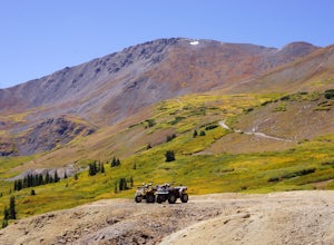
ATV Leavenworth Creek Road (Guanella Pass)
16.6 mi / 3655 ft gainSeptember is famous in Colorado for clear, deep blue skies,sublimely perfect temperatures, and gold-digging – of the leaf variety, thatis. On September 9, wildflower season was recently past and the best of theleaves were yet to come, but it was the perfect, clear and sunny day to checkout the hi...Read more -
Silver Plume, Colorado
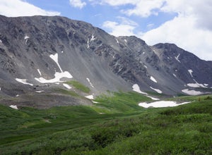
Grays and Torreys Peaks
4.37.97 mi / 3458 ft gainAt about an hour's drive from Denver, Grays Peak (14,270 ft./4338m) and its sister mountain, Torreys Peak (14,267 ft./4337m), are two of the most popular 14ers in the state. Because of this, a wealth of information is available on the internet. Rather than go into all the details of the technical...Read more -
Dillon, Colorado
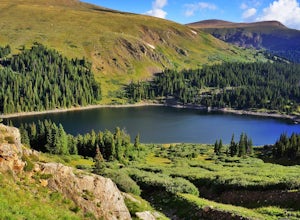
Silver Dollar Lake Trail
5.03.93 mi / 945 ft gainGuanella Pass, which connects the charming and historic town of Georgetown in the north to the blink-and-you’ll-miss-it Grant to the south, is a recreational outdoorsman’s dream. Volumes could be written on what this 22-mile scenic byway has to offer. Silver Dollar Lake Trail is just one tiny po...Read more -
Dillon, Colorado
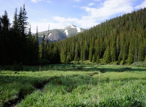
Wildflowers, Lakes, and Peaks, Oh My!
5.0Herman Gulch is one of those special places that makes you fall in love with Colorado all over again. This spectacular wildflower hike that ends at an alpine lake will have your head swiveling from start to finish. Wildflower season is July and August, with peak season being mid-to-late July. Ple...Read more -
Idaho Springs, Colorado
Lower and Upper Chicago Lake
4.59.22 mi / 2270 ft gainFrom the parking lot, stay to the right of Echo Lake and you will run into the Chicago Lakes Trailhead. Follow the switchbacks down and across Chicago Creek. After crossing the creek, follow the sign indicating that the trail follows the dirt road and hang a left; from here, you'll reach the Idah...Read more -
Evergreen, Colorado
Hike the Resthouse/Lincoln Lake Trail
4.5While the Mt. Evans Wilderness never has a shortage of visitors, thanks to its proximity to Denver, it is possible to find a more private hike if you know where to look. Lincoln Lake Trail, accessible from Echo Lake year-round, is not as glamorous as its sister trail, Chicago Lakes, but is a wond...Read more -
Parshall, Colorado
Ski or Snowshoe Jones Pass
4.06 mi / 1600 ft gainIts sister trail, Butler Gulch, is an all-time favorite hike (both summer and winter), and since they share a trailhead, I knew Jones Pass would be special as well.Jones Pass is not the type of trail I normally take, since it is actually a 4x4 road that is used for Jeeping in the summer and snowm...Read more -
Idaho Springs, Colorado
Explore 'The Hidden Gems' of Loch Lomond
5.04.6 mi / 950 ft gainGetting There From Denver, go W on I-70 and take exit 238 for Fall River Rd. Continue on this road before taking a left on Alice Rd. Continue on Alice Rd. until you see the right hand turn for Steuart Rd. This is where you park. Do not attempt this road in a AWD or 2WD you definitely need a good ...Read more -
Winter Park, Colorado
Snowshoe to Broome Hut
1.5 mi / 729 ft gainTake I-70 from Denver and then US 40, go all the way to Mile marker 240 of US 40 and park in the area at the side of the road. The Second Creek trail head is just behind the parking area and is easy to find.The trail climbs from a start at 10,600ft and finishes up at 11,325ft at the hut, but you ...Read more -
Idaho Springs, Colorado
Camp and Fish at Loch Lomond
5.0The trail to Loch Lomond is very rocky. I suggest a high clearance 4x4 vehicle (I did see a small SUV and a Subaru..Not sure how they did it!!!). There are a few campsites at the lake and several along the way. I set up camp by the lake but had to move because the wind was so intense. I recommend...Read more -
Idaho Springs, Colorado
Hiking James Peak (13,294')
8.3 mi / 3000 ft gainJames Peak is one of 76 13,000'+ peaks in Colorado's front range. On your way up to the peak you will pass St. Mary's Glacier. It is not an actual glacier yet a permeant snow field that is popular among skiers and snowboarders year round. St. Mary's Glaicer is a very popular destination (though m...Read more -
Nederland, Colorado
Heart and Rogers Peak Lakes
4.88.62 mi / 2113 ft gainThe hike begins at the East Portal Trailhead outside Rollinsville. Start hiking along the South Boulder trail to the right (north) of the very obvious Moffat Rail tunnel. The trail begins with moderate grades past the Forest Lakes cutoff just 1.25 miles from the trailhead. Continue hiking straigh...Read more -
Nederland, Colorado
3 Crater Lakes via South Boulder Creek
5.06.92 mi / 1804 ft gainAfter turning on to Co. 16 (Tolland Rd.) from 119 at Rollinsville, drive about 8 miles down the dirt road along South Boulder Creek. The road will dead end at Moffat Tunnel where you'll find ample parking in a gravel lot with restrooms. You'll begin your hike along sweeping meadows until you ent...Read more -
Nederland, Colorado
Upper Forest Lakes Trail
7.86 mi / 1778 ft gainUpper Forest Lakes Trail is an out-and-back trail that takes you by a river located near Rollinsville, Colorado.Read more -
Nederland, Colorado
Hike Rollins Pass to Devils Thumb
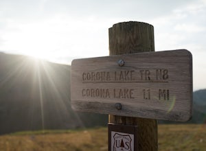
2.1 mi / 622 ft gainCorona Lake is an easy, short hike if you're pressed for time. It's scenic, secluded, and will put you in a great spot to hike to Devils Thumb the next day. There are two ways to reach Devils Thumb. This is considered the "easier" route because of the "lack of elevation gain." The sun and wind re...Read more -
Fraser, Colorado
Summit Byers Peak
8.8 mi / 2774 ft gainThe drive to the start of the trail is okay, having a high clearance vehicle would make the drive easier, but is not necessary. Free parking is available along the side of the road.The trail starts on a closed service road at a gate and requires you to either hike or bike up the dirt road (2 mil...Read more

