
Snowshoe or Ski Watrous Gulch
Dillon, Colorado
Details
Distance
4 miles
Elevation Gain
1200 ft
Route Type
Out-and-Back
Description
Added by Amy Kesic
Snowshoe or XC Ski in the beautiful Arapaho National Forest. Fairly easy 1200’ elevation gain. 4 miles round trip. Stunning views of Torreys Peak and Kelso Mountain. Easy access from Denver.
Despite sharing a trailhead with the popular Herman Gulch, I had not heard of Watrous Gulch until I stumbled across it while researching something else. Knowing that Herman Gulch is filled with spectacular views and deep snow ideal for snowshoeing/skiing, I had to discover if the smaller, lesser-known Watrous lives up to Herman’s reputation.
Their proximity notwithstanding, Watrous and Herman Gulches share very little by way of views, and Watrous is definitely worth checking out. The route is only 2 miles long (the trail peters out as it approaches Woods Mountain), and I divide it into two parts.
The first mile is mostly forested with a mix of aspen and evergreens. You’ll pass through a lot of downed trees, which are timber harvest from the mining days, according to the trailhead map. Fortunately, the snow covers up a lot of the dead wood. This part of the trail heads mostly eastward, and if you set out at dawn, as I did, you’ll witness the sunrise as you climb.
At the one-mile mark, the trail curves toward the northwest, and continues that way throughout mile 2. This is also when the views improve dramatically. The two most prominent mountains, seen to the southeast, are Kelso Mountain (13,164’) and Torreys Peak (14,267’). Also, the trees are healthier looking here, and you will begin to see more of the surrounding 13ers (Mt. Parnassus, Bard Peak, and Woods Mountain in particular).
You will cross the creek, which may or may not be frozen over, depending on the time of year. You should see the sign indicating the Bard Creek Trail* and Watrous Gulch fork. You’ll continue parallel to the creek until the trail peters out. In my case, I followed previous tracks until they disappeared, and then I continued to break trail for a little while longer. I would have liked to go further, but weather conditions force me to turn around at that point. Sadly, the cloudy weather prevented me from seeing all of the mountains, and so I’ll be returning on a clear day.
The trailhead map indicates that the elevation gain is 1500 feet, but according to my GPS it’s more like 1200 feet, maybe less. It also claims that you’ll climb above the treeline, which is not true. While the terrain does open up with more expansive views, you will still be some distance from the tree line at the turn around point.
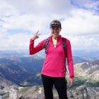
Overall, it’s a short, easy-ish snowshoe/ski hike whose views of Torreys Peak and the 13ers are well worth the effort.
*Bard Creek Trail takes you to the summit of Bard Peak, and from there, three more 13ers in the area.
Download the Outbound mobile app
Find adventures and camping on the go, share photos, use GPX tracks, and download maps for offline use.
Get the appFeatures
Snowshoe or Ski Watrous Gulch Reviews
I took the left fork and I rented snowshoes that day (Jan 2020). The trail was packed for the most part and light spikes were perfect. Two big climbs at the beginning. However, going off the trail, the snow is neck deep at some spots (I'm 6'2 and 2' off the trail I sank up to my neck). Great hike, watch out for weather.
4.0
To get to Watrous Gulch, follow the Herman Gulch Trailhead for the first 1/4 mile. Where it forks, take the right fork.
Leave No Trace
Always practice Leave No Trace ethics on your adventures and follow local regulations. Please explore responsibly!
Nearby

Backcountry Snowshoe and Ski Paradise

Wildflowers, Lakes, and Peaks, Oh My!

Bakerville Scenic Snowshoe/XC Ski Trek

Hike Grizzly Peak at Loveland Pass

Hiking Mount Sniktau

Photograph the Milky Way at Loveland Pass
Community
Mobile Apps

© 2024 The Outbound Collective - Terms of Use - Privacy Policy