CanadaAlbertaJohnston Canyon Hiking Area
Johnston Canyon Hiking Area, Alberta
Top Spots in and near Johnston Canyon Hiking Area
-
Improvement District No. 9, Alberta
5.0
1.6 mi
/ 393.7 ft gain
Getting There:
The Canyon is very well marked, but here are directions anyway if you're coming from Banff: Head West on the Trans-Canada Highway for about 5 km or so. Take the Bow Valley Parkway exit, and continue West for another 18km - you'll then see signs to your right for Johnston Canyon.
Th...
Read more
-
Improvement District No. 9, Alberta
It’s amazing how much varied scenery you see over the course of the very short 1.7 mile hike. Follow the catwalks through the canyon as the stunning turquoise water flows below. If you’re feeling up for a longer hike, you can continue along the trail to the Ink Pots (makes for a great winter hike...
Read more
-
Improvement District No. 9, Alberta
3.8
7.5 mi
/ 1050 ft gain
The hike through Johnston Canyon to its Upper and Lower falls is one of the most popular hikes to do in Banff - mostly due the little effort required for the great reward.To start, take the Bow Valley Parkway (Highway 1A) - the parking lot and trailhead are clearly marked by a Johnston Canyon sig...
Read more
-
Improvement District No. 9, Alberta
This is an amazing trail, but not for the feint of heart!The trailhead is located on the Bow Valley Parkway (Highway 1A) in Banff National Park, AB at the Castle Mountain sign. The trailhead is marked by an information sign in the north of the parking lot and the trail initially heads north - not...
Read more
-
Improvement District No. 9, Alberta
Starting at the Rockbound Lake trailhead you will want to follow the flat dirt path straight, until you see the junction in the road with the sign pointing you to Silverton Falls (it will be about 500 steps or a quarter of a mile). We made the mistake of taking the first junction which lead us to...
Read more
-
Improvement District No. 9, Alberta
Park at Rockbound Lake Trailhead, 0.2 km east of Castle Junction on Bow Valley Parkway (Highway 1A).The trail wanders through forest until coming to a fork to the right, leading to SilvertonFalls. This is a worthwhile 1 km side trip to a beautiful small waterfall dropping into a turquoise blue po...
Read more
-
Sawback, Alberta
The Bourgeau Lake trailhead offers easy parking and bathrooms before departing. The hike begins with approximately an hour and a half of fairly easy walking through forest with several glimpses of the surrounding mountains and Wolverine Creek. This first stretch ends with a gorgeous waterfall, ...
Read more
-
Sawback, Alberta
5.0
12.5 mi
/ 3360 ft gain
The trailhead for Bourgeau Lake/Harvey Pass is on the west side of Trans-Canada Highway approximately 5 miles west of Banff. The turn-off is approximately 0.9 miles past the Sunshine Village Ski Resort exit. There is a small parking lot and a restroom at the trailhead.
Enter through the gate to...
Read more
-
Sawback, Alberta
Taking Hwy 1 West of Banff for approximately 8 miles you'll come to the Bourgeau Lake Trailhead. This trail starts with a 4.5 mile, 2460ft elevation through the forest to the beautiful Bourgeau Lake. This glacial tarn signals the start of the alpine and a wonderful morning hike on it's own.
From ...
Read more
-
Improvement District No. 9, Alberta
Boom Lake offers amazing views of Boom Mountain and the ridge separating Alberta and British Columbia. It is not as popular as many other hikes in the area, which means exclusion for anyone willing to explore the lake. The abundant wildlife in the area includes wolves, bears, mountain goats, de...
Read more
-
Sawback, Alberta
Park at the viewpoint parking lot on the left side of the highway, approximately 2.8 km (1.7 mi) after turning off of the Trans Canada Highway. The trailhead is easily located on the north side of the highway.
The approach is short but steep and sustained. It starts as a trail and finishes as a s...
Read more
-
Sawback, Alberta
Route on Mount CoryThe spectacular view of the river and forest below is called Backswamp- in the past it was referred to as Aftonroe by a local writer Jon Whyte- The naming of this route was made in his memory5.7 Sport Route- 9 Pitches
Approach: Park on the left side of the Bow Valley Parkway, H...
Read more
-
Eldon, Alberta
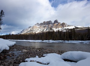
Castle mountain, so named for its fortress-like shape, is a quick hop away from the town of Banff.
If you don't have time to hike to Rockbound Lake (at the base of Castle), head to the viewpoint just off of Highway 91 and snap some pictures of this epic mountain. Drive north for about 10 minutes...
Read more
-
Sawback, Alberta
From the parking lot head East for about 200m, to find the trail that heads North. The trail follows the riverbed for about 45 minutes and in parts is washed out. A piece of flagging tape and a downed tree that is used as a bench marks the point where the trail gets tougher.
At this point you wil...
Read more
-
Improvement District No. 9, Alberta
4.0
9.3 mi
/ 3002 ft gain
Going west from Banff, take the first exit for Highway 1A (Bow Valley Parkway). Take the first right up to the fireside picnic area and begin your hike here.
The first 5kms of the hike climb uphill through the forest, making up most of the 915m elevation gain. Watch for trail markers over the ro...
Read more
-
Edgewater, Alberta
Do you like skiing wide open slopes of light, fluffy powder? How about staring off at massive, jagged peaks while you do it? Then do I have the resort for you…
Sunshine Village in the heart of Banff National Park offers something for everyone on the slopes. There are ample wide open groomers for ...
Read more

