New South Wales
Looking for the best hiking in New South Wales? We've got you covered with the top trails, trips, hiking, backpacking, camping and more around New South Wales. The detailed guides, photos, and reviews are all submitted by the Outbound community.
Top Hiking Spots in and near New South Wales
-
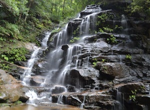
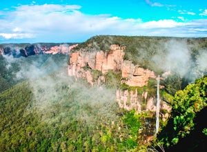
Wentworth Falls, New South Wales
Hike to Wentworth Falls
5.0While you are on Highway 32 (away from Sydney) you will look for Falls Road on the right (heading south). Follow this until you get to the parking lot. Once to the parking lot follow signs for the National Pass trail.Hike down a cliff edge carved into the stone, and follow it all the way to the...Read more -
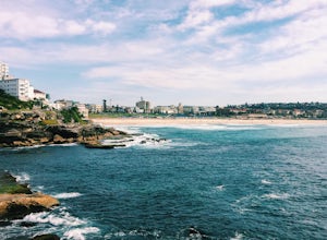
Bondi Beach, New South Wales
Hike the Bondi to Coogee Beach Coastal Walk
4.34.1 mi / 700 ft gainThe Basics: Australia's pristine beaches and coastlines are probably its main tourism attraction, and one of the most famous beaches is Bondi Beach in Sydney. It is only 45 minutes by train from Sydney Intl. Airport, or 2-3 train stops from Downtown Sydney. From Central Station, take the T4 line ...Read more -
Kosciuszko National Park, New South Wales
Hike to Kosciuszko Summit
5.012.4 mi / 1476.4 ft gainThe walk to Kosciuszko's Summit is easily one of the most scenic walks Australia has to offer. Australia's 'Snowy' Mountain range is enveloped in deep snow through Winter, so Spring, Summer and Autumn are the best times to hike this track - although a weather check doesn't go astray in the cooler...Read more -
Newnes Plateau, New South Wales
Explore Deep Pass Canyon
Hiking up Nayook Creek - Deep Pass Canyon, provides a unique opportunity within the Blue Mountains to escape the crowds and experience one of the many canyons that litter the range.The walk begins at the carpark of a small dirt road, which is accessed via turning off the popular Glowworm tunnel r...Read more -
Katoomba, New South Wales
Hike to Katoomba Falls
5.00.93 mi / 521 ft gainThe hike starts out at the Prince Henry Cliff Walk at the popular Scenic World in the Blue Mountains. The length of the trail isn't very long, but it's a very steep drop down to the bottom and the hike back out is quite strenuous. We took snacks with us and hung out the bottom for a while before ...Read more -
Bundeena, New South Wales
Hike to Wedding Cake Rock
4.03.1 miThe trailhead is located about 30 minutes outside of Sydney, NSW in the Royal National Park.Finding the trailhead was a bit difficult as Google Maps had taken us (as well as others we met along the way) to a different trail head in the park. So make sure you know where the trailhead is before you...Read more -
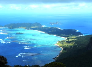
Lord Howe Island, New South Wales
Climb Mt. Gower On Lord Howe Island
8.7 mi / 2870.7 ft gainStarting at sea level, the hike begins as a gentle stroll along the coast. However, don't get lulled into a false sense of security, this hike gets tough very quickly. Climbing up around 50-60 metres from sea level, it's time to strap on a helmet and use the ropes that are fixed to the sheer clif...Read more -
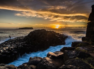
Fingal Head, New South Wales
Photograph Australia's Giant's Causeway
5.0Just an hour and a half drive from brisbane you will find the little town of Fingal Heads. Park at the end of the Lighthouse Parade Rd and follow the Fingal Lighthouse Track out towards the water and explore from there.Some of the most beautiful beaches Australia has to offer are just along here,...Read more -
Mount Warning, New South Wales
Hike to the Mount Warning Summit
4.75.5 mi / 2300 ft gainStanding at 3,793 feet tall, Mount Warning in New South Wales, Australia is the first peak to see the sunrise in all of Australia every morning. Though you can hike the mountain at any time of the day, most people arrive in the middle of the night in order to hike it in time for the sunrise.The m...Read more -
Seal Rocks, New South Wales
Camp and Surf in Seal Rocks
5.0Just a three-hour, 280km drive north of Sydney is the sleepy town of Seal Rocks. Meandering round the tight bends to the end of the headland, you’ll find yourself a 10-minute walk from the picturesque lighthouse, which offers views up and down the deserted coastline.There is a small holiday park ...Read more -
Manly, New South Wales
Hike North Head Sanctuary
5.08.1 mi / 1099.1 ft gainSince there are many different walkways, I have put together several different ways to get to North Head, though there are many different places to explore along the way. It's a great way to get outside the Sydney and escape for a few hours without a long commute. If you follow the paths around t...Read more -
Repentance Creek, New South Wales
Hike Minyon Falls Loop
5.05.1 miLocated within Nightcap National Park, Minyon Falls is approximately 30 minutes South-West of the sleepy, hippie town of Mullumbimby. Mullum has an eclectic market on the third Saturday of the month from 9am-2pm with which you could synch your hike.Minyon Falls itself flows over a 100m cliff befo...Read more -
Waterfall, New South Wales
Hike to Uloola Falls
3.08.7 mi / 70 ft gainThe trail begins at the waterfall station commuter car park. Head down the small flight of stairs at the rear of the parking area to the forest where you will find a sign for the hike. Follow the path for 7 KM staying with the signs for Uloola Falls. The path is well cleared and marked. With a fe...Read more -
Kurnell, New South Wales
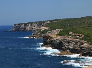
Hike the Cape Baily Coast Walk
4.55 mi / 492.1 ft gainThis is a great hike if you enjoy heights and looking out on the ocean, as most of the hike takes you along white rocky cliffs on the edge of the park.Given the majority of the walk is exposed, please make sure to bring sun protection and lots of water.I've started the walk at the Cape Solander c...Read more -
Bundeena, New South Wales
Hike the Coast Track from Bundeena to Wattamolla
5.014.9 mi / 1246.7 ft gainThis hike is a part of the 26km Coast Track in Royal National Park. Please note that you must purchase a parking permit from one of the visitors centres. Another option is to make this hike into a point-to-point and leave the second car at the Wattamolla day area.You can also get to Bundeena from...Read more -
Royal National Park, New South Wales
Hike Curra Moors Loop Track
5.06.2 miPlease note that a lot of the track is exposed, so make sure if it's a nice day to bring a hat and sun protection. If it's rainy, please be careful of the rocks and note that the trail can get boggy.At certain times of the year, you can see whales off the coast as the track follows their migrator...Read more

