
5 Trail Runs For Busy Seattleites
Seattle has many miles of paved trails throughout the city, but hitting the trails doesn’t just have to be for weekend pursuits. There are many opportunities for singletrack and these trails are all within 20 miles of downtown Seattle. So get up, get dirty, and get to work before your boss. These are my five favorites:
Coal Creek Trail, Bellevue

The roughly six-mile Coal Creek Trail can be accessed from two different lots. Park at the Red Town lot (exit 13 off I-90) and cross the street to get to the trailhead. You’ll soon spot an old coal mine shaft and a small waterfall. You can make your run longer by linking the connecting Primrose and Forest Drive Trails.
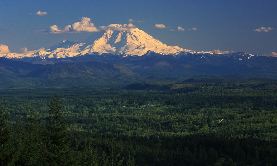
Loop Trail, Discovery Park

Discovery Park, located on a bluff in Magnolia overlooking the Puget Sound, is the city’s largest park at 534 acres. On a clear day views of the Olympics and Rainier are in surplus. Leave your car in any of the three lots and hop on the 2.8-mile Loop Trail that circles the park. The elevation gain is minimal and dirt trails cruise through canopied forest, through meadows and along sandy bluffs. From the Loop Trail you can link intersecting trails–there’s 11 miles total in the park–if time allows. When it does head to the iconic West Point lighthouse on the beach.
Grand Ridge Trail, Grand Ridge, Issaquah Alps

The trail from the parking lot (just off exit 20 on I-90) is flat and wide for the first half mile or so. Look for the intersecting trail on the right hand side and hop on the Grand Ridge. It’s a winding, steady climb that leads to nice rolling singletrack surrounded by cedars and ferns. It’s a seven mile out and back so knock out as many miles as you have time for before heading back to the car. Carry a map if you’re prone to getting lost and keep in mind that bikers and equestrians also have access to these trails.
Anti-aircraft Peak, Cougar Mountain, Issaquah Alps

Cougar Mountain has tons of small trails that you can link together to create trails runs of any distance, which is what you’ll do to get to Anti-aircraft Peak. That said, it’s a good idea to carry a map the first few times. Link about four trails together to get to your halfway point at mile 3; this run is 6 miles total with 625 feet of elevation gain. Scenic even when the sky is overcast, views of Mount Baker and the Seattle skyline are possible as you reach the peak. To get here take exit 13 off I-90 and weave through neighborhoods for a few miles to a big parking lot.
Poo Poo Point, Chirico Trail, Tiger Mountain

The first four runs are pretty tame in terms of elevation gain, but for a quick thigh burner run the nearly 2 miles up to Poo Poo Point via the Chirico Trail on Tiger Mountain’s West side. And at 1,760 feet of gain you’ll be climbing a moderately steep grade through the trees for most of the way. On a clear day you can see Mount Rainier from the top, and if the winds are right you can watch paragliders launch from the grassy hillside. There’s a big parking lot at the trailhead just outside of downtown Issaquah (exit 17 of I-90).
We want to acknowledge and thank the past, present, and future generations of all Native Nations and Indigenous Peoples whose ancestral lands we travel, explore, and play on. Always practice Leave No Trace ethics on your adventures and follow local regulations. Please explore responsibly!
Do you love the outdoors?
Yep, us too. That's why we send you the best local adventures, stories, and expert advice, right to your inbox.


